
| Birth | : | 7 Oct 1920 Crofton, Knox County, Nebraska, USA |
| Death | : | 9 Mar 2009 Sioux Falls, Minnehaha County, South Dakota, USA |
| Burial | : | Blyth Union Cemetery, Blyth, Huron County, Canada |
| Coordinate | : | 43.7300034, -81.4564743 |
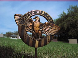
| Description | : | Norman Kube Burial will be in St. Rose Cemetery, Crofton with military rites by the Crofton American Legion Post #128. Norman Joseph Kube was born on October 7, 1920, in Crofton, NE, to Frank and Elizabeth (Meyer) Kube. Norman graduated from Crofton High School and attended Springfield State Teachers College in Springfield, MO, for one year. Norman served in the U.S. Air Force for five years during WWII. He was trained as an airplane mechanic, then as a pilot, and flew B-25's in the Fifth Air Force with the occupational forces in Japan. Norman married Marie Irene Arens on June 7, 1949,... Read More |
frequently asked questions (FAQ):
-
Where is Deacon Norman Joseph Kube's memorial?
Deacon Norman Joseph Kube's memorial is located at: Blyth Union Cemetery, Blyth, Huron County, Canada.
-
When did Deacon Norman Joseph Kube death?
Deacon Norman Joseph Kube death on 9 Mar 2009 in Sioux Falls, Minnehaha County, South Dakota, USA
-
Where are the coordinates of the Deacon Norman Joseph Kube's memorial?
Latitude: 43.7300034
Longitude: -81.4564743
Family Members:
Parent

Spouse
Siblings
Flowers:


Nearby Cemetories:
1. Blyth Union Cemetery
Blyth, Huron County, Canada
Coordinate: 43.7300034, -81.4564743
2. Blyth Anglican Potter's Historic Cemetery
Blyth, Huron County, Canada
Coordinate: 43.7441000, -81.4327200
3. Blyth Memorial Cairn
Blyth, Huron County, Canada
Coordinate: 43.7341580, -81.4242160
4. German Evangelical Lutheran Cemetery
Hullett Township, Huron County, Canada
Coordinate: 43.7520530, -81.4856970
5. Hope Chapel Cemetery
Central Huron Township, Huron County, Canada
Coordinate: 43.7297610, -81.5031730
6. Londesborough Cemetery
Londesborough, Huron County, Canada
Coordinate: 43.6977800, -81.4812200
7. Ball's Cemetery
Hullett Township, Huron County, Canada
Coordinate: 43.7344320, -81.5418630
8. Burns United Church Cemetery
Hullett Township, Huron County, Canada
Coordinate: 43.6720600, -81.4192660
9. Westfield Methodist Cemetery
Westfield, Huron County, Canada
Coordinate: 43.7989500, -81.4854500
10. Saint Michaels Roman Catholic Cemetery
Blyth, Huron County, Canada
Coordinate: 43.7490100, -81.3562610
11. Saint Joseph's Roman Catholic Cemetery
Hullett Township, Huron County, Canada
Coordinate: 43.6421190, -81.4980580
12. Colborne Evangelical Cemetery
Colborne Township, Huron County, Canada
Coordinate: 43.7213800, -81.5891380
13. Sunshine Cemetery
Sunshine, Huron County, Canada
Coordinate: 43.7833640, -81.3362500
14. Kinburn United Cemetery
Kinburn, Huron County, Canada
Coordinate: 43.6307870, -81.4226600
15. Clinton Public Cemetery
Clinton, Huron County, Canada
Coordinate: 43.6351790, -81.5293200
16. Donnybrook Cemetery
Donnybrook, Huron County, Canada
Coordinate: 43.8367480, -81.4878700
17. Brandon-Belgrave Cemetery
Belgrave, Huron County, Canada
Coordinate: 43.8243713, -81.3630295
18. Saint Augustine Catholic Cemetery
Saint-Augustine, Huron County, Canada
Coordinate: 43.8415400, -81.5062400
19. Saint Johns Cemetery
Brussels, Huron County, Canada
Coordinate: 43.7426500, -81.2912830
20. Holmesville Memorial Cemetery
Holmesville, Huron County, Canada
Coordinate: 43.6493090, -81.6074690
21. Brussels Cemetery
Brussels, Huron County, Canada
Coordinate: 43.7276300, -81.2632300
22. Saint Ambrose Cemetery
Brussels, Huron County, Canada
Coordinate: 43.7268710, -81.2628650
23. Deacon's Memorial Cemetery
East Wawanosh Township, Huron County, Canada
Coordinate: 43.8683210, -81.4073363
24. Varcoe Memorial Cemetery
Colborne Township, Huron County, Canada
Coordinate: 43.7800120, -81.6498520