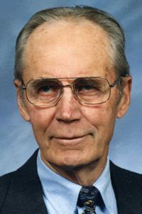
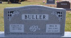
Dell Dewey Buller
| Birth | : | 9 Sep 1925 Rexford, Thomas County, Kansas, USA |
| Death | : | 14 Sep 2007 Aurora, Hamilton County, Nebraska, USA |
| Burial | : | St Margaret and St Remigius Churchyard, Seething, South Norfolk District, England |
| Coordinate | : | 52.5303390, 1.4185000 |
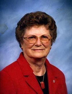
| Description | : | Dell Dewy Buller, the son of John and Dora (Doell) Buller, was born in Rexford, Kansas on September 9, 1925 and died in Aurora, Nebraska on September 14, 2007, at the age of 82 When Dell was an infant his family moved to York County. He attended country school through the 8th grade. Dell was united in marriage to Evelyn Rousselle on August 23, 1964. He spent his entire career farming in Clay County. Dell retired from farming in 1990 and in 1999 they moved to Aurora. Dell was a member of the Pleasant View Bible Church,... Read More |
frequently asked questions (FAQ):
-
Where is Dell Dewey Buller's memorial?
Dell Dewey Buller's memorial is located at: St Margaret and St Remigius Churchyard, Seething, South Norfolk District, England.
-
When did Dell Dewey Buller death?
Dell Dewey Buller death on 14 Sep 2007 in Aurora, Hamilton County, Nebraska, USA
-
Where are the coordinates of the Dell Dewey Buller's memorial?
Latitude: 52.5303390
Longitude: 1.4185000
Family Members:
Parent
Spouse
Siblings
Flowers:
Nearby Cemetories:
1. St Margaret and St Remigius Churchyard
Seething, South Norfolk District, England
Coordinate: 52.5303390, 1.4185000
2. St Peter's Churchyard
Mundham, South Norfolk District, England
Coordinate: 52.5303890, 1.4260120
3. St. Peter and St. Paul Churchyard
Bergh Apton, South Norfolk District, England
Coordinate: 52.5480290, 1.4060870
4. St Margaret's Churchyard
Kirstead, South Norfolk District, England
Coordinate: 52.5358860, 1.3840860
5. St Peters Churchyard
Brooke, South Norfolk District, England
Coordinate: 52.5452560, 1.3814930
6. St Mary's Parish Churchyard
Ashby St Mary, South Norfolk District, England
Coordinate: 52.5679100, 1.4354760
7. Holy Trinity Churchyard
Loddon, South Norfolk District, England
Coordinate: 52.5350430, 1.4832560
8. All Saints Churchyard
Chedgrave, South Norfolk District, England
Coordinate: 52.5409130, 1.4831200
9. St. Michaels's Church Cemetery
Langley with Hardley, South Norfolk District, England
Coordinate: 52.5552220, 1.4727530
10. St. Peter's Churchyard
Hedenham, South Norfolk District, England
Coordinate: 52.4891780, 1.4041660
11. St Peter's Churchyard
Carleton St Peter, South Norfolk District, England
Coordinate: 52.5680520, 1.4514100
12. St Mary Churchyard
Howe, South Norfolk District, England
Coordinate: 52.5497970, 1.3541770
13. St. John the Baptist Churchyard
Hellington, South Norfolk District, England
Coordinate: 52.5761440, 1.4132050
14. St Andrews
Claxton, South Norfolk District, England
Coordinate: 52.5769660, 1.4340060
15. St Michael's Churchyard
Broome, South Norfolk District, England
Coordinate: 52.4860360, 1.4547410
16. Ditchingham Cemetery
Ditchingham, South Norfolk District, England
Coordinate: 52.4793614, 1.4307304
17. Saint Andrews Churchyard
Bedingham, South Norfolk District, England
Coordinate: 52.4902500, 1.3643180
18. St. Mary's Churchyard
Ditchingham, South Norfolk District, England
Coordinate: 52.4776358, 1.4282946
19. St. Mary's Churchyard
Rockland St Mary, South Norfolk District, England
Coordinate: 52.5843940, 1.4112390
20. Hardley Methodist Chapel
Langley with Hardley, South Norfolk District, England
Coordinate: 52.5577290, 1.4957960
21. All Saints Churchyard
Poringland, South Norfolk District, England
Coordinate: 52.5657160, 1.3496310
22. St Andrew Churchyard
Framingham Earl, South Norfolk District, England
Coordinate: 52.5748560, 1.3596480
23. St Gregory Churchyard
Heckingham, South Norfolk District, England
Coordinate: 52.5350940, 1.5144710
24. Langley Abbey
Langley with Hardley, South Norfolk District, England
Coordinate: 52.5719000, 1.4875700


