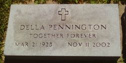
Della Havens Pennington
| Birth | : | 21 Mar 1928 Topeka, Shawnee County, Kansas, USA |
| Death | : | 11 Nov 2002 Scranton, Osage County, Kansas, USA |
| Burial | : | Oak Hill Cemetery, Battle Creek, Calhoun County, USA |
| Coordinate | : | 42.3060989, -85.1774979 |
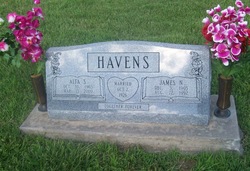
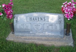
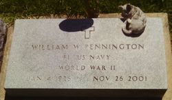
| Description | : | SCRANTON --- Della Pennington, 74, formerly of Carbondale, died Monday, Nov. 11, 2002, at her home near Scranton. Mrs. Pennington worked for several years for F.W. Woolworth Co. in Topeka and the Western Auto Store and the Santa Fe Nursing Center, both in Burlingame, until she retired. She was born March 21, 1928, in Topeka, the daughter of James and Alta Streeter Havens. She married William "Bill" Pennington on March 25, 1950, in Topeka. He died Nov. 26, 2001. Survivors include two daughters, Linda Kurtz, Scranton, and Rita Emmons, Topeka; a son, Terry Pennington, rural Burlingame; two sisters, Alta Kane and Sharon Winrick, both... Read More |
frequently asked questions (FAQ):
-
Where is Della Havens Pennington's memorial?
Della Havens Pennington's memorial is located at: Oak Hill Cemetery, Battle Creek, Calhoun County, USA.
-
When did Della Havens Pennington death?
Della Havens Pennington death on 11 Nov 2002 in Scranton, Osage County, Kansas, USA
-
Where are the coordinates of the Della Havens Pennington's memorial?
Latitude: 42.3060989
Longitude: -85.1774979
Family Members:
Parent
Spouse
Children
Flowers:
Nearby Cemetories:
1. Oak Hill Cemetery
Battle Creek, Calhoun County, USA
Coordinate: 42.3060989, -85.1774979
2. Mount Olivet Cemetery
Battle Creek, Calhoun County, USA
Coordinate: 42.3074989, -85.1817017
3. Saint Thomas Episcopal Church Memorial Gardens
Battle Creek, Calhoun County, USA
Coordinate: 42.3208710, -85.1795390
4. Haskell Home Cemetery
Battle Creek, Calhoun County, USA
Coordinate: 42.3350590, -85.2093310
5. Youngs Cemetery
Battle Creek, Calhoun County, USA
Coordinate: 42.3031693, -85.2358398
6. Memorial Park Cemetery
Battle Creek, Calhoun County, USA
Coordinate: 42.3005981, -85.2358017
7. Memorial Park Sunset Gardens
Battle Creek, Calhoun County, USA
Coordinate: 42.3010950, -85.2393690
8. Reese Cemetery
Springfield, Calhoun County, USA
Coordinate: 42.3196983, -85.2375031
9. Dubois Cemetery
Battle Creek, Calhoun County, USA
Coordinate: 42.2606010, -85.1956024
10. Harmon Halladay Cemetery
Bedford, Calhoun County, USA
Coordinate: 42.3546982, -85.2061005
11. Floral Lawn Memorial Gardens
Battle Creek, Calhoun County, USA
Coordinate: 42.3055992, -85.1033020
12. Beckley Cemetery
Battle Creek, Calhoun County, USA
Coordinate: 42.2633018, -85.2375031
13. Newbre Cemetery
Battle Creek, Calhoun County, USA
Coordinate: 42.2606010, -85.1196976
14. Morgan Cemetery
Battle Creek, Calhoun County, USA
Coordinate: 42.2397003, -85.1983032
15. Sandstone Cemetery
Emmett Township, Calhoun County, USA
Coordinate: 42.2963715, -85.0819778
16. Harmonia Cemetery
Bedford, Calhoun County, USA
Coordinate: 42.3436012, -85.2782974
17. Hicks Cemetery
Pennfield Township, Calhoun County, USA
Coordinate: 42.3883018, -85.1335983
18. Ceresco Cemetery
Emmett Township, Calhoun County, USA
Coordinate: 42.2785988, -85.0625000
19. Bedford Cemetery
Bedford Township, Calhoun County, USA
Coordinate: 42.3938103, -85.2306671
20. Fort Custer National Cemetery
Augusta, Kalamazoo County, USA
Coordinate: 42.3384514, -85.3191986
21. Newton Township Cemetery
Marshall, Calhoun County, USA
Coordinate: 42.2031780, -85.1229720
22. West Leroy Cemetery
West Leroy, Calhoun County, USA
Coordinate: 42.2241660, -85.2822220
23. Lawler Cemetery
Augusta, Kalamazoo County, USA
Coordinate: 42.3050003, -85.3469009
24. Checkered Cemetery
Assyria Township, Barry County, USA
Coordinate: 42.4331810, -85.1698350


