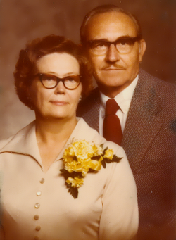
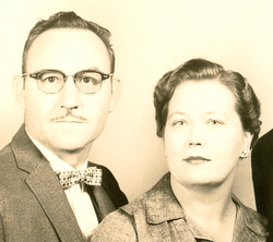
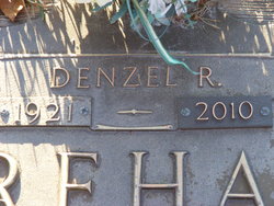
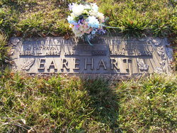
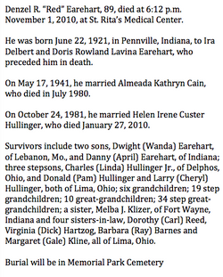
Denzel Rowland “Red” Earehart
| Birth | : | 22 Jun 1921 Pennville, Jay County, Indiana, USA |
| Death | : | 1 Nov 2010 Lima, Allen County, Ohio, USA |
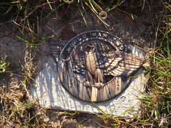
| Burial | : | Jackson Springs Cemetery, Jackson Springs, Moore County, USA |
| Coordinate | : | 35.2134810, -79.6231730 |
| Description | : | Denzel was an Army veteran that served in World War II, from April 24, 1944, to January 9, 1946, with the 10th Mountain Division in Italy, where he received the Purple Heart and Bronze Star. He was a life member of American Legion Post 96, Veterans of Foreign Wars Post 1275 and the Disabled American Veterans. He was a 60-year member of Lodge 585 Free & Accepted Masons and a longtime member of Fraternal Order of Eagles Aerie 370. |
frequently asked questions (FAQ):
-
Where is Denzel Rowland “Red” Earehart's memorial?
Denzel Rowland “Red” Earehart's memorial is located at: Jackson Springs Cemetery, Jackson Springs, Moore County, USA.
-
When did Denzel Rowland “Red” Earehart death?
Denzel Rowland “Red” Earehart death on 1 Nov 2010 in Lima, Allen County, Ohio, USA
-
Where are the coordinates of the Denzel Rowland “Red” Earehart's memorial?
Latitude: 35.2134810
Longitude: -79.6231730
Family Members:
Parent
Spouse
Siblings
Children
Flowers:
Nearby Cemetories:
1. Jackson Springs Cemetery
Jackson Springs, Moore County, USA
Coordinate: 35.2134810, -79.6231730
2. Jackson Springs Presbyterian Church Cemetery
Jackson Springs, Moore County, USA
Coordinate: 35.2102080, -79.6243680
3. Providence Presbyterian Church Cemetery
Jackson Springs, Moore County, USA
Coordinate: 35.2198140, -79.6376120
4. Marsh Chapel AME Zion Church Cemetery
Jackson Springs, Moore County, USA
Coordinate: 35.2229810, -79.6420790
5. Copeland Family Cemetery
Jackson Springs, Moore County, USA
Coordinate: 35.2108139, -79.6575778
6. Marcus Grove Cemetery
Montgomery County, USA
Coordinate: 35.1879300, -79.6769800
7. West End Presbyterian Church Columbarium
West End, Moore County, USA
Coordinate: 35.2414110, -79.5701800
8. West End Cemetery
West End, Moore County, USA
Coordinate: 35.2457700, -79.5723700
9. Cedar Grove Missionary Baptist Church Cemetery
West End, Moore County, USA
Coordinate: 35.2609100, -79.5817860
10. Pleasant Hill United Methodist Church Cemetery
Montgomery County, USA
Coordinate: 35.2409790, -79.6867040
11. Belford Church Cemetery
Candor, Montgomery County, USA
Coordinate: 35.2279243, -79.6972612
12. Seven Lakes Cemetery
Seven Lakes, Moore County, USA
Coordinate: 35.2701240, -79.5895770
13. Belford Baptist Cemetery
Jackson Springs, Moore County, USA
Coordinate: 35.2308350, -79.6986618
14. West End Community Cemetery
West End, Moore County, USA
Coordinate: 35.2602780, -79.5652780
15. McDonalds Chapel Presbyterian Church Cemetery
Aberdeen, Moore County, USA
Coordinate: 35.1816940, -79.5461590
16. Derby Baptist Church Cemetery
Ellerbe, Richmond County, USA
Coordinate: 35.1434150, -79.6335090
17. Piney Grove Free Will Baptist Cemetery
Derby, Richmond County, USA
Coordinate: 35.1421432, -79.6324463
18. Eagle Springs United Methodist Church Cemetery
Eagle Springs, Moore County, USA
Coordinate: 35.2787100, -79.6635030
19. Holly Grove Deliverance Church of God Cemetery
Eagle Springs, Moore County, USA
Coordinate: 35.2874390, -79.6354560
20. Hogan Cemetery
Ellerbe, Richmond County, USA
Coordinate: 35.1334500, -79.6250800
21. Jones Springs United Methodist Church Cemetery
Ellerbe, Richmond County, USA
Coordinate: 35.1331080, -79.6257210
22. Eagle Springs Baptist Church Cemetery
Eagle Springs, Moore County, USA
Coordinate: 35.2916750, -79.6489000
23. McQueen Cemetery
Richmond County, USA
Coordinate: 35.1338610, -79.6432940
24. Saint Josephs Bible Church Cemetery
Ellerbe, Richmond County, USA
Coordinate: 35.1542930, -79.6918960

