Don Darell “Buck” Tague
| Birth | : | 18 Nov 1925 Gorin, Scotland County, Missouri, USA |
| Death | : | 3 Dec 2021 Columbia, Boone County, Missouri, USA |
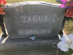
| Burial | : | Pleasant Grove Cemetery, Gorin, Scotland County, USA |
| Coordinate | : | 40.3669014, -92.0250015 |
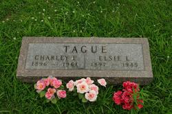
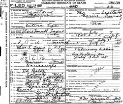
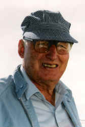
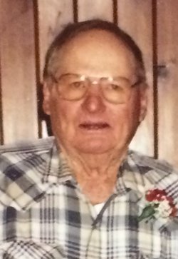
| Description | : | Don Darell Tague, 96, of Gorin, MO, passed away December 3, 2021 at the Harry S. Truman Memorial Veterans' Hospital in Columbia, MO. Don was born at home on the Sandridge Bottom northwest of Gorin on November 18, 1925 to Charley Tague and Elsie Boltz Tague. Don was known since childhood as "Buck" by family and friends. He graduated from Gorin High School in 1943 and was a lifetime member of the Gorin Christian Church. Don and Dorothy Jean "DJ" Stiff were married in 1952, and to this union were born five children: Sandra (Les) Kalman, Jane... Read More |
frequently asked questions (FAQ):
-
Where is Don Darell “Buck” Tague's memorial?
Don Darell “Buck” Tague's memorial is located at: Pleasant Grove Cemetery, Gorin, Scotland County, USA.
-
When did Don Darell “Buck” Tague death?
Don Darell “Buck” Tague death on 3 Dec 2021 in Columbia, Boone County, Missouri, USA
-
Where are the coordinates of the Don Darell “Buck” Tague's memorial?
Latitude: 40.3669014
Longitude: -92.0250015
Family Members:
Parent
Siblings
Flowers:
Nearby Cemetories:
1. Pleasant Grove Cemetery
Gorin, Scotland County, USA
Coordinate: 40.3669014, -92.0250015
2. Hicks-Shacklett Cemetery
Gorin, Scotland County, USA
Coordinate: 40.3880860, -92.0127620
3. Indian Creek Cemetery
Sand Hill Township, Scotland County, USA
Coordinate: 40.3539009, -92.0781021
4. Hicks Farm Cemetery
Rutledge, Scotland County, USA
Coordinate: 40.3131300, -92.0617600
5. Dancing Rabbit
Rutledge, Scotland County, USA
Coordinate: 40.3324900, -92.0962100
6. Ewing-Lasswell Cemetery
Scotland County, USA
Coordinate: 40.3022003, -92.0346985
7. Union Cemetery
Scotland County, USA
Coordinate: 40.4157982, -92.0836029
8. Suter Cemetery
Gorin, Scotland County, USA
Coordinate: 40.3292007, -91.9522018
9. Harmony Grove Cemetery
Knox County, USA
Coordinate: 40.2973300, -92.0297200
10. Etna Cemetery
Etna, Scotland County, USA
Coordinate: 40.4310989, -91.9794006
11. Pauline Cemetery
Rutledge, Scotland County, USA
Coordinate: 40.3093987, -92.0892029
12. Standifird Cemetery
Colony, Knox County, USA
Coordinate: 40.2947006, -91.9839020
13. Wyaconda Cemetery
Wyaconda, Clark County, USA
Coordinate: 40.3947800, -91.9266300
14. South Bethel Cemetery
Sand Hill, Scotland County, USA
Coordinate: 40.3468710, -92.1361430
15. Matlick Cemetery
Sand Hill, Scotland County, USA
Coordinate: 40.3307690, -92.1308330
16. Bear Creek Cemetery
Wyaconda, Clark County, USA
Coordinate: 40.3120600, -91.9317100
17. Blattner Cemetery
Wyaconda, Clark County, USA
Coordinate: 40.4014015, -91.9150009
18. Sand Hill Cemetery
Sand Hill, Scotland County, USA
Coordinate: 40.3130989, -92.1250000
19. Fairmont Cemetery
Clark County, USA
Coordinate: 40.3317900, -91.9071800
20. Carder Cemetery
Colony, Knox County, USA
Coordinate: 40.2692850, -92.0398290
21. Buskirk Cemetery
Scotland County, USA
Coordinate: 40.4406013, -92.1110992
22. Concord Cemetery
Scotland County, USA
Coordinate: 40.3941994, -92.1496964
23. Hickory Grove Cemetery
Arbela, Scotland County, USA
Coordinate: 40.4658012, -92.0280991
24. Spilman Cemetery
Scotland County, USA
Coordinate: 40.3311930, -92.1501190


