
| Birth | : | 13 Sep 1933 Jamestown, Moniteau County, Missouri, USA |
| Death | : | 6 Oct 2009 California, Moniteau County, Missouri, USA |
| Burial | : | Clark Cemetery, Hubbardston, Worcester County, USA |
| Coordinate | : | 42.4840900, -71.9587800 |
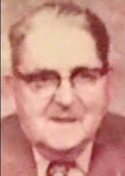
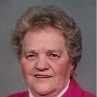
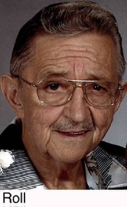
| Description | : | Jefferson City News-Tribune (MO) - Thursday, October 8, 2009: Donald F. Roll, 76, of California, Mo., passed away on Tuesday, October 6, 2009 at his home. He was born on September 13, 1933, at Jamestown, Mo., the son of William R. and Gertrude (Walterscheid) Roll who preceded him in death. On November 17, 1955, he married Erma Dean Flippin, who survives of the home. Donald worked as a Marker for California Manufacturing, retiring in 1998, after 49 years with the company. He was co-owner of Roll's Highway Beverage until 1977, and after retirement was a part-time security guard... Read More |
frequently asked questions (FAQ):
-
Where is Donald Franklin Roll's memorial?
Donald Franklin Roll's memorial is located at: Clark Cemetery, Hubbardston, Worcester County, USA.
-
When did Donald Franklin Roll death?
Donald Franklin Roll death on 6 Oct 2009 in California, Moniteau County, Missouri, USA
-
Where are the coordinates of the Donald Franklin Roll's memorial?
Latitude: 42.4840900
Longitude: -71.9587800
Family Members:
Parent

Spouse
Siblings
Flowers:


Nearby Cemetories:
1. Clark Cemetery
Hubbardston, Worcester County, USA
Coordinate: 42.4840900, -71.9587800
2. Greenwood Cemetery
Hubbardston, Worcester County, USA
Coordinate: 42.4984700, -71.9812300
3. Brookside Cemetery
Hubbardston, Worcester County, USA
Coordinate: 42.4662700, -71.9993400
4. Rural Glen Cemetery
Hubbardston, Worcester County, USA
Coordinate: 42.4653015, -71.9985962
5. Evergreen Cemetery
Hubbardston, Worcester County, USA
Coordinate: 42.4630750, -71.9974320
6. Parish Cemetery
Hubbardston, Worcester County, USA
Coordinate: 42.4754140, -72.0054840
7. Lovewell Cemetery
Hubbardston, Worcester County, USA
Coordinate: 42.4961900, -72.0096100
8. Pine Grove Cemetery
Hubbardston, Worcester County, USA
Coordinate: 42.4653015, -72.0119019
9. West Cemetery
Princeton, Worcester County, USA
Coordinate: 42.4454100, -71.9256500
10. Warren Cemetery
Hubbardston, Worcester County, USA
Coordinate: 42.5240310, -72.0008110
11. Route 62 Cemetery
Hubbardston, Worcester County, USA
Coordinate: 42.4426910, -72.0014980
12. Forest Hill Cemetery
Hubbardston, Worcester County, USA
Coordinate: 42.4763985, -72.0361023
13. Meetinghouse Cemetery
Princeton, Worcester County, USA
Coordinate: 42.4551600, -71.8823000
14. North Cemetery
Princeton, Worcester County, USA
Coordinate: 42.4797700, -71.8724000
15. Mount Pleasant Cemetery
Westminster, Worcester County, USA
Coordinate: 42.5424995, -71.9222031
16. Woodlawn Cemetery
Princeton, Worcester County, USA
Coordinate: 42.4447260, -71.8835880
17. Boylston Burial Ground
Princeton, Worcester County, USA
Coordinate: 42.4490700, -71.8787000
18. Woodside Cemetery
Westminster, Worcester County, USA
Coordinate: 42.5402985, -71.8933029
19. Green Bower Cemetery
Gardner, Worcester County, USA
Coordinate: 42.5555992, -71.9860992
20. Parker Cemetery
Barre, Worcester County, USA
Coordinate: 42.4250800, -72.0240400
21. Parker I Cemetery
Princeton, Worcester County, USA
Coordinate: 42.4828500, -71.8529500
22. South Burying Ground
Princeton, Worcester County, USA
Coordinate: 42.4192009, -71.8957977
23. Goose Hill Cemetery
Rutland, Worcester County, USA
Coordinate: 42.3997400, -71.9914000
24. Walker Burial Ground
Barre, Worcester County, USA
Coordinate: 42.4374500, -72.0605600