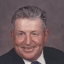
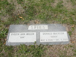
Donald Macklem 'Tinner' Spies
| Birth | : | 24 May 1924 Cordova, Talbot County, Maryland, USA |
| Death | : | 11 Dec 2009 Easton, Talbot County, Maryland, USA |
| Burial | : | Spring Hill Cemetery, Easton, Talbot County, USA |
| Coordinate | : | 38.7775002, -76.0727997 |
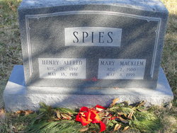
| Description | : | Obituaries Donald M. Spies Published: Friday, December 11, 2009 4:48 AM CST EASTON Donald Macklem "Tinner" Spies, 85, died Wednesday, Dec. 9, 2009, at the Memorial Hospital at Easton, due to complications related to recovery from injuries sustained in an auto accident and heart surgery several weeks ago. Born May 4, 1924, to Henry Alfred and Mary Macklem Spies, he graduated from Cordova High School in 1940. He was a third generation farmer, and an active member of both the state and local agriculture community. Tinner Spies was many things to many people. His involvement and community offices are too numerous to list entirely and... Read More |
frequently asked questions (FAQ):
-
Where is Donald Macklem 'Tinner' Spies's memorial?
Donald Macklem 'Tinner' Spies's memorial is located at: Spring Hill Cemetery, Easton, Talbot County, USA.
-
When did Donald Macklem 'Tinner' Spies death?
Donald Macklem 'Tinner' Spies death on 11 Dec 2009 in Easton, Talbot County, Maryland, USA
-
Where are the coordinates of the Donald Macklem 'Tinner' Spies's memorial?
Latitude: 38.7775002
Longitude: -76.0727997
Family Members:
Parent
Spouse
Siblings
Children
Flowers:
Nearby Cemetories:
1. Spring Hill Cemetery
Easton, Talbot County, USA
Coordinate: 38.7775002, -76.0727997
2. Maryland State Police Canine Cemetery Barrack I
Easton, Talbot County, USA
Coordinate: 38.7843938, -76.0753632
3. Richards Memorial Park
Easton, Talbot County, USA
Coordinate: 38.7761002, -76.0821991
4. Doverbrook Cemetery
Easton, Talbot County, USA
Coordinate: 38.7733002, -76.0643997
5. Third Haven Meeting Burial Ground
Easton, Talbot County, USA
Coordinate: 38.7672005, -76.0764008
6. Peachblossom Meeting House Cemetery
Easton, Talbot County, USA
Coordinate: 38.7332900, -76.0681500
7. Lombardy Farm Cemetery
Unionville, Talbot County, USA
Coordinate: 38.8158530, -76.1259852
8. Chapel Cemetery
Easton, Talbot County, USA
Coordinate: 38.8171997, -76.0211029
9. Saint Stephens Church Cemetery
Easton, Talbot County, USA
Coordinate: 38.8091020, -76.1397660
10. Roberts Cemetery
Talbot County, USA
Coordinate: 38.7192001, -76.0488968
11. Ashby-Goldsborough Family Cemetery
Easton, Talbot County, USA
Coordinate: 38.8251600, -76.1239840
12. Queen Esther Cemetery
Talbot County, USA
Coordinate: 38.7132988, -76.0456009
13. All Saints Cemetery
Easton, Talbot County, USA
Coordinate: 38.8464012, -76.0817032
14. Saint Pauls Cemetery
Talbot County, USA
Coordinate: 38.7439003, -76.1624985
15. White Marsh Cemetery
Trappe, Talbot County, USA
Coordinate: 38.6970329, -76.0600662
16. Landing Neck Cemetery
Trappe Landing, Talbot County, USA
Coordinate: 38.7000008, -76.0402985
17. Woodlawn Memorial Park
Easton, Talbot County, USA
Coordinate: 38.8610992, -76.0597000
18. Royal Oak Cemetery
Bellevue, Talbot County, USA
Coordinate: 38.7421989, -76.1774979
19. DeShields Cemetery
Talbot County, USA
Coordinate: 38.8278008, -76.1678009
20. Banning Graveyard
Easton, Talbot County, USA
Coordinate: 38.7205353, -76.1647339
21. Kings Creek Cemetery
Talbot County, USA
Coordinate: 38.8167000, -75.9527969
22. Hammond Family Plot
Saint Michaels, Talbot County, USA
Coordinate: 38.7495600, -76.1988400
23. Mount Zion Cemetery
Bethlehem, Caroline County, USA
Coordinate: 38.7500000, -75.9430900
24. Tuckahoe Friends Meeting House Burying Ground
Talbot County, USA
Coordinate: 38.8253460, -75.9531270


