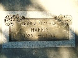
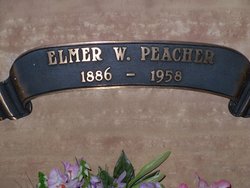
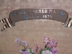
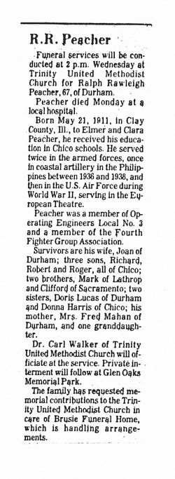
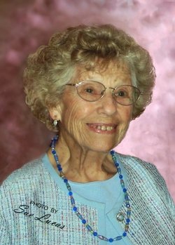
Donna Edith Peacher Harris
| Birth | : | 27 Aug 1923 Chico, Butte County, California, USA |
| Death | : | 14 Mar 1993 Sonoma County, California, USA |
| Burial | : | Old Order Cemetery, Rossville, Clinton County, USA |
| Coordinate | : | 40.3955956, -86.6198273 |
| Plot | : | Sec 35 Row 5 Lot 1865 |
| Description | : | Birth and death dates and locations, mother's maiden name Spencer from California Death Index Records. 69-year-old Donna P. Harris was interred, per the Chico Cemetery Association Records, in the plot noted, on March 19, 1993. |
frequently asked questions (FAQ):
-
Where is Donna Edith Peacher Harris's memorial?
Donna Edith Peacher Harris's memorial is located at: Old Order Cemetery, Rossville, Clinton County, USA.
-
When did Donna Edith Peacher Harris death?
Donna Edith Peacher Harris death on 14 Mar 1993 in Sonoma County, California, USA
-
Where are the coordinates of the Donna Edith Peacher Harris's memorial?
Latitude: 40.3955956
Longitude: -86.6198273
Family Members:
Parent
Siblings
Flowers:
Nearby Cemetories:
1. Old Order Cemetery
Rossville, Clinton County, USA
Coordinate: 40.3955956, -86.6198273
2. Pleasant View Cemetery
Rossville, Clinton County, USA
Coordinate: 40.3880997, -86.6369019
3. Kuhns Cemetery
Rossville, Clinton County, USA
Coordinate: 40.4173889, -86.6270905
4. Latshaw Cemetery
Clinton County, USA
Coordinate: 40.3880119, -86.5781403
5. Riley Gunkle Cemetery
Rossville, Clinton County, USA
Coordinate: 40.4258000, -86.5975000
6. Cripe Cemetery
Rossville, Clinton County, USA
Coordinate: 40.4242325, -86.6464157
7. Mennonite Cemetery
Edna Mills, Clinton County, USA
Coordinate: 40.4049683, -86.6661301
8. Rossville Cemetery
Rossville, Clinton County, USA
Coordinate: 40.4230003, -86.5875015
9. Blickenstaff Cemetery
Edna Mills, Clinton County, USA
Coordinate: 40.4265000, -86.6472000
10. Hiner Cemetery
Rossville, Clinton County, USA
Coordinate: 40.3880800, -86.5715230
11. Gray Family Cemetery
Delphi, Carroll County, USA
Coordinate: 40.4338720, -86.6258560
12. Hufford Cemetery
Owasco, Carroll County, USA
Coordinate: 40.4338989, -86.6063995
13. Fairhaven Cemetery
Mulberry, Clinton County, USA
Coordinate: 40.3665848, -86.6663895
14. Mount Hope Cemetery
Rossville, Clinton County, USA
Coordinate: 40.3869019, -86.5522003
15. Oxford Cemetery
Pettit, Tippecanoe County, USA
Coordinate: 40.3947983, -86.6949005
16. Carroll County Cemetery
Clay Township, Carroll County, USA
Coordinate: 40.4545010, -86.6384960
17. Saint Johns Cemetery
Owasco, Carroll County, USA
Coordinate: 40.4538689, -86.6462173
18. Bennett Cemetery
Hamilton, Clinton County, USA
Coordinate: 40.3300018, -86.6164017
19. Swank Cemetery
Pettit, Tippecanoe County, USA
Coordinate: 40.4103012, -86.7042007
20. Hufford Cemetery #2
Clay Township, Carroll County, USA
Coordinate: 40.4608615, -86.6002739
21. Hughes Cemetery
Clay Township, Carroll County, USA
Coordinate: 40.4604940, -86.5979180
22. Wagoner Cemetery
Owasco, Carroll County, USA
Coordinate: 40.4605713, -86.5979538
23. Beard Cemetery
Clay Township, Carroll County, USA
Coordinate: 40.4631996, -86.6245422
24. Bethel Church Cemetery
Pettit, Tippecanoe County, USA
Coordinate: 40.4220300, -86.7078700

