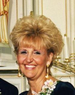
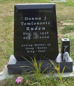
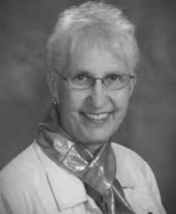
Donna J. Tomlonovic Ruden
| Birth | : | 12 Dec 1936 Newton, Jasper County, Iowa, USA |
| Death | : | 15 Aug 2006 Johnston, Polk County, Iowa, USA |
| Burial | : | Methwold Cemetery, Methwold, Kings Lynn and West Norfolk Borough, England |
| Coordinate | : | 52.5257758, 0.5575197 |
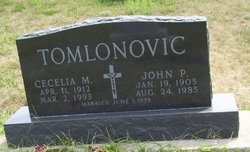
| Description | : | Donna J. Tomlonovic Ruden, of Kailua, Kona, Hawaii, died Tuesday, August 15, 2006 at Mercy Hospice in Johnston, Iowa. The daughter of John and Cecelia (Smith) Tomlonovic, Donna was born on December 12, 1936 in Newton. Donna graduated from Colfax High School. Donna was also a graduate of Iowa State University, receiving a Bachelor of Science in Psychology. Donna then went on to receive her Masters of Social Work at the University of Iowa. Donna worked as the Director of Personal Development of Story County until 1986 when she moved to Hawaii. Donna was a social worker for... Read More |
frequently asked questions (FAQ):
-
Where is Donna J. Tomlonovic Ruden's memorial?
Donna J. Tomlonovic Ruden's memorial is located at: Methwold Cemetery, Methwold, Kings Lynn and West Norfolk Borough, England.
-
When did Donna J. Tomlonovic Ruden death?
Donna J. Tomlonovic Ruden death on 15 Aug 2006 in Johnston, Polk County, Iowa, USA
-
Where are the coordinates of the Donna J. Tomlonovic Ruden's memorial?
Latitude: 52.5257758
Longitude: 0.5575197
Family Members:
Parent
Spouse
Siblings
Children
Flowers:
Nearby Cemetories:
1. Methwold Cemetery
Methwold, Kings Lynn and West Norfolk Borough, England
Coordinate: 52.5257758, 0.5575197
2. St. George's Churchyard
Methwold, Kings Lynn and West Norfolk Borough, England
Coordinate: 52.5229060, 0.5568700
3. Northwold Cemetery
Northwold, Kings Lynn and West Norfolk Borough, England
Coordinate: 52.5419000, 0.5820000
4. St. Andrew's Old Cemetery
Northwold, Kings Lynn and West Norfolk Borough, England
Coordinate: 52.5405523, 0.5864157
5. St Andrew Churchyard
Northwold, Kings Lynn and West Norfolk Borough, England
Coordinate: 52.5425540, 0.5878920
6. St Mary's Churchyard
Cranwich, Breckland Borough, England
Coordinate: 52.5224040, 0.6262310
7. St Nicholas Churchyard
Feltwell, Kings Lynn and West Norfolk Borough, England
Coordinate: 52.4888000, 0.5209700
8. St. Mary's Churchyard
Feltwell, Kings Lynn and West Norfolk Borough, England
Coordinate: 52.4874580, 0.5245110
9. All Saints Churchyard
Foulden, Breckland Borough, England
Coordinate: 52.5599040, 0.6021930
10. All Saints Churchyard
Stoke Ferry, Kings Lynn and West Norfolk Borough, England
Coordinate: 52.5702970, 0.5138070
11. Saint John the Evangelist Churchyard
Oxborough, Breckland Borough, England
Coordinate: 52.5828040, 0.5727550
12. St Leonard's Churchyard
Mundford, Breckland Borough, England
Coordinate: 52.5125080, 0.6521150
13. St James' Church Cemetery
Hockwold, Kings Lynn and West Norfolk Borough, England
Coordinate: 52.4625100, 0.5519400
14. St. Peter Church Cemetery
Hockwold, Kings Lynn and West Norfolk Borough, England
Coordinate: 52.4627780, 0.5376030
15. St George's Churchyard
Gooderstone, Breckland Borough, England
Coordinate: 52.5884010, 0.6003860
16. St Peter's Churchyard
Ickburgh, Breckland Borough, England
Coordinate: 52.5232010, 0.6755200
17. All Saints Churchyard
Boughton, Kings Lynn and West Norfolk Borough, England
Coordinate: 52.5913020, 0.5080360
18. St. Margaret of Antioch Churchyard
Wereham, Kings Lynn and West Norfolk Borough, England
Coordinate: 52.5867700, 0.4799200
19. St. Peter's Churchyard
Brandon, Forest Heath District, England
Coordinate: 52.4445800, 0.6132600
20. St. Andrew's Churchyard
West Dereham, Kings Lynn and West Norfolk Borough, England
Coordinate: 52.5911080, 0.4599020
21. Brandon Cemetery
Brandon, Forest Heath District, England
Coordinate: 52.4445140, 0.6149550
22. All Saints Churchyard
Hilborough, Breckland Borough, England
Coordinate: 52.5673800, 0.6921240
23. St. Mary's Churchyard
Bodney, Breckland Borough, England
Coordinate: 52.5561990, 0.7002570
24. St. Mary the Virgin Churchyard
Beachamwell, Breckland Borough, England
Coordinate: 52.6178670, 0.5844730

