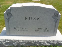
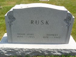
Dovie Hope Smith Rusk
| Birth | : | 7 May 1895 Tippecanoe County, Indiana, USA |
| Death | : | 1 Apr 1955 Lafayette, Tippecanoe County, Indiana, USA |
| Burial | : | Immaculate Conception Cemetery, Smartsville, Yuba County, USA |
| Coordinate | : | 39.2023500, -121.2989300 |
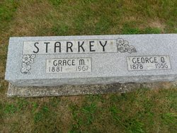
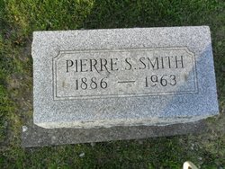
| Description | : | Mrs. Dovie Hope Rusk, 54 yr, of 1605 Adams street died Friday at 4:50 a.m. in Home hospital. She was admitted the hospital March 5. Born in Tippecanoe county, she spent her life here. She married Thomas Rusk who died in 1943. She formerly was employed at the Alcoa Plant and was last employed at the Window Shop. She was a member of Grace Evangelical United Brethren church, Royal Neighbors, Sons of Union Veterans and Women’s Christian Temperance Union. Surviving are a sister, Mrs. Grace Starkey of Lafayette and two brothers, Pierce Smith... Read More |
frequently asked questions (FAQ):
-
Where is Dovie Hope Smith Rusk's memorial?
Dovie Hope Smith Rusk's memorial is located at: Immaculate Conception Cemetery, Smartsville, Yuba County, USA.
-
When did Dovie Hope Smith Rusk death?
Dovie Hope Smith Rusk death on 1 Apr 1955 in Lafayette, Tippecanoe County, Indiana, USA
-
Where are the coordinates of the Dovie Hope Smith Rusk's memorial?
Latitude: 39.2023500
Longitude: -121.2989300
Family Members:
Parent
Spouse
Siblings
Flowers:
Nearby Cemetories:
1. Immaculate Conception Cemetery
Smartsville, Yuba County, USA
Coordinate: 39.2023500, -121.2989300
2. McGanney Cemetery
Smartsville, Yuba County, USA
Coordinate: 39.2018100, -121.2988310
3. Smartsville Cemetery
Smartsville, Yuba County, USA
Coordinate: 39.1973500, -121.2953500
4. Smartsville Pioneer Cemetery
Smartsville, Yuba County, USA
Coordinate: 39.1993220, -121.2915280
5. Blue Point Mine Gravesite
Smartsville, Yuba County, USA
Coordinate: 39.2087081, -121.2892876
6. Timbuctoo Cemetery
Smartsville, Yuba County, USA
Coordinate: 39.2159925, -121.3175461
7. Vineyard Cemetery
Yuba County, USA
Coordinate: 39.1557900, -121.3281600
8. Methuen Family Cemetery
Browns Valley, Yuba County, USA
Coordinate: 39.2641106, -121.3197076
9. Long Bar Cemetery
Brownsville, Yuba County, USA
Coordinate: 39.2234900, -121.3860400
10. Church Family Graves Site
Penn Valley, Nevada County, USA
Coordinate: 39.1709400, -121.2017900
11. Indian Springs Cemetery
Penn Valley, Nevada County, USA
Coordinate: 39.1807760, -121.1947130
12. Penn Valley Cemetery
Penn Valley, Nevada County, USA
Coordinate: 39.2001100, -121.1849700
13. Browns Valley Cemetery
Browns Valley, Yuba County, USA
Coordinate: 39.2332100, -121.4079400
14. Cabbage Patch Cemetery
Waldo Junction, Yuba County, USA
Coordinate: 39.1117300, -121.3066200
15. Kneebone Cemetery
Nevada County, USA
Coordinate: 39.1226333, -121.2425500
16. Spenceville Ranch Cemetery
Penn Valley, Nevada County, USA
Coordinate: 39.1226330, -121.2425500
17. Pleasant Valley Cemetery
Nevada County, USA
Coordinate: 39.2590890, -121.1970900
18. Peoria Memorial Park
Browns Valley, Yuba County, USA
Coordinate: 39.2831001, -121.3891983
19. Fellowship of Friends Cemetery
Oregon House, Yuba County, USA
Coordinate: 39.3274920, -121.2509750
20. Lehr Family Cemetery
Grass Valley, Nevada County, USA
Coordinate: 39.1910300, -121.1309100
21. Rough And Ready Cemetery
Nevada County, USA
Coordinate: 39.2317009, -121.1343994
22. Clear Creek Cemetery
Grass Valley, Nevada County, USA
Coordinate: 39.1433540, -121.1438480
23. Lofton Cemetery
Yuba County, USA
Coordinate: 39.0783005, -121.3696976
24. Elster Memorial Cemetery
Grass Valley, Nevada County, USA
Coordinate: 39.1050790, -121.1530230

