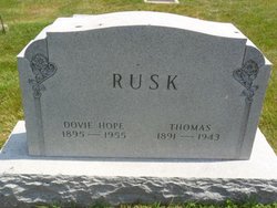
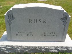
Thomas Rusk
| Birth | : | 26 Mar 1891 Romney, Tippecanoe County, Indiana, USA |
| Death | : | 27 Jan 1943 Lafayette, Tippecanoe County, Indiana, USA |
| Burial | : | Immaculate Conception Cemetery, Smartsville, Yuba County, USA |
| Coordinate | : | 39.2023500, -121.2989300 |
| Description | : | Thomas Rusk, 51, native of Randolph township, and employed at the Aluminum company plant, was found dead from a heart attack in the room at the Travelers Inn, Second and South streets, at 11:30 o’clock Tuesday morning by Frank Patrey, proprietor. Corner John S. Morrison investigated. Mr. Rusk had recently recovered from pneumonia, but four-days ago he suffered a relapse. He married Dovie Smith, March 30, 1912. She is employed at the Home hospital and was at work when her husband died. Surviving are three brothers, Charles Rusk, Stockwell; Oliver Rusk, Lafayette, and Earl Rusk,... Read More |
frequently asked questions (FAQ):
-
Where is Thomas Rusk's memorial?
Thomas Rusk's memorial is located at: Immaculate Conception Cemetery, Smartsville, Yuba County, USA.
-
When did Thomas Rusk death?
Thomas Rusk death on 27 Jan 1943 in Lafayette, Tippecanoe County, Indiana, USA
-
Where are the coordinates of the Thomas Rusk's memorial?
Latitude: 39.2023500
Longitude: -121.2989300
Family Members:
Flowers:
Nearby Cemetories:
1. Immaculate Conception Cemetery
Smartsville, Yuba County, USA
Coordinate: 39.2023500, -121.2989300
2. McGanney Cemetery
Smartsville, Yuba County, USA
Coordinate: 39.2018100, -121.2988310
3. Smartsville Cemetery
Smartsville, Yuba County, USA
Coordinate: 39.1973500, -121.2953500
4. Smartsville Pioneer Cemetery
Smartsville, Yuba County, USA
Coordinate: 39.1993220, -121.2915280
5. Blue Point Mine Gravesite
Smartsville, Yuba County, USA
Coordinate: 39.2087081, -121.2892876
6. Timbuctoo Cemetery
Smartsville, Yuba County, USA
Coordinate: 39.2159925, -121.3175461
7. Vineyard Cemetery
Yuba County, USA
Coordinate: 39.1557900, -121.3281600
8. Methuen Family Cemetery
Browns Valley, Yuba County, USA
Coordinate: 39.2641106, -121.3197076
9. Long Bar Cemetery
Brownsville, Yuba County, USA
Coordinate: 39.2234900, -121.3860400
10. Church Family Graves Site
Penn Valley, Nevada County, USA
Coordinate: 39.1709400, -121.2017900
11. Indian Springs Cemetery
Penn Valley, Nevada County, USA
Coordinate: 39.1807760, -121.1947130
12. Penn Valley Cemetery
Penn Valley, Nevada County, USA
Coordinate: 39.2001100, -121.1849700
13. Browns Valley Cemetery
Browns Valley, Yuba County, USA
Coordinate: 39.2332100, -121.4079400
14. Cabbage Patch Cemetery
Waldo Junction, Yuba County, USA
Coordinate: 39.1117300, -121.3066200
15. Kneebone Cemetery
Nevada County, USA
Coordinate: 39.1226333, -121.2425500
16. Spenceville Ranch Cemetery
Penn Valley, Nevada County, USA
Coordinate: 39.1226330, -121.2425500
17. Pleasant Valley Cemetery
Nevada County, USA
Coordinate: 39.2590890, -121.1970900
18. Peoria Memorial Park
Browns Valley, Yuba County, USA
Coordinate: 39.2831001, -121.3891983
19. Fellowship of Friends Cemetery
Oregon House, Yuba County, USA
Coordinate: 39.3274920, -121.2509750
20. Lehr Family Cemetery
Grass Valley, Nevada County, USA
Coordinate: 39.1910300, -121.1309100
21. Rough And Ready Cemetery
Nevada County, USA
Coordinate: 39.2317009, -121.1343994
22. Clear Creek Cemetery
Grass Valley, Nevada County, USA
Coordinate: 39.1433540, -121.1438480
23. Lofton Cemetery
Yuba County, USA
Coordinate: 39.0783005, -121.3696976
24. Elster Memorial Cemetery
Grass Valley, Nevada County, USA
Coordinate: 39.1050790, -121.1530230


