Dugald Robert Sarty
| Birth | : | 1903 Bridgewater, Lunenburg County, Nova Scotia, Canada |
| Death | : | 7 Feb 1994 Bridgewater, Lunenburg County, Nova Scotia, Canada |
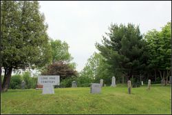
| Burial | : | United Reform Churchyard, Bramfield, Suffolk Coastal District, England |
| Coordinate | : | 52.3119170, 1.5183490 |
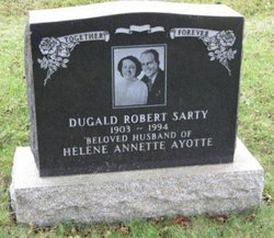
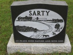
| Inscription | : | SARTY(AYOTTE) Helene Annette No dates Farm house & barn yard scene on back of stone 3 SARTY Dugald Robert 1903 1994 |
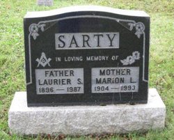
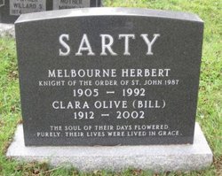
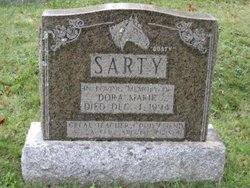
| Description | : | Dugald Robert Sarty 1994 Halifax Herald Dugald Robert Sarty, 90, Lapland, died February 7, 1994, in South Shore Regional Hospital, Bridgewater. Born in Bridgewater, he was a son of the late Willard and Minnie (Conrad) Sarty. He is survived by his wife, the former Helene Ayotte; two sons, Larry, Vancouver; Mel, Truro; two daughters, Diane (Mrs. Brian Scruten-Sarty), Rosemary (Mrs. Gordon Clarke), both of Victoria, B.C.; two sisters, Dorothy Wamboldt, Marie Sarty, both of Bridgewater; brother, Carroll, New Hampshire; eight grandchildren. He was predeceased by five brothers, William, Roger, Leander, Laurier, Melbourne. Funeral was held February 8 in Sweeny's Funeral Chapel,... Read More |
frequently asked questions (FAQ):
-
Where is Dugald Robert Sarty's memorial?
Dugald Robert Sarty's memorial is located at: United Reform Churchyard, Bramfield, Suffolk Coastal District, England.
-
When did Dugald Robert Sarty death?
Dugald Robert Sarty death on 7 Feb 1994 in Bridgewater, Lunenburg County, Nova Scotia, Canada
-
Where are the coordinates of the Dugald Robert Sarty's memorial?
Latitude: 52.3119170
Longitude: 1.5183490
Family Members:
Parent
Spouse
Siblings
Flowers:
Nearby Cemetories:
1. United Reform Churchyard
Bramfield, Suffolk Coastal District, England
Coordinate: 52.3119170, 1.5183490
2. St. Andrew's Churchyard
Bramfield, Suffolk Coastal District, England
Coordinate: 52.3102311, 1.5179990
3. Saint Peter's Churchyard
Thorington, Suffolk Coastal District, England
Coordinate: 52.3118310, 1.5534681
4. St Mary Churchyard
Halesworth, Waveney District, England
Coordinate: 52.3423990, 1.5013380
5. Halesworth Cemetery
Halesworth, Waveney District, England
Coordinate: 52.3437080, 1.5097340
6. All Saints Churchyard
Blyford, Waveney District, England
Coordinate: 52.3351840, 1.5574440
7. Saint Peter's Churchyard
Holton, Waveney District, England
Coordinate: 52.3462540, 1.5259730
8. Halesworth & Bramfield United Reformed Churchy
Halesworth, Waveney District, England
Coordinate: 52.3456000, 1.5033000
9. All Saints Churchyard
Darsham, Suffolk Coastal District, England
Coordinate: 52.2741900, 1.5474200
10. St Michael and All Angels Churchyard
Cookley, Suffolk Coastal District, England
Coordinate: 52.3258980, 1.4466090
11. Holy Trinity Churchyard
Blythburgh, Suffolk Coastal District, England
Coordinate: 52.3211920, 1.5947390
12. St. Peter's Churchyard
Sibton, Suffolk Coastal District, England
Coordinate: 52.2730300, 1.4688850
13. St. Mary Churchyard
Chediston, Suffolk Coastal District, England
Coordinate: 52.3475100, 1.4613130
14. St Andrews Churchyard
Wissett, Waveney District, England
Coordinate: 52.3606730, 1.4735980
15. St. Mary The Virgin Churchyard
Huntingfield, Suffolk Coastal District, England
Coordinate: 52.3170350, 1.4263510
16. St. Peter's Churchyard
Spexhall, Waveney District, England
Coordinate: 52.3678960, 1.4923050
17. St Michael Churchyard
Peasenhall, Suffolk Coastal District, England
Coordinate: 52.2706000, 1.4509580
18. St Margaret Churchyard
Heveningham, Suffolk Coastal District, England
Coordinate: 52.3017670, 1.4209263
19. Peasenhall Cemetery
Peasenhall, Suffolk Coastal District, England
Coordinate: 52.2693020, 1.4474450
20. St. Andrew's Churchyard
Westhall, Waveney District, England
Coordinate: 52.3683891, 1.5580100
21. St Andrew's Churchyard
Sotherton, Waveney District, England
Coordinate: 52.3591930, 1.5837900
22. Holy Trinity Churchyard
Middleton, Suffolk Coastal District, England
Coordinate: 52.2542140, 1.5589130
23. St. Margaret's Churchyard of Antioch
Linstead Parva, Suffolk Coastal District, England
Coordinate: 52.3477630, 1.4302960
24. St. Peter's Churchyard
Ubbeston, Suffolk Coastal District, England
Coordinate: 52.3021220, 1.4062940

