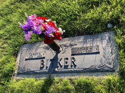
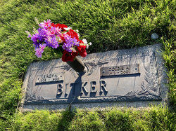
DuWayne L. Bitker
| Birth | : | 15 Nov 1934 |
| Death | : | 13 Jun 2007 |
| Burial | : | Yew Tree Roman Catholic Cemetery, West Derby, Metropolitan Borough of Liverpool, England |
| Coordinate | : | 53.4285700, -2.8790700 |
| Description | : | DuWayne L. Bitker, 72, died Wednesday, June 13, 2007 at the Heritage Care Center, Mason City, IA. A Memorial Service will be held Monday, June 18, 4:00 pm at Ward-Van Slyke Colonial Chapel, 101 N. 4th St., Clear Lake, IA, with Rev. Tom Healey officiating. Visitation with the family will begin at 3:00 PM. Inurnment will be held at Memorial Park Cemetery, Mason City, IA at a later date. Memorials may be given to the DuWayne L. Bitker Memorial Fund. DuWayne was born November 15, 1934 in rural Garner, IA, the son of LeRoy and Goldie (Pitkin) Bitker. He attended... Read More |
frequently asked questions (FAQ):
-
Where is DuWayne L. Bitker's memorial?
DuWayne L. Bitker's memorial is located at: Yew Tree Roman Catholic Cemetery, West Derby, Metropolitan Borough of Liverpool, England.
-
When did DuWayne L. Bitker death?
DuWayne L. Bitker death on 13 Jun 2007 in
-
Where are the coordinates of the DuWayne L. Bitker's memorial?
Latitude: 53.4285700
Longitude: -2.8790700
Family Members:
Parent
Spouse
Siblings
Flowers:
Nearby Cemetories:
1. Yew Tree Roman Catholic Cemetery
West Derby, Metropolitan Borough of Liverpool, England
Coordinate: 53.4285700, -2.8790700
2. St. John the Evangelist Churchyard
Knotty Ash, Metropolitan Borough of Liverpool, England
Coordinate: 53.4160757, -2.8913708
3. Broadgreen Jewish Cemetery
Liverpool, Metropolitan Borough of Liverpool, England
Coordinate: 53.4101320, -2.8977320
4. St. Bartholomew's Churchyard
Huyton with Roby, Metropolitan Borough of Knowsley, England
Coordinate: 53.4120023, -2.8556125
5. St Michael Churchyard Extension
Huyton with Roby, Metropolitan Borough of Knowsley, England
Coordinate: 53.4143310, -2.8418050
6. Saint Oswald King & Martyr Catholic Churchyard
Old Swan, Metropolitan Borough of Liverpool, England
Coordinate: 53.4121650, -2.9146190
7. St. Michael Churchyard
Huyton with Roby, Metropolitan Borough of Knowsley, England
Coordinate: 53.4139560, -2.8396720
8. Saint Anne Churchyard
Stanley, Metropolitan Borough of Liverpool, England
Coordinate: 53.4158800, -2.9238300
9. Green Lane Jewish Cemetery
Liverpool, Metropolitan Borough of Liverpool, England
Coordinate: 53.4234720, -2.9280170
10. West Derby Jewish Cemetery
Liverpool, Metropolitan Borough of Liverpool, England
Coordinate: 53.4504986, -2.9137393
11. West Derby Cemetery
West Derby, Metropolitan Borough of Liverpool, England
Coordinate: 53.4513790, -2.9154630
12. St. Mary's Churchyard
Knowsley, Metropolitan Borough of Knowsley, England
Coordinate: 53.4561960, -2.8528580
13. St Swithins Churchyard
Liverpool, Metropolitan Borough of Liverpool, England
Coordinate: 53.4585631, -2.9012280
14. All Saints Churchyard
Childwall, Metropolitan Borough of Liverpool, England
Coordinate: 53.3952880, -2.8816030
15. St. Agnes Roman Catholic
Huyton with Roby, Metropolitan Borough of Knowsley, England
Coordinate: 53.4090600, -2.8320100
16. Holy Trinity Churchyard
Wavertree, Metropolitan Borough of Liverpool, England
Coordinate: 53.3946000, -2.9175700
17. Prescot Cemetery
Prescot, Metropolitan Borough of Knowsley, England
Coordinate: 53.4266620, -2.8081590
18. St. Mary the Virgin Churchyard
Prescot, Metropolitan Borough of Knowsley, England
Coordinate: 53.4284600, -2.8067000
19. Deane Road Cemetery
Liverpool, Metropolitan Borough of Liverpool, England
Coordinate: 53.4114570, -2.9460500
20. Long Lane Jewish Cemetery
Liverpool, Metropolitan Borough of Liverpool, England
Coordinate: 53.4550140, -2.9420480
21. Everton Cemetery
Everton, Metropolitan Borough of Liverpool, England
Coordinate: 53.4555430, -2.9442480
22. Anfield Cemetery and Crematorium
Anfield, Metropolitan Borough of Liverpool, England
Coordinate: 53.4354680, -2.9578100
23. Calderstones Park
Liverpool, Metropolitan Borough of Liverpool, England
Coordinate: 53.3817419, -2.8956218
24. Toxteth Park Cemetery
Toxteth, Metropolitan Borough of Liverpool, England
Coordinate: 53.3952960, -2.9396300


