
| Memorials | : | 50 |
| Location | : | Alexander Mills, Rutherford County, USA |
| Coordinate | : | 35.3007300, -81.8490800 |
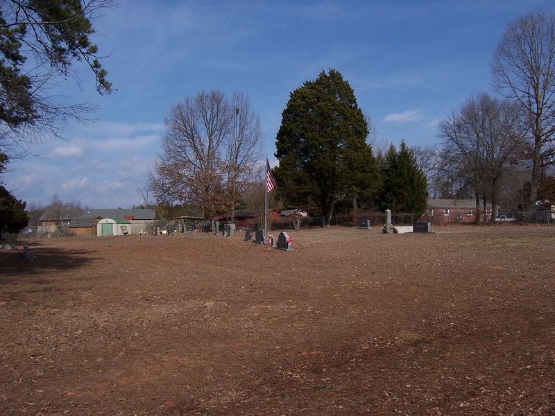
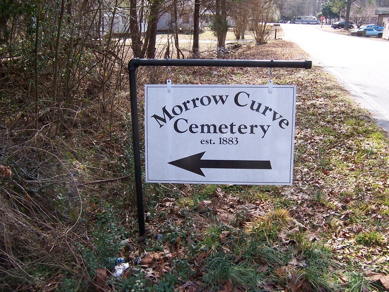
| Description | : | There are two Morrow Cemeteries in Rutherford County. This one is located between Alexander and Sandy Mush. W. D. Floyd provides driving instructions as follows: From Forest City, NC or Highway US 74 take Highway US 221A south and go through the town of Alexander, NC and take the next road to the left after you pass the Forrest Hunt School driveway. This road is Bridges Dr. Go past the first house on the right and there will be an old railroad bed and just past it a driveway out to the cemetery. |
frequently asked questions (FAQ):
-
Where is Morrow Curve Cemetery?
Morrow Curve Cemetery is located at Alexander Mills, Rutherford County ,North Carolina ,USA.
-
Morrow Curve Cemetery cemetery's updated grave count on graveviews.com?
50 memorials
-
Where are the coordinates of the Morrow Curve Cemetery?
Latitude: 35.3007300
Longitude: -81.8490800
Nearby Cemetories:
1. Mount Pleasant Baptist Cemetery
Sandy Mush, Rutherford County, USA
Coordinate: 35.3026220, -81.8395470
2. Alexander Mills Cemetery
Alexander Mills, Rutherford County, USA
Coordinate: 35.3059100, -81.8566200
3. Morrow Cemetery
Forest City, Rutherford County, USA
Coordinate: 35.3216800, -81.8361000
4. New Bethel Independent Church Cemetery
Forest City, Rutherford County, USA
Coordinate: 35.2802970, -81.8657590
5. New Bethel AME Zion Cemetery
Forest City, Rutherford County, USA
Coordinate: 35.2816470, -81.8682090
6. Doggett Cemetery
Forest City, Rutherford County, USA
Coordinate: 35.2932710, -81.8780670
7. Trout Family Cemetery
Sandy Mush, Rutherford County, USA
Coordinate: 35.2762150, -81.8428660
8. Doggett Grove AME Zion Cemetery
Forest City, Rutherford County, USA
Coordinate: 35.2808050, -81.8686810
9. M&T Ministries Cemetery
Forest City, Rutherford County, USA
Coordinate: 35.3324970, -81.8517900
10. McDonald Family Cemetery
Forest City, Rutherford County, USA
Coordinate: 35.3075850, -81.8876240
11. Baxter Family Cemetery
Caroleen, Rutherford County, USA
Coordinate: 35.3028590, -81.8087310
12. Bethany Baptist Church Cemetery
Forest City, Rutherford County, USA
Coordinate: 35.3029200, -81.8933260
13. Oak Grove Missionary Baptist Church
Forest City, Rutherford County, USA
Coordinate: 35.3296300, -81.8782300
14. Joshua Baptist Cemetery
Bostic, Rutherford County, USA
Coordinate: 35.3331750, -81.8260650
15. Providence United Methodist Church Cemetery
Forest City, Rutherford County, USA
Coordinate: 35.2633018, -81.8305969
16. Morning Star Baptist Cemetery
Forest City, Rutherford County, USA
Coordinate: 35.2851830, -81.8952620
17. Glenwood Baptist Cemetery
Bostic, Rutherford County, USA
Coordinate: 35.3422700, -81.8374700
18. Cool Springs Cemetery
Forest City, Rutherford County, USA
Coordinate: 35.3396988, -81.8711014
19. Saint Luke F.B.H. Church Cemetery
Forest City, Rutherford County, USA
Coordinate: 35.3405390, -81.8697340
20. Sisk Memorial Missionary Methodist Church Cemetery
Ellenboro, Rutherford County, USA
Coordinate: 35.3278710, -81.8077240
21. Sulphur Springs Holiness Cemetery
Danieltown, Rutherford County, USA
Coordinate: 35.2844250, -81.9004050
22. Old Cool Springs Baptist Cemetery
Rutherford County, USA
Coordinate: 35.3420280, -81.8712940
23. Tanners Grove United Methodist Cemetery
Rutherford County, USA
Coordinate: 35.2905410, -81.9049720
24. Bostic Baptist Cemetery
Bostic, Rutherford County, USA
Coordinate: 35.3489370, -81.8371580