| Birth | : | 11 Jan 1897 Waltham, Middlesex County, Massachusetts, USA |
| Death | : | 3 Jan 1953 Worcester, Worcester County, Massachusetts, USA |
| Burial | : | Kumara Cemetery, Kumara, Westland District, New Zealand |
| Coordinate | : | -42.6464650, 171.1721970 |
| Plot | : | Section 16 Lot 126 1/2 |
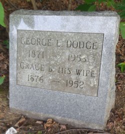
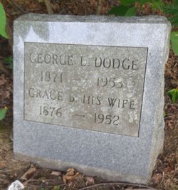
| Description | : | Son of George L. Dodge and Grace D. Beverly. Married to Theresa Agatha Cleary Marital status: Age: 55 Cause: Residence: 1 Chestnut St Leominster Occupation: Informant: Buried: 06 Jan 1953 Undertaker/Funeral Home: Wright Sources: Evergreen Cemetery Records Birth: Massachusetts, Town and Vital Records, 1620-1988 Marriage: Death: Fitchburg Sentinel, Fitchburg, Massachusetts, Monday, January 05, 1953 Page 12 ************************** Earl R. Dodge, 55, of 1 Chestnut street, died Saturday night in Worcester hospital after a brief illness. He was born in Waltham and lived in Leominster 40 years where he was employed in Nixon's drugstore for 35 years. He leaves his wife; Mrs. Teresa (Keating) Dodge; his father, George Dodge of Keene, N. H., three... Read More |
frequently asked questions (FAQ):
-
Where is Earl Raymond Dodge's memorial?
Earl Raymond Dodge's memorial is located at: Kumara Cemetery, Kumara, Westland District, New Zealand.
-
When did Earl Raymond Dodge death?
Earl Raymond Dodge death on 3 Jan 1953 in Worcester, Worcester County, Massachusetts, USA
-
Where are the coordinates of the Earl Raymond Dodge's memorial?
Latitude: -42.6464650
Longitude: 171.1721970
Family Members:
Parent
Spouse
Siblings
Flowers:
Nearby Cemetories:
1. Kumara Cemetery
Kumara, Westland District, New Zealand
Coordinate: -42.6464650, 171.1721970
2. Old Stafford Cemetery
Hokitika, Westland District, New Zealand
Coordinate: -42.6662370, 171.0893140
3. Greenstone Cemetery
Kumara, Westland District, New Zealand
Coordinate: -42.6361450, 171.2751350
4. Gladstone Cemetery
Greymouth, Grey District, New Zealand
Coordinate: -42.5381220, 171.1522540
5. Hokitika Municipal Cemetery
Hokitika, Westland District, New Zealand
Coordinate: -42.7102940, 170.9759800
6. Karoro Cemetery
Greymouth, Grey District, New Zealand
Coordinate: -42.4678260, 171.1893800
7. St Pauls Methodist Church (Defunct)
Greymouth, Grey District, New Zealand
Coordinate: -42.4500880, 171.2114610
8. Cobden Cemetery
Greymouth, Grey District, New Zealand
Coordinate: -42.4371700, 171.2019000
9. Stillwater Cemetery
Greymouth, Grey District, New Zealand
Coordinate: -42.4394820, 171.3494380
10. Notown Cemetery
Dobson, Grey District, New Zealand
Coordinate: -42.4514530, 171.4465670
11. Blackball Cemetery
Greymouth, Grey District, New Zealand
Coordinate: -42.3757410, 171.4135760
12. Nelson Creek Cemetery
Ngahere, Grey District, New Zealand
Coordinate: -42.3865620, 171.4595500
13. Ross Cemetery
Ross, Westland District, New Zealand
Coordinate: -42.8898440, 170.8226160
14. Evans Grave
Arthurs Pass, Selwyn District, New Zealand
Coordinate: -42.7723610, 171.6249940
15. Ross Historic Cemetery
Ross, Westland District, New Zealand
Coordinate: -42.9023200, 170.8113230
16. Ahaura Cemetery
Ahaura, Grey District, New Zealand
Coordinate: -42.3516790, 171.5581700
17. Barrytown Cemetery
Barrytown, Grey District, New Zealand
Coordinate: -42.2455150, 171.3166710
18. Hari Hari Cemetery
Hari Hari, Westland District, New Zealand
Coordinate: -43.1501430, 170.5576110
19. Old Reefton Cemetery
Reefton, Buller District, New Zealand
Coordinate: -42.1115220, 171.8590850
20. Reefton Cemetery
Reefton, Buller District, New Zealand
Coordinate: -42.0856940, 171.8470730
21. Charleston Catholic Cemetery
Charleston, Buller District, New Zealand
Coordinate: -41.9093390, 171.4359110
22. Lake Coleridge Cemetery
Lake Coleridge, Selwyn District, New Zealand
Coordinate: -43.3695530, 171.5264300
23. Nile Hill Cemetery
Charleston, Buller District, New Zealand
Coordinate: -41.8991610, 171.4394080
24. Boatmans Cemetery
Cronadun, Buller District, New Zealand
Coordinate: -42.0391020, 171.8775660


