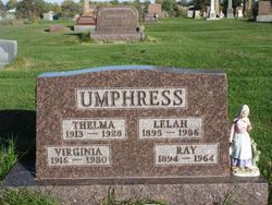
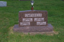
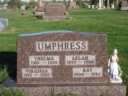
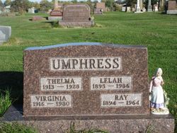
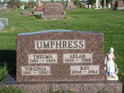
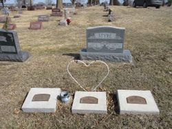
Earl Raymond Umphress
| Birth | : | 10 Jan 1894 Eden Township, Decatur County, Iowa, USA |
| Death | : | 24 Apr 1964 Ottumwa, Wapello County, Iowa, USA |
| Burial | : | Highland Cemetery, Athol, Worcester County, USA |
| Coordinate | : | 42.5889015, -72.2110977 |
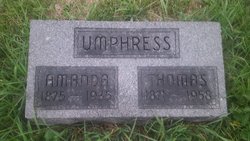
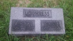
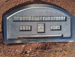
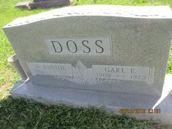
| Description | : | The Ottumwa Daily Courier Apr 25, 1964, Earl R. Umphress, 70 of 729 E. Mary died at 8:30 P.M. Friday at St. Joseph Hospital. He was the son of Thomas O. and Amanda Akes Umpress, and was born in Decatur County, Jan. 10. 1894. He had been a resident of Ottumwa since 1837. He was member of the Ottumwa Baptist Temple. His marriage to Lelah Marvin took place Aug. 12, 1913 at Leon. She survives. Also surviving are two sons, Otis of Ottumwa and Donald Umphress of Eldon; three daughters, Mrs. Bonnie Doss of Des Moines and Miss Virginia Umphress and Mrs. Nonean Johnson, both of Ottumwa;... Read More |
frequently asked questions (FAQ):
-
Where is Earl Raymond Umphress's memorial?
Earl Raymond Umphress's memorial is located at: Highland Cemetery, Athol, Worcester County, USA.
-
When did Earl Raymond Umphress death?
Earl Raymond Umphress death on 24 Apr 1964 in Ottumwa, Wapello County, Iowa, USA
-
Where are the coordinates of the Earl Raymond Umphress's memorial?
Latitude: 42.5889015
Longitude: -72.2110977
Family Members:
Parent
Spouse
Siblings
Children
Flowers:
Nearby Cemetories:
1. Highland Cemetery
Athol, Worcester County, USA
Coordinate: 42.5889015, -72.2110977
2. Old Pleasant Street Cemetery
Athol, Worcester County, USA
Coordinate: 42.5860800, -72.2145100
3. Calvary Cemetery
Athol, Worcester County, USA
Coordinate: 42.5842018, -72.2117004
4. Old Burial Ground
Athol, Worcester County, USA
Coordinate: 42.5889840, -72.2270420
5. Silver Lake Cemetery
Athol, Worcester County, USA
Coordinate: 42.6018982, -72.2249985
6. Mount Pleasant Cemetery
Athol, Worcester County, USA
Coordinate: 42.5943985, -72.2433014
7. Ellinwood Cemetery
Athol, Worcester County, USA
Coordinate: 42.5589400, -72.2142600
8. Gethsemane Cemetery
Athol, Worcester County, USA
Coordinate: 42.5791960, -72.2578310
9. Chestnut Hill Cemetery
Athol, Worcester County, USA
Coordinate: 42.6296997, -72.2042007
10. Fay Cemetery
Athol, Worcester County, USA
Coordinate: 42.5466300, -72.2364200
11. Adams Road Cemetery
Athol, Worcester County, USA
Coordinate: 42.5425560, -72.2133610
12. Stratton Cemetery
Athol, Worcester County, USA
Coordinate: 42.5407872, -72.2151265
13. New Sherborn Cemetery
Athol, Worcester County, USA
Coordinate: 42.5402985, -72.2166977
14. Jones Cemetery
Orange, Franklin County, USA
Coordinate: 42.6148224, -72.2728806
15. Tully Cemetery
Orange, Franklin County, USA
Coordinate: 42.6398000, -72.2504700
16. Lower Cemetery
Phillipston, Worcester County, USA
Coordinate: 42.5583000, -72.1425018
17. Harvard Cemetery
Petersham, Worcester County, USA
Coordinate: 42.5305000, -72.1896100
18. North Orange Cemetery
Orange, Franklin County, USA
Coordinate: 42.6360230, -72.2690530
19. Riverside Cemetery
Royalston, Worcester County, USA
Coordinate: 42.6302986, -72.1453018
20. Maple Cemetery
Royalston, Worcester County, USA
Coordinate: 42.6545520, -72.2235460
21. Upper Cemetery
Phillipston, Worcester County, USA
Coordinate: 42.5512820, -72.1339770
22. Northwest Cemetery
Petersham, Worcester County, USA
Coordinate: 42.5210991, -72.2268982
23. Central Cemetery
Orange, Franklin County, USA
Coordinate: 42.5932960, -72.3066420
24. Nahum Greene Gravesite
Royalston, Worcester County, USA
Coordinate: 42.6545700, -72.1712900

