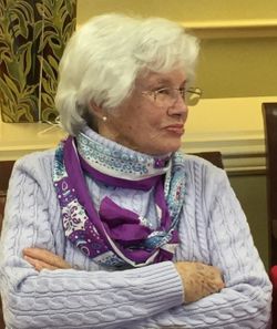
| Birth | : | 24 Apr 1922 |
| Death | : | 14 Feb 2008 |
| Burial | : | Sandy Plains Baptist Church Cemetery, New House, Cleveland County, USA |
| Coordinate | : | 35.3895200, -81.6891200 |
| Description | : | SNYDER, Colo. - Earnest Earl Amsberry, 85, died Thursday (Feb. 14, 2008), at the Colorado Plains Medical Center in Fort Morgan. He was born April, 24, 1922, in St. Francis to Alfred and Susanna (Talmon) Amsberry. He served his country in the U.S. Marines during World War II. He married Betty Billington on Dec. 20, 1945, in St. Francis. They moved from Bird City to Snyder, Colo., in 1950. In 1964, he started his own hay business in Snyder. He attended the Bethlehem Lutheran Church in Brush, Colo. He was a member of the VFW and was involved with the... Read More |
frequently asked questions (FAQ):
-
Where is Earnest Earl Amsberry's memorial?
Earnest Earl Amsberry's memorial is located at: Sandy Plains Baptist Church Cemetery, New House, Cleveland County, USA.
-
When did Earnest Earl Amsberry death?
Earnest Earl Amsberry death on 14 Feb 2008 in
-
Where are the coordinates of the Earnest Earl Amsberry's memorial?
Latitude: 35.3895200
Longitude: -81.6891200
Family Members:
Parent
Spouse
Siblings
Flowers:
Nearby Cemetories:
1. Sandy Plains Baptist Church Cemetery
New House, Cleveland County, USA
Coordinate: 35.3895200, -81.6891200
2. Bridges Cemetery
New House, Cleveland County, USA
Coordinate: 35.4024630, -81.6885070
3. Crowder Cemetery
Polkville, Cleveland County, USA
Coordinate: 35.3927994, -81.6682968
4. Old Hopewell Church Cemetery
Ellenboro, Rutherford County, USA
Coordinate: 35.3863889, -81.7130556
5. Green Cemetery
Cleveland County, USA
Coordinate: 35.4075012, -81.6761017
6. Augustus Wiggins Family Cemetery
Polkville, Cleveland County, USA
Coordinate: 35.3931840, -81.6542530
7. Allen Crowder Cemetery
Polkville, Cleveland County, USA
Coordinate: 35.3978780, -81.6550280
8. Thomas Walker Family Cemetery
Rutherford County, USA
Coordinate: 35.3693990, -81.7184830
9. Chitwood Family Cemetery
Rutherford County, USA
Coordinate: 35.4137190, -81.7136730
10. Mount Olivet Baptist Cemetery
Ellenboro, Rutherford County, USA
Coordinate: 35.4038530, -81.7240990
11. White Oak Springs Baptist Cemetery
Ellenboro, Rutherford County, USA
Coordinate: 35.4086113, -81.7208328
12. Rehobeth Methodist Church Cemetery
Shelby, Cleveland County, USA
Coordinate: 35.3659500, -81.6556200
13. Elliott Cemetery
Polkville, Cleveland County, USA
Coordinate: 35.4247017, -81.6781006
14. Hopewell Community Cemetery
Ellenboro, Rutherford County, USA
Coordinate: 35.3821440, -81.7343430
15. Beam Cemetery
Ellenboro, Rutherford County, USA
Coordinate: 35.3497009, -81.7127991
16. Polkville Baptist Church Cemetery
Polkville, Cleveland County, USA
Coordinate: 35.4167175, -81.6433716
17. Big Springs Baptist Cemetery
Hollis, Rutherford County, USA
Coordinate: 35.4366430, -81.7119510
18. Drury Dobbins Church Cemetery
Ellenboro, Rutherford County, USA
Coordinate: 35.3403200, -81.7093340
19. Drury Dobbins Baptist Church Cemetery
Lattimore, Cleveland County, USA
Coordinate: 35.3386540, -81.7065240
20. Causby Family Cemetery
Shelby, Cleveland County, USA
Coordinate: 35.3999500, -81.6254300
21. Union Baptist Church Cemetery
Polkville, Cleveland County, USA
Coordinate: 35.3867134, -81.6217362
22. Brooks Chapel United Methodist Church Cemetery
Shelby, Cleveland County, USA
Coordinate: 35.4461580, -81.6905520
23. Dobbins Cemetery
Ellenboro, Rutherford County, USA
Coordinate: 35.3369410, -81.7163310
24. Lattimore Baptist Cemetery
Lattimore, Cleveland County, USA
Coordinate: 35.4435997, -81.6667023


