
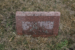
Eddie Lee Brown
| Birth | : | 4 Mar 1872 Roseville, Perry County, Ohio, USA |
| Death | : | 3 May 1950 Pawnee City, Pawnee County, Nebraska, USA |
| Burial | : | Pawnee City Cemetery, Pawnee City, Pawnee County, USA |
| Coordinate | : | 40.1109009, -96.1608810 |
| Plot | : | Hazel Cem. N1/2- 11- 8 |
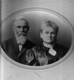
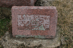
| Description | : | Son of Jacob T. & Martha Jane "Mattie" Brown. Married to Effie Scott on June 28, 1904. (Pawnee Library, book of obits in the Pawnee Republican.) (Pawnee Republican, May 11, 1950) EDDIE L. BROWN Eddie L. Brown was born March 4, 1872 at Roseville, Ohio. He was the son of Jacob T. and Martha J. Brown. His parents were among the early settlers of Pawnee County, coming to Pawnee County in Feb. 1885. He departed this life on May 3, 1950 at the Pawnee County hospital at the age of 78 years, 1 month and 29 days. Eddie L. Brown was united in marriage June 28,... Read More |
frequently asked questions (FAQ):
-
Where is Eddie Lee Brown's memorial?
Eddie Lee Brown's memorial is located at: Pawnee City Cemetery, Pawnee City, Pawnee County, USA.
-
When did Eddie Lee Brown death?
Eddie Lee Brown death on 3 May 1950 in Pawnee City, Pawnee County, Nebraska, USA
-
Where are the coordinates of the Eddie Lee Brown's memorial?
Latitude: 40.1109009
Longitude: -96.1608810
Family Members:
Parent

Spouse
Siblings
Flowers:


Nearby Cemetories:
1. Pawnee City Cemetery
Pawnee City, Pawnee County, USA
Coordinate: 40.1109009, -96.1608810
2. East Amish Cemetery
Table Rock, Pawnee County, USA
Coordinate: 40.1310000, -96.0854000
3. Evergreen Cemetery
Pawnee County, USA
Coordinate: 40.0485992, -96.1417007
4. Pleasant Valley Cemetery
Pawnee County, USA
Coordinate: 40.0299988, -96.1554794
5. Table Rock Cemetery
Table Rock, Pawnee County, USA
Coordinate: 40.1791400, -96.1037400
6. Prairie Star Pioneer Cemetery
Du Bois, Pawnee County, USA
Coordinate: 40.0293000, -96.1041000
7. Beranek Cemetery
Table Rock, Pawnee County, USA
Coordinate: 40.2042007, -96.1607971
8. Pleasant Ridge Cemetery
Du Bois, Pawnee County, USA
Coordinate: 40.0156000, -96.1494000
9. West Branch Cemetery
Pawnee County, USA
Coordinate: 40.0787940, -96.2797160
10. Saint Anthonys Cemetery
Steinauer, Pawnee County, USA
Coordinate: 40.2075005, -96.2189026
11. Johnson Creek Cemetery
Pawnee City, Pawnee County, USA
Coordinate: 40.0270000, -96.2465000
12. Clear Creek Cemetery
Table Rock, Pawnee County, USA
Coordinate: 40.2193985, -96.1391983
13. Bohemian Cemetery
Table Rock, Pawnee County, USA
Coordinate: 40.1786003, -96.0374985
14. Saint Peters Evangelican Cemetery
Du Bois, Pawnee County, USA
Coordinate: 40.0010000, -96.1095000
15. Dry Branch Pioneer Cemetery
Richardson County, USA
Coordinate: 40.1292000, -96.0100021
16. DuBois Cemetery
Du Bois, Pawnee County, USA
Coordinate: 40.0231018, -96.0488968
17. Bohemian Cemetery
Richardson County, USA
Coordinate: 40.1175003, -95.9955978
18. Saint Johns Cemetery
Table Rock, Pawnee County, USA
Coordinate: 40.2148000, -96.0657000
19. Salems Cemetery
Steinauer, Pawnee County, USA
Coordinate: 40.2166000, -96.2555000
20. McCaffrey Cemetery
Nemaha County, USA
Coordinate: 39.9827100, -96.1474500
21. Madden Cemetery
Axtell, Marshall County, USA
Coordinate: 39.9866800, -96.2490300
22. Friedens United Church of Christ Cemetery
Bern, Nemaha County, USA
Coordinate: 39.9929008, -96.0529480
23. Saint Peters Lutheran Church Cemetery
Steinauer, Pawnee County, USA
Coordinate: 40.2555000, -96.1801000
24. Cincinnati Cemetery
Du Bois, Pawnee County, USA
Coordinate: 40.0042000, -96.0274963