
| Birth | : | 14 Jul 1909 Anderson County, Kansas, USA |
| Death | : | 12 Mar 2001 Topeka, Shawnee County, Kansas, USA |
| Burial | : | Holy Cross Cemetery and Chapel Mausoleum, Mays Landing, Atlantic County, USA |
| Coordinate | : | 39.4490395, -74.6839523 |
| Plot | : | O'Leary Sec, Lot 62-C |
| Inscription | : | MOTHER |
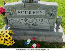
| Description | : | Edith Helena Strobel Harrison, 91, Topeka, died Monday, March 12, 2001, at a Topeka hospice. Mrs. Harrison and her husband purchased Dairy Queen on N. Topeka Boulevard in 1954 and owned and operated it until 1971. She continued to work there until 1980. She attended Scipio Schools and graduated from Ottawa Business College. She was born July 14, 1909, in the Mount Caramel community in Anderson County, the daughter of John and Anna Steinbacher Strobel. Mrs. Harrison was a member of Most Pure Heart of Mary Catholic Church, Daughters of Isabella Little Flower Circle No. 503, Perpetual Member of St. Francis... Read More |
frequently asked questions (FAQ):
-
Where is Edith Helena Strobel Harrison's memorial?
Edith Helena Strobel Harrison's memorial is located at: Holy Cross Cemetery and Chapel Mausoleum, Mays Landing, Atlantic County, USA.
-
When did Edith Helena Strobel Harrison death?
Edith Helena Strobel Harrison death on 12 Mar 2001 in Topeka, Shawnee County, Kansas, USA
-
Where are the coordinates of the Edith Helena Strobel Harrison's memorial?
Latitude: 39.4490395
Longitude: -74.6839523
Family Members:
Parent

Spouse

Siblings
Children
Flowers:


Nearby Cemetories:
1. Holy Cross Cemetery and Chapel Mausoleum
Mays Landing, Atlantic County, USA
Coordinate: 39.4490395, -74.6839523
2. Lincoln Memorial Park
Mays Landing, Atlantic County, USA
Coordinate: 39.4478493, -74.6872635
3. Union Cemetery
Mays Landing, Atlantic County, USA
Coordinate: 39.4373894, -74.7080536
4. Carmantown Cemetery
Carmantown, Atlantic County, USA
Coordinate: 39.4483250, -74.6446000
5. Presbyterian Cemetery
Mays Landing, Atlantic County, USA
Coordinate: 39.4539185, -74.7269821
6. Westcott Free Burying Ground
Mays Landing, Atlantic County, USA
Coordinate: 39.4526215, -74.7281189
7. Catawba Church and Burying Ground
Atlantic County, USA
Coordinate: 39.4082794, -74.7136078
8. Smith-Ireland Burying Ground
Estellville, Atlantic County, USA
Coordinate: 39.4151800, -74.7329640
9. Laurel Memorial Park and Crematory
Egg Harbor Township, Atlantic County, USA
Coordinate: 39.4565887, -74.5941925
10. Estellville Methodist Church Cemetery
Mays Landing, Atlantic County, USA
Coordinate: 39.3976900, -74.7477700
11. Methodist Burying Ground
Estellville, Atlantic County, USA
Coordinate: 39.3978615, -74.7480164
12. Atlantic County Veterans Cemetery
Estell Manor, Atlantic County, USA
Coordinate: 39.3882790, -74.7386017
13. Steelmans Creek Burial Ground
Estell Manor, Atlantic County, USA
Coordinate: 39.3878517, -74.7388687
14. Old Burying Ground
Estellville, Atlantic County, USA
Coordinate: 39.3959680, -74.7518810
15. Asbury Methodist Episcopal Church Cemetery
English Creek, Atlantic County, USA
Coordinate: 39.3621483, -74.6706314
16. Saint Nicholas Roman Catholic Church Cemetery
Egg Harbor City, Atlantic County, USA
Coordinate: 39.5318222, -74.6367950
17. Beth Kehillah Cemetery
Egg Harbor Township, Atlantic County, USA
Coordinate: 39.4091250, -74.5689580
18. Old Weymouth Meeting House Cemetery
Weymouth, Atlantic County, USA
Coordinate: 39.5122070, -74.7802200
19. Rodef Sholom Cemetery
Egg Harbor Township, Atlantic County, USA
Coordinate: 39.4080000, -74.5670500
20. Emeth Shalom Cemetery
Egg Harbor Township, Atlantic County, USA
Coordinate: 39.4067154, -74.5674896
21. Palestine Bible Protestant Church Cemetery
Scullville, Atlantic County, USA
Coordinate: 39.3487091, -74.6608810
22. Egg Harbor City Cemetery
Egg Harbor City, Atlantic County, USA
Coordinate: 39.5504799, -74.6369095
23. Zion United Methodist Church Cemetery
Egg Harbor Township, Atlantic County, USA
Coordinate: 39.3674200, -74.5880000
24. Zion Cemetery
Bargaintown, Atlantic County, USA
Coordinate: 39.3661390, -74.5885100