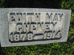
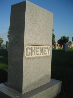
Edith May Ladd Cheney
| Birth | : | 7 May 1878 Hawthorne, Montgomery County, Iowa, USA |
| Death | : | 11 Feb 1914 Emerson, Mills County, Iowa, USA |
| Burial | : | Arnstein Cemetery, Arnstein, Parry Sound District, Canada |
| Coordinate | : | 45.9082100, -79.9174300 |
| Plot | : | 1st Addition #147 |
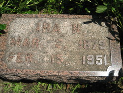
| Description | : | Mills County Tribune, 1914-01-23, page 2 Edith May Ladd was born near Hawthorne, Iowa May 7, 1878, moved to Red Oak in 1902. She was married to Ira N. Cheney in May 1911. She was a graduate of Emerson High School, and afterwards became a successful teacher. She became a member of the Emerson Baptist Church in 1891. She is survived by a husband, mother, and four sisters. Mrs. Ira Cheney passed away Feb. 11, 1914. ------------------------- |
frequently asked questions (FAQ):
-
Where is Edith May Ladd Cheney's memorial?
Edith May Ladd Cheney's memorial is located at: Arnstein Cemetery, Arnstein, Parry Sound District, Canada.
-
When did Edith May Ladd Cheney death?
Edith May Ladd Cheney death on 11 Feb 1914 in Emerson, Mills County, Iowa, USA
-
Where are the coordinates of the Edith May Ladd Cheney's memorial?
Latitude: 45.9082100
Longitude: -79.9174300
Family Members:
Flowers:
Nearby Cemetories:
1. Arnstein Cemetery
Arnstein, Parry Sound District, Canada
Coordinate: 45.9082100, -79.9174300
2. Port and Loring Cemetery
Port Loring, Parry Sound District, Canada
Coordinate: 45.9200833, -79.9874667
3. St. Mary's Cemetery
Loring, Parry Sound District, Canada
Coordinate: 45.9357167, -79.9843667
4. Pioneer Cemetery
Loring, Parry Sound District, Canada
Coordinate: 45.9352167, -79.9869333
5. Golden Valley Cemetery
Golden Valley, Parry Sound District, Canada
Coordinate: 45.9251970, -79.8041630
6. Cedar Grove Cemetery
Restoule, Parry Sound District, Canada
Coordinate: 46.0254720, -79.7339640
7. Maple Island Cemetery
Maple Island, Parry Sound District, Canada
Coordinate: 45.6994100, -79.8725300
8. Ahmic Harbour Cemetery
Ahmic Harbour, Parry Sound District, Canada
Coordinate: 45.6623383, -79.7782211
9. Zion Lutheran Deer Lake Cemetery
Parry Sound, Parry Sound District, Canada
Coordinate: 45.7932440, -79.5596210
10. Barber Poineer Cemetery
Restoule, Parry Sound District, Canada
Coordinate: 46.0636100, -79.5771700
11. Chapman Community Cemetery
Chapman, Parry Sound District, Canada
Coordinate: 45.6943265, -79.6374739
12. Spence Community Cemetery
Spence, Parry Sound District, Canada
Coordinate: 45.6794395, -79.6414413
13. Dunchurch-Fairholme Cemetery
Dunchurch, Parry Sound District, Canada
Coordinate: 45.5963989, -79.9045702
14. Nipissing Union Cemetery
Nipissing, Nipissing District, Canada
Coordinate: 46.0894700, -79.5131200
15. Siloam Cemetery
South River, Parry Sound District, Canada
Coordinate: 45.8499800, -79.4176500
16. South River Cemetery
South River, Parry Sound District, Canada
Coordinate: 45.8359500, -79.3982400
17. Community Of Christ Cemetery
Nipissing District, Canada
Coordinate: 46.1780000, -80.2846667
18. Higher Heights Christian Fellowship Cemetery
South River, Parry Sound District, Canada
Coordinate: 45.8953070, -79.3786800
19. St. Aidan's Anglican Church Cemetery
Monetville, Sudbury District, Canada
Coordinate: 46.1775640, -80.2938640
20. Union Cemetery
Trout Creek, Parry Sound District, Canada
Coordinate: 45.9833200, -79.3768000
21. Strong Community Cemetery
Sundridge, Parry Sound District, Canada
Coordinate: 45.7767448, -79.4004288
22. Calvary Mennonite Cemetery
Monetville, Sudbury District, Canada
Coordinate: 46.1774530, -80.3119470
23. All Peoples Cemetery
Monetville, Sudbury District, Canada
Coordinate: 46.1620556, -80.3435000
24. Sacred Heart Cemetery
Trout Creek, Parry Sound District, Canada
Coordinate: 45.9979500, -79.3710000


