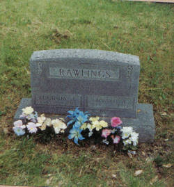
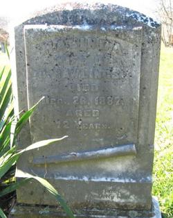
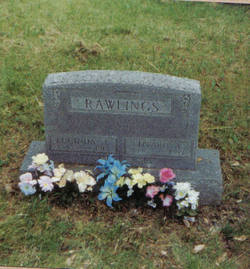
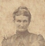
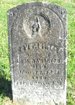
Edward Aaron Rawlings
| Birth | : | 1836 Crawford County, Indiana, USA |
| Death | : | 1885 Crawford County, Indiana, USA |
| Burial | : | Sandhults kyrkogård, Borås, Borås kommun, Sweden |
| Coordinate | : | 57.7696917, 12.8221206 |
| Description | : | Born 1836 Whiskey Run Twp, Crawford Co. IN. Died 1855 Whiskey Run Twp, Crawford Co. IN. M. 1866 Crawford Co. IN. Minnie B (William H Stroud) Feb 11 1867-Nov 11 1894 Lillie S, (James T Roll) memorial 29511289 John T (Lissie E Limeberry) 1871-1942 James Slaughter (Stella M Vanlandingham) Aug 25 1873-Aug 27 1959 Malinda Maude (Wilbur Walk) Leora Monzelle (George Burrell) |
frequently asked questions (FAQ):
-
Where is Edward Aaron Rawlings's memorial?
Edward Aaron Rawlings's memorial is located at: Sandhults kyrkogård, Borås, Borås kommun, Sweden.
-
When did Edward Aaron Rawlings death?
Edward Aaron Rawlings death on 1885 in Crawford County, Indiana, USA
-
Where are the coordinates of the Edward Aaron Rawlings's memorial?
Latitude: 57.7696917
Longitude: 12.8221206
Family Members:
Parent
Spouse
Siblings
Children
Flowers:
Nearby Cemetories:
1. Sandhults kyrkogård
Borås, Borås kommun, Sweden
Coordinate: 57.7696917, 12.8221206
2. Caroli kyrkogård
Borås kommun, Sweden
Coordinate: 57.7219569, 12.9391612
3. Sankt Ansgars griftegård
Borås, Borås kommun, Sweden
Coordinate: 57.7182057, 12.9351487
4. Sankta Birgittas griftegård
Borås, Borås kommun, Sweden
Coordinate: 57.7142538, 12.9332699
5. Sankt Sigfrids griftegård
Borås, Borås kommun, Sweden
Coordinate: 57.7049706, 12.9184835
6. Vänga Kyrkogården
Fristad, Borås kommun, Sweden
Coordinate: 57.8588920, 12.9315350
7. Fristad Church Cemetery
Borås, Borås kommun, Sweden
Coordinate: 57.8181000, 13.0091000
8. Brämhults kyrkogård
Borås, Borås kommun, Sweden
Coordinate: 57.7356940, 13.0276110
9. Toarp nya kyrkogård
Dalsjofors, Borås kommun, Sweden
Coordinate: 57.7360900, 13.1036900
10. Toarp Church Cemetery
Dalsjofors, Borås kommun, Sweden
Coordinate: 57.7377500, 13.1068330
11. Rångedala kyrkogård
Rangedala, Borås kommun, Sweden
Coordinate: 57.7904470, 13.1219796
12. Bollebygd Cemetery
Bollebygd, Bollebygds kommun, Sweden
Coordinate: 57.6666679, 12.5500002
13. Ljushults Kyrkogård
Borås, Borås kommun, Sweden
Coordinate: 57.6174795, 13.0432013
14. Äspered kyrkogård
Aspered, Borås kommun, Sweden
Coordinate: 57.7551211, 13.1835097
15. Hemsjö gamla kyrkogård
Alingsås kommun, Sweden
Coordinate: 57.8530210, 12.4895540
16. Fritsla gamla kyrkogård
Fritsla, Marks kommun, Sweden
Coordinate: 57.5574232, 12.7928255
17. Ornunga gamla kyrkogård
Ornunga, Vårgårda kommun, Sweden
Coordinate: 57.9795830, 12.9132220
18. Landskyrkogården
Alingsås, Alingsås kommun, Sweden
Coordinate: 57.9311746, 12.5397798
19. Alingsås stadskyrkogård
Alingsås, Alingsås kommun, Sweden
Coordinate: 57.9322200, 12.5316200
20. Dannike kyrkogård
Dannike, Borås kommun, Sweden
Coordinate: 57.6833902, 13.2280893
21. Skephult kyrkogård
Skepphult, Marks kommun, Sweden
Coordinate: 57.5361110, 12.8811110
22. Od Church Cemetery
Od, Herrljunga kommun, Sweden
Coordinate: 57.9432060, 13.1874130
23. Tvärred kyrkogård
Ulricehamn, Ulricehamns kommun, Sweden
Coordinate: 57.7258320, 13.3139710
24. Fullestad kyrka
Vårgårda, Vårgårda kommun, Sweden
Coordinate: 58.0297890, 12.6960560

