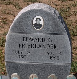
Edward G. Friedlander
| Birth | : | 10 Jul 1950 Coulee Dam, Okanogan County, Washington, USA |
| Death | : | 4 Aug 1993 Bremerton, Kitsap County, Washington, USA |
| Burial | : | George Maxwell Memorial Cemetery, Avondale, Auckland Council, New Zealand |
| Coordinate | : | -36.8890320, 174.6849320 |
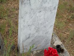
| Description | : | Edward G. Friedlander, 43, Nespelem, died Wednesday, Aug. 4, 1993, in Harrison Hospital, Bremerton. He was born July 10, 1950, to William and Mayselle Friedlander at Coulee Dam. He was raised and educated at Kennewick. He received an electrical degree from Bates Vocational Institute this past year. He is survived by his mother, Mayselle Davis of Port Orchard; three daughters, Lalainia Verduzco of Omak, Faith J. Friedlander of Nespelem and Brittany Joy Friedlander of Quincy; a sister, Peggy Sandaine of Coulee Dam; and a granddaughter, Corina Friedlander of Nespelem. He was preceded in death by his father, William... Read More |
frequently asked questions (FAQ):
-
Where is Edward G. Friedlander's memorial?
Edward G. Friedlander's memorial is located at: George Maxwell Memorial Cemetery, Avondale, Auckland Council, New Zealand.
-
When did Edward G. Friedlander death?
Edward G. Friedlander death on 4 Aug 1993 in Bremerton, Kitsap County, Washington, USA
-
Where are the coordinates of the Edward G. Friedlander's memorial?
Latitude: -36.8890320
Longitude: 174.6849320
Family Members:
Parent
Flowers:
Nearby Cemetories:
1. George Maxwell Memorial Cemetery
Avondale, Auckland Council, New Zealand
Coordinate: -36.8890320, 174.6849320
2. Saint Ninians Churchyard
Avondale, Auckland Council, New Zealand
Coordinate: -36.8994510, 174.6966690
3. Auckland Provincial Memorial
Glen Eden, Auckland Council, New Zealand
Coordinate: -36.9020700, 174.6548500
4. Waikumete Cemetery & Crematorium
Glen Eden, Auckland Council, New Zealand
Coordinate: -36.9025130, 174.6539610
5. St. Luke's Anglican Church Cemetery
Mount Albert, Auckland Council, New Zealand
Coordinate: -36.8785540, 174.7290400
6. Oratia Cemetery
Oratia, Auckland Council, New Zealand
Coordinate: -36.9108800, 174.6218900
7. Settlers Cemetery
Oratia, Auckland Council, New Zealand
Coordinate: -36.9108770, 174.6218870
8. Saint Andrew's Churchyard
Epsom, Auckland Council, New Zealand
Coordinate: -36.8937200, 174.7654100
9. Hillsborough Cemetery
Hillsborough, Auckland Council, New Zealand
Coordinate: -36.9246600, 174.7524030
10. Oratia Combined Church Cemetery
Oratia, Auckland Council, New Zealand
Coordinate: -36.9196396, 174.6119362
11. Mount Eden Stockade Cemetery
Mount Eden, Auckland Council, New Zealand
Coordinate: -36.8678370, 174.7666430
12. Symonds Street Cemetery
Auckland, Auckland Council, New Zealand
Coordinate: -36.8582828, 174.7636628
13. St Mark's Anglican Church Cemetery
Remuera, Auckland Council, New Zealand
Coordinate: -36.8729300, 174.7801600
14. Swanson Cemetery
Swanson, Auckland Council, New Zealand
Coordinate: -36.8718400, 174.5836200
15. St. Peter's Anglican Cemetery
Ōnehunga, Auckland Council, New Zealand
Coordinate: -36.9227113, 174.7847550
16. Our Lady of the Assumption Catholic Church
Ōnehunga, Auckland Council, New Zealand
Coordinate: -36.9223690, 174.7884530
17. Onehunga Catholic Cemetery
Ōnehunga, Auckland Council, New Zealand
Coordinate: -36.9224360, 174.7884560
18. Pompallier Cemetery
Birkenhead, Auckland Council, New Zealand
Coordinate: -36.8036900, 174.7251200
19. Hobsonville Church and Settlers' Cemetery
Hobsonville, Auckland Council, New Zealand
Coordinate: -36.8000500, 174.6551800
20. St. Stephen's Churchyard
Auckland, Auckland Council, New Zealand
Coordinate: -36.8504860, 174.7899970
21. Mangere Piriti Urupā St. James Churchyard
Mangere, Auckland Council, New Zealand
Coordinate: -36.9418970, 174.7835260
22. Birkenhead-Glenfield Cemetery
Birkenhead, Auckland Council, New Zealand
Coordinate: -36.7989000, 174.7234700
23. Waikaraka Cemetery
Ōnehunga, Auckland Council, New Zealand
Coordinate: -36.9297140, 174.7967170
24. Royal New Zealand Navy Memorial
Devonport, Auckland Council, New Zealand
Coordinate: -36.8305900, 174.7898900


