Edward M. Trausch
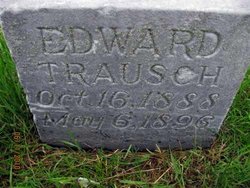
| Birth | : | 16 Oct 1888 |
| Death | : | 6 May 1896 Adams County, Nebraska, USA |
| Burial | : | Assumption Cemetery, Assumption, Adams County, USA |
| Coordinate | : | 40.5103500, -98.5692500 |
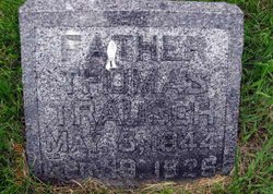
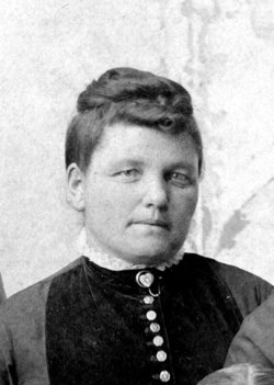
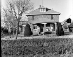
| Description | : | Son of Thomas and Anna Trausch. Adams County Democrat May 1, 1896 A Roseland Accident Near Roseland lives a progressive farmer named Thomas Trausch. Monday afternoon his seventeen year old boy loaded up his shot gun to go hunting. He put the gun to his shoulder and started out, as he did so, the gun was in some manner discharged, the contents entering the head of his younger brother Edward killing him instantly. Coroner Cooke went down and a jury rendered a verdict of accidental killing. This is a terrible blow to the family and the boy who was the... Read More |
frequently asked questions (FAQ):
-
Where is Edward M. Trausch's memorial?
Edward M. Trausch's memorial is located at: Assumption Cemetery, Assumption, Adams County, USA.
-
When did Edward M. Trausch death?
Edward M. Trausch death on 6 May 1896 in Adams County, Nebraska, USA
-
Where are the coordinates of the Edward M. Trausch's memorial?
Latitude: 40.5103500
Longitude: -98.5692500
Family Members:
Parent
Siblings
Flowers:
Nearby Cemetories:
1. Roseland Cemetery
Roseland, Adams County, USA
Coordinate: 40.4622002, -98.5736008
2. Zion Lutheran Cemetery
Wanda Township, Adams County, USA
Coordinate: 40.5340540, -98.6286260
3. Silver Lake Cemetery
Roseland, Adams County, USA
Coordinate: 40.4522018, -98.5425034
4. Holstein Cemetery
Holstein, Adams County, USA
Coordinate: 40.4660988, -98.6378021
5. Mount Pleasant Cemetery
Adams County, USA
Coordinate: 40.4961014, -98.4788971
6. Saint Pauls Lutheran Cemetery
Holstein, Adams County, USA
Coordinate: 40.4667400, -98.6568700
7. Roseland Mennonite Cemetery
Roseland, Adams County, USA
Coordinate: 40.4411011, -98.5164032
8. Juniata Cemetery
Juniata, Adams County, USA
Coordinate: 40.5889015, -98.5286026
9. Immanuel Lutheran Church Cemetery
Ayr, Adams County, USA
Coordinate: 40.5247870, -98.4583300
10. West Ward Cemetery
Holstein, Adams County, USA
Coordinate: 40.4805984, -98.6857986
11. Shiloh Cemetery
Adams County, USA
Coordinate: 40.5525017, -98.7050018
12. Kenesaw Cemetery
Kenesaw, Adams County, USA
Coordinate: 40.6035995, -98.6603012
13. Ingleside Cemetery
Adams County, USA
Coordinate: 40.5862340, -98.4464990
14. Saxour Cemetery
Ayr, Adams County, USA
Coordinate: 40.3940700, -98.4867600
15. Logan Cemetery
Adams County, USA
Coordinate: 40.3927994, -98.6658020
16. Blue Valley Cemetery
Ayr, Adams County, USA
Coordinate: 40.4488983, -98.4011002
17. Concordia Cemetery
Adams County, USA
Coordinate: 40.6556015, -98.5811005
18. Grace Methodist Church Memorial Columbarium
Hastings, Adams County, USA
Coordinate: 40.5937480, -98.4082340
19. Morseville Cemetery
Adams County, USA
Coordinate: 40.3941994, -98.6996994
20. Saint Marks Episcopal Chapel Columbarium
Hastings, Adams County, USA
Coordinate: 40.5877800, -98.3922100
21. First Presbyterian Columbarium
Hastings, Adams County, USA
Coordinate: 40.5895900, -98.3913100
22. Meyer Cemetery
Hayland, Adams County, USA
Coordinate: 40.6696300, -98.5827800
23. Highland Cemetery
Hastings, Adams County, USA
Coordinate: 40.5983009, -98.3906021
24. Kingston Cemetery
Adams County, USA
Coordinate: 40.4383250, -98.3695220

