
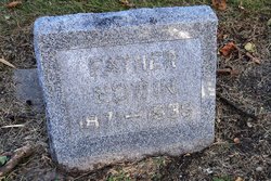
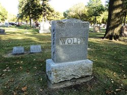
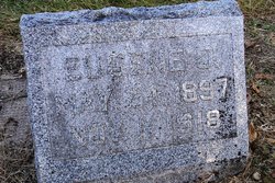
Edwin E Wolfe
| Birth | : | 3 Sep 1871 Ulysses, Butler County, Nebraska, USA |
| Death | : | 26 May 1939 Seward, Seward County, Nebraska, USA |
| Burial | : | Hillcrest Cemetery, Bessemer, Gogebic County, USA |
| Coordinate | : | 46.4855995, -90.0456009 |
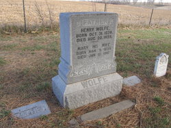
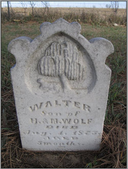
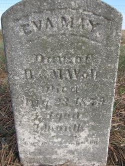
| Description | : | Edwin Wolfe was born September 3, 1871, and died May 26, 1939, at his home four miles south of Garland at the age of 67 years, 8 months and 23 days. His parents were Henry and Mary Wolfe, who came from Illinois to Nebraska in the spring of 1871 and took a homestead near David City, where Edwin was born. His entire life was spent in Butler and Seward Counties, with the exception of the year 1912 when he lived on a farm in Sherman County. He was deeply imbued with the pioneer spirit, living in the adventurous days of homesteading.... Read More |
frequently asked questions (FAQ):
-
Where is Edwin E Wolfe's memorial?
Edwin E Wolfe's memorial is located at: Hillcrest Cemetery, Bessemer, Gogebic County, USA.
-
When did Edwin E Wolfe death?
Edwin E Wolfe death on 26 May 1939 in Seward, Seward County, Nebraska, USA
-
Where are the coordinates of the Edwin E Wolfe's memorial?
Latitude: 46.4855995
Longitude: -90.0456009
Family Members:
Parent

Spouse
Siblings

Children
Flowers:


Nearby Cemetories:
1. Hillcrest Cemetery
Bessemer, Gogebic County, USA
Coordinate: 46.4855995, -90.0456009
2. Lakeside Cemetery
Wakefield, Gogebic County, USA
Coordinate: 46.4674988, -89.9456024
3. Sunset Acres Cemetery
Ironwood, Gogebic County, USA
Coordinate: 46.5189490, -90.1660820
4. Riverside Cemetery
Ironwood, Gogebic County, USA
Coordinate: 46.4599476, -90.1829530
5. Saint Mary's Cemetery
Hurley, Iron County, USA
Coordinate: 46.4443200, -90.1812600
6. Hurley Cemetery
Hurley, Iron County, USA
Coordinate: 46.4429800, -90.1813800
7. Sharey Zedek Cemetery
Hurley, Iron County, USA
Coordinate: 46.4433280, -90.1824760
8. Hillside Cemetery
Iron Belt, Iron County, USA
Coordinate: 46.4000015, -90.3377991
9. Indian Cemetery
Ironwood, Gogebic County, USA
Coordinate: 46.6058330, -90.3305560
10. Lake View Cemetery
Saxon, Iron County, USA
Coordinate: 46.5010986, -90.4227982
11. Marenisco Township Cemetery
Marenisco, Gogebic County, USA
Coordinate: 46.3847220, -89.6969440
12. Calvary Cemetery
Upson, Iron County, USA
Coordinate: 46.3774986, -90.4080963
13. Greenwood Cemetery
Upson, Iron County, USA
Coordinate: 46.3778000, -90.4094009
14. Winchester Memorial Cemetery
Winchester, Vilas County, USA
Coordinate: 46.2452300, -89.8359900
15. Presque Isle Cemetery
Presque Isle, Vilas County, USA
Coordinate: 46.2442017, -89.7624969
16. Edgewood Cemetery
Gurney, Iron County, USA
Coordinate: 46.4972000, -90.5077972
17. Shanty Boy Hill Cemetery
Presque Isle, Vilas County, USA
Coordinate: 46.2473520, -89.7279540
18. Mercer Cemetery
Mercer, Iron County, USA
Coordinate: 46.1575012, -90.0539017
19. Lakeview Cemetery
Bergland, Ontonagon County, USA
Coordinate: 46.5924644, -89.5733185
20. Bergland Cemetery
Bergland, Ontonagon County, USA
Coordinate: 46.6016998, -89.5766983
21. Saint Johns Lutheran Cemetery
Mellen, Ashland County, USA
Coordinate: 46.3923800, -90.5690100
22. Pine Lawn Cemetery
Manitowish Waters, Vilas County, USA
Coordinate: 46.1241250, -89.8659110
23. Mellen Union Cemetery
Mellen, Ashland County, USA
Coordinate: 46.3294800, -90.6621800
24. Cemetery of the Pines
Boulder Junction, Vilas County, USA
Coordinate: 46.1110600, -89.6682100