Elda I. Moore Anneler
| Birth | : | 16 Aug 1913 Arlington, Reno County, Kansas, USA |
| Death | : | 17 Nov 2009 Stafford, Stafford County, Kansas, USA |
| Burial | : | Ruru Lawn Cemetery, Bromley, Christchurch City, New Zealand |
| Coordinate | : | -43.5322470, 172.6918010 |
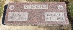
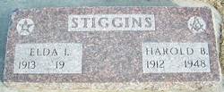
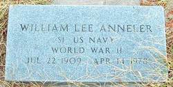
| Description | : | SYLVIA - Elda I. "Grams" (Stiggins) Anneler, 96, died Tuesday, Nov. 17, 2009, at Leisure Homestead, Stafford. Born Aug. 16, 1913, in Sego Township, Arlington, Kansas she was the daughter of Samuel and Mina Moore. She was the owner/operator of Elda's Beauty Shop of Sylvia. She was married to Harold B. Stiggins before his death on March 1, 1948. On June 1, 1950, she married William L. Anneler at Sylvia. He died April 14, 1978. She is survived by: sons, Robert Stiggins and his wife Luetta of Hutchinson, George Jones and his wife Ann of Ellsworth; 10 grandchildren; 29 great-grandchildren; and... Read More |
frequently asked questions (FAQ):
-
Where is Elda I. Moore Anneler's memorial?
Elda I. Moore Anneler's memorial is located at: Ruru Lawn Cemetery, Bromley, Christchurch City, New Zealand.
-
When did Elda I. Moore Anneler death?
Elda I. Moore Anneler death on 17 Nov 2009 in Stafford, Stafford County, Kansas, USA
-
Where are the coordinates of the Elda I. Moore Anneler's memorial?
Latitude: -43.5322470
Longitude: 172.6918010
Family Members:
Parent
Spouse
Siblings
Children
Flowers:
Nearby Cemetories:
1. Ruru Lawn Cemetery
Bromley, Christchurch City, New Zealand
Coordinate: -43.5322470, 172.6918010
2. Canterbury Provincial Memorial
Bromley, Christchurch City, New Zealand
Coordinate: -43.5329620, 172.6896830
3. Memorial Park Cemetery
Bromley, Christchurch City, New Zealand
Coordinate: -43.5291840, 172.6877410
4. Linwood Cemetery
Linwood, Christchurch City, New Zealand
Coordinate: -43.5299220, 172.6828180
5. Bromley Cemetery
Bromley, Christchurch City, New Zealand
Coordinate: -43.5384980, 172.6862960
6. Canterbury Memorial Gardens and Crematorium
Bromley, Christchurch City, New Zealand
Coordinate: -43.5420790, 172.6893340
7. Woolston Cemetery
Woolston, Christchurch City, New Zealand
Coordinate: -43.5559770, 172.6825880
8. Avonside Anglican Cemetery
Avonside, Christchurch City, New Zealand
Coordinate: -43.5265780, 172.6585100
9. All Saints Church Cemetery
Burwood, Christchurch City, New Zealand
Coordinate: -43.4999650, 172.6865820
10. Blessed Sacrament Cathedral
Christchurch, Christchurch City, New Zealand
Coordinate: -43.5384250, 172.6458880
11. Barbadoes Street Cemetery
Christchurch, Christchurch City, New Zealand
Coordinate: -43.5230370, 172.6458760
12. Addington Cemetery
Addington, Christchurch City, New Zealand
Coordinate: -43.5434880, 172.6235790
13. Sydenham Cemetery
Sydenham, Christchurch City, New Zealand
Coordinate: -43.5582330, 172.6254900
14. Lyttelton Anglican Cemetery
Lyttelton, Christchurch City, New Zealand
Coordinate: -43.5985240, 172.7226520
15. St Paul's Anglican Church Cemetery
Papanui, Christchurch City, New Zealand
Coordinate: -43.4966540, 172.6067210
16. Lyttelton Cemetery
Lyttelton, Christchurch City, New Zealand
Coordinate: -43.6018530, 172.7255220
17. Belfast Cemetery
Belfast, Christchurch City, New Zealand
Coordinate: -43.4532460, 172.6424400
18. St Peter's Anglican Churchyard
Upper Riccarton, Christchurch City, New Zealand
Coordinate: -43.5317570, 172.5701330
19. Waimairi Cemetery
Burnside, Christchurch City, New Zealand
Coordinate: -43.4997760, 172.5773860
20. Mount Magdala Cemetery
Halswell, Christchurch City, New Zealand
Coordinate: -43.5622700, 172.5672600
21. Diamond Harbour Cemetery
Diamond Harbour, Christchurch City, New Zealand
Coordinate: -43.6237700, 172.7410400
22. St. Mary's Anglican Church Cemetery
Halswell, Christchurch City, New Zealand
Coordinate: -43.5794830, 172.5686440
23. Harewood Memorial Gardens & Crematorium
Harewood, Christchurch City, New Zealand
Coordinate: -43.4642810, 172.5845430
24. Avonhead Memorial Cemetery
Avonhead, Christchurch City, New Zealand
Coordinate: -43.5095390, 172.5503920

