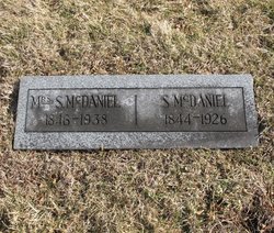
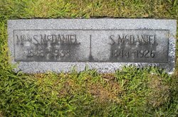
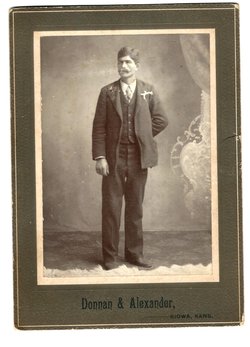
Eleanor Jane Wood McDaniel
| Birth | : | 14 Dec 1846 Saline County, Missouri, USA |
| Death | : | 23 Jun 1938 Westphalia, Osage County, Missouri, USA |
| Burial | : | Harvard Grove Cemetery, Cleveland, Cuyahoga County, USA |
| Coordinate | : | 41.4522040, -81.6471880 |
| Description | : | Eleanor Jane Wood McDaniel was the daughter of Elisha Wood (abt 1826-aft 1900) and Susan Ann Baker Wood (1824 or 1827-?) of Saline County, MO. She married Samuel P. McDaniel, her favorite competitor in spelling bees at school when she was a girl, in Pettis County, 11 Oct. 1866, after he returned from his adventures serving in the Army of the Confederacy. He became a pastor in the Christian Church, Disciples of Christ (Campbellites). Eleanor was a devoted Christian wife and mother and a diligent pastor's wife/farmer's wife. She worked very hard. She was also very determined and laid down... Read More |
frequently asked questions (FAQ):
-
Where is Eleanor Jane Wood McDaniel's memorial?
Eleanor Jane Wood McDaniel's memorial is located at: Harvard Grove Cemetery, Cleveland, Cuyahoga County, USA.
-
When did Eleanor Jane Wood McDaniel death?
Eleanor Jane Wood McDaniel death on 23 Jun 1938 in Westphalia, Osage County, Missouri, USA
-
Where are the coordinates of the Eleanor Jane Wood McDaniel's memorial?
Latitude: 41.4522040
Longitude: -81.6471880
Family Members:
Parent
Spouse
Siblings
Children
Flowers:
Nearby Cemetories:
1. Harvard Grove Cemetery
Cleveland, Cuyahoga County, USA
Coordinate: 41.4522040, -81.6471880
2. Lansing Cemetery
Cleveland, Cuyahoga County, USA
Coordinate: 41.4502983, -81.6492004
3. Harvard Cemetery
Cleveland, Cuyahoga County, USA
Coordinate: 41.4485321, -81.6483917
4. Baxter Cemetery
Cleveland, Cuyahoga County, USA
Coordinate: 41.4596596, -81.6432800
5. Saint Marys Cemetery
Cuyahoga Heights, Cuyahoga County, USA
Coordinate: 41.4296989, -81.6427994
6. Calvary Cemetery
Cleveland, Cuyahoga County, USA
Coordinate: 41.4449900, -81.6147300
7. Cleveland State Hospital Cemetery
Newburgh Heights, Cuyahoga County, USA
Coordinate: 41.4393010, -81.6177790
8. Saint John Cemetery
Cleveland, Cuyahoga County, USA
Coordinate: 41.4860992, -81.6408005
9. Saint Josephs Cemetery
Cleveland, Cuyahoga County, USA
Coordinate: 41.4869003, -81.6318970
10. Foote Family Cemetery
Brooklyn Heights, Cuyahoga County, USA
Coordinate: 41.4199830, -81.6717380
11. Woodland Cemetery
Cleveland, Cuyahoga County, USA
Coordinate: 41.4900017, -81.6425018
12. Denison Cemetery
Cleveland, Cuyahoga County, USA
Coordinate: 41.4517400, -81.6993300
13. Riverside Cemetery
Cleveland, Cuyahoga County, USA
Coordinate: 41.4555206, -81.7008667
14. Brooklyn Union Burial Ground
Cleveland, Cuyahoga County, USA
Coordinate: 41.4362488, -81.6974411
15. Scranton Road Cemetery
Cleveland, Cuyahoga County, USA
Coordinate: 41.4733391, -81.6962891
16. Saint John Lutheran Cemetery
Garfield Heights, Cuyahoga County, USA
Coordinate: 41.4164009, -81.6046982
17. Brookmere Cemetery
Cleveland, Cuyahoga County, USA
Coordinate: 41.4432983, -81.7102966
18. Brooklyn Heights Cemetery
Cleveland, Cuyahoga County, USA
Coordinate: 41.4286003, -81.7035980
19. Saint Mary Polish National Church Cemetery
Parma, Cuyahoga County, USA
Coordinate: 41.4155830, -81.6919290
20. Saint Mary Cemetery
Cleveland, Cuyahoga County, USA
Coordinate: 41.4704900, -81.7119750
21. Monroe Street Cemetery
Cleveland, Cuyahoga County, USA
Coordinate: 41.4787700, -81.7066600
22. Erie Street Cemetery
Cleveland, Cuyahoga County, USA
Coordinate: 41.4972687, -81.6831131
23. Crossview Cemetery
Seven Hills, Cuyahoga County, USA
Coordinate: 41.4022789, -81.6688995
24. West Family Cemetery
Independence, Cuyahoga County, USA
Coordinate: 41.3993301, -81.6499939

