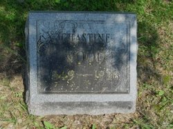
Chastine Wood
| Birth | : | 6 Feb 1849 Cooper County, Missouri, USA |
| Death | : | 21 Mar 1926 Sedalia, Pettis County, Missouri, USA |
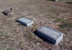
| Burial | : | Calvary Cemetery, Austin, Lander County, USA |
| Coordinate | : | 39.5006800, -117.0851300 |
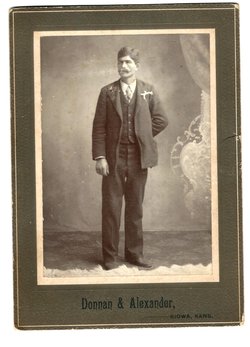
| Description | : | Chastine Wood, aged 70 years, died at 4:30 o'clock Sunday afternoon at his home, 620 East Broadway, following a short illness. He was born in Cooper county, February 6, 1849 and has been a resident of Sedalia for the past 25 years. He was a member of the Baptist church. For the past six years he was watchman at M.K.T. crossing at Broadway. Besides his widow, Minnie (Nannie) B. Wood, he is survived by the following children: Ord W. Wood, Walter A. Wood and Clarence A.... Read More |
frequently asked questions (FAQ):
-
Where is Chastine Wood's memorial?
Chastine Wood's memorial is located at: Calvary Cemetery, Austin, Lander County, USA.
-
When did Chastine Wood death?
Chastine Wood death on 21 Mar 1926 in Sedalia, Pettis County, Missouri, USA
-
Where are the coordinates of the Chastine Wood's memorial?
Latitude: 39.5006800
Longitude: -117.0851300
Family Members:
Parent
Spouse
Siblings
Children
Flowers:
Nearby Cemetories:
1. Calvary Cemetery
Austin, Lander County, USA
Coordinate: 39.5006800, -117.0851300
2. IOOF Cemetery
Austin, Lander County, USA
Coordinate: 39.5009700, -117.0854100
3. Masonic Cemetery
Austin, Lander County, USA
Coordinate: 39.5008000, -117.0846200
4. Austin Indian Cemetery
Austin, Lander County, USA
Coordinate: 39.5009900, -117.0878000
5. Mount Airy Gravesite
Mount Airy, Lander County, USA
Coordinate: 39.5041400, -117.3793700
6. Kingston Cemetery
Lander County, USA
Coordinate: 39.1991997, -117.0856018
7. Millett Cemetery
Millett, Nye County, USA
Coordinate: 39.0152069, -117.1809221
8. Farr Ranch Cemetery
Battle Mountain, Lander County, USA
Coordinate: 39.9538610, -117.4256080
9. Old Miner Cemetery
Ophir, Nye County, USA
Coordinate: 38.9403305, -117.2408295
10. Reese River Cemetery
Reese River, Nye County, USA
Coordinate: 38.9966583, -117.4687576
11. Yomba Indian Tribal Cemetery
Reese River, Nye County, USA
Coordinate: 38.9122000, -117.4905000
12. Ione Cemetery
Ione, Nye County, USA
Coordinate: 38.9448013, -117.5942993
13. Darrough Family Cemetery
Darroughs Hot Springs, Nye County, USA
Coordinate: 38.8201500, -117.1816000
14. Cortez Cemetery
Cortez, Lander County, USA
Coordinate: 40.1395300, -116.5991700
15. Ellsworth Mining Camp Cemetery
Nye County, USA
Coordinate: 38.9728500, -117.7571500
16. Berlin Cemetery
Nye County, USA
Coordinate: 38.8799000, -117.6137000
17. Wonder Cemetery
Middlegate, Churchill County, USA
Coordinate: 39.4247600, -118.0580900
18. Grantsville Cemetery
Nye County, USA
Coordinate: 38.8389015, -117.5626984
19. Round Mountain Cemetery
Nye County, USA
Coordinate: 38.7153015, -117.0678024
20. Dixie Valley Cemetery
Dixie Valley, Churchill County, USA
Coordinate: 39.6521090, -118.1466400
21. Alexander Brown Gravesite
Pershing County, USA
Coordinate: 40.0578400, -117.9150900
22. Broken Hills Grave
Mina, Mineral County, USA
Coordinate: 39.0542500, -118.0211400
23. Eureka County Cemetery
Eureka, Eureka County, USA
Coordinate: 39.5099200, -115.9721100
24. Cedar Hills Cemetery
Eureka, Eureka County, USA
Coordinate: 39.5137000, -115.9716700

