

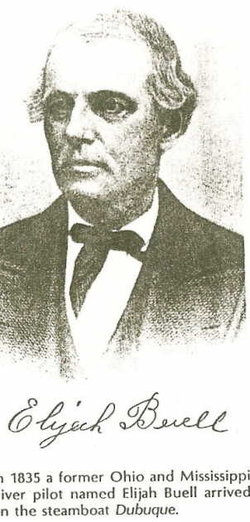
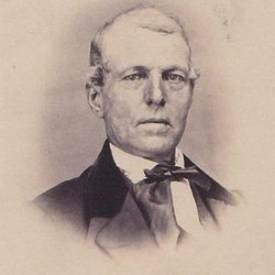
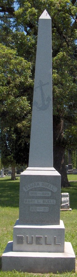
Elijah Buell
| Birth | : | 4 Apr 1805 Utica, Oneida County, New York, USA |
| Death | : | 9 Mar 1889 Lyons, Clinton County, Iowa, USA |
| Burial | : | St. Fabian & St. Sebastian Churchyard, Woodbastwick, Broadland District, England |
| Coordinate | : | 52.6841900, 1.4492890 |
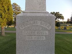
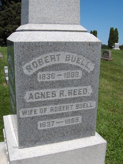
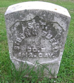
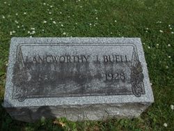
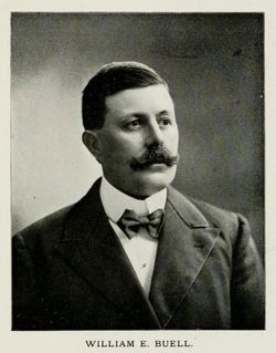
| Description | : | Early settler in Lyons, Iowa. Operated a ferry across the Mississippi River in 1835. Piloted Great Lakes and Mississippi River vessels. Married Caroline Boyd in 1824. Children born of their marriage were Robert and Strong. Caroline died in 1838. Elijah married Mary L. Pearce in 1841. They had following children: George, Langworthy, William, Mary, Caroline, Louisa, and Eliza. |
frequently asked questions (FAQ):
-
Where is Elijah Buell's memorial?
Elijah Buell's memorial is located at: St. Fabian & St. Sebastian Churchyard, Woodbastwick, Broadland District, England.
-
When did Elijah Buell death?
Elijah Buell death on 9 Mar 1889 in Lyons, Clinton County, Iowa, USA
-
Where are the coordinates of the Elijah Buell's memorial?
Latitude: 52.6841900
Longitude: 1.4492890
Family Members:
Spouse
Children


Flowers:


Nearby Cemetories:
1. St. Fabian & St. Sebastian Churchyard
Woodbastwick, Broadland District, England
Coordinate: 52.6841900, 1.4492890
2. Salhouse Baptist Church
Salhouse, Broadland District, England
Coordinate: 52.6807500, 1.4223800
3. All Saints Churchyard
Panxworth, Broadland District, England
Coordinate: 52.6688790, 1.4703430
4. St. Helen's Churchyard
Ranworth, Broadland District, England
Coordinate: 52.6792260, 1.4836790
5. St. Benedict's Church Cemetery
Horning, North Norfolk District, England
Coordinate: 52.6955690, 1.4836570
6. All Saints Churchyard
Salhouse, Broadland District, England
Coordinate: 52.6833600, 1.4063280
7. St John's Churchyard
Hoveton, North Norfolk District, England
Coordinate: 52.7120040, 1.4174270
8. St. Mary's Churchyard
South Walsham, Broadland District, England
Coordinate: 52.6650660, 1.4965400
9. All Saints Churchyard
Hemblington, Broadland District, England
Coordinate: 52.6505100, 1.4769600
10. St. Mary the Virgin Churchyard
Wroxham, Broadland District, England
Coordinate: 52.7067470, 1.3984620
11. South Walsham Cemetery
South Walsham, Broadland District, England
Coordinate: 52.6636180, 1.5026400
12. Wroxham Parish Council Cemetery
Wroxham, Broadland District, England
Coordinate: 52.7079631, 1.3994432
13. Neatishead Baptist Churchyard
Neatishead, North Norfolk District, England
Coordinate: 52.7240100, 1.4633560
14. St. Peter Churchyard
Neatishead, North Norfolk District, England
Coordinate: 52.7244260, 1.4703220
15. St. Peter's Churchyard
Hoveton, North Norfolk District, England
Coordinate: 52.7239790, 1.4256250
16. St Gervase and St Protase Churchyard
Little Plumstead, Broadland District, England
Coordinate: 52.6468000, 1.4093000
17. St. Benets Abbey
Horning, North Norfolk District, England
Coordinate: 52.6864000, 1.5247000
18. St. Peter's Churchyard
Belaugh, Broadland District, England
Coordinate: 52.7153080, 1.3867600
19. St Andrew Burial Ground
North Burlingham, Broadland District, England
Coordinate: 52.6371215, 1.4878464
20. St. Peter and St. Andrew Churchyard
Blofield, Broadland District, England
Coordinate: 52.6302560, 1.4451200
21. St. Mary the Virgin Churchyard
Great Plumstead, North Norfolk District, England
Coordinate: 52.6385560, 1.4007180
22. St. Mary the Virgin Churchyard
Great Plumstead, Broadland District, England
Coordinate: 52.6384790, 1.4008340
23. Cucumber Lane Cemetery
Brundall, Broadland District, England
Coordinate: 52.6304330, 1.4259830
24. St. Michael's Churchyard
Irstead, North Norfolk District, England
Coordinate: 52.7299947, 1.5015802