

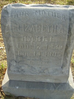
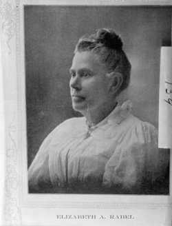
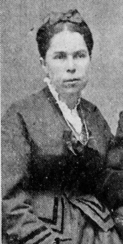
Elizabeth Ann Holdaway Rabel
| Birth | : | 7 Jul 1829 Hawkins County, Tennessee, USA |
| Death | : | 14 Jan 1905 San Bernardino County, California, USA |
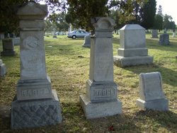
| Burial | : | Eastnor Township Cemetery, Eastnor Township, Bruce County, Canada |
| Coordinate | : | 44.9565200, -81.2648500 |
| Plot | : | block 4-8-7-space 7 |
| Inscription | : | San Bernardino Pioneer plaque |
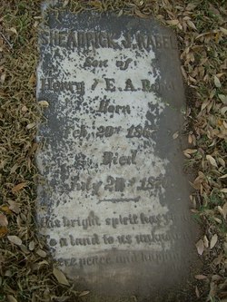
| Description | : | Daughter of Timothy(1801-1834 San Luis Obispo) and Mary "Elizabeth" Mahala(Trent)(1803-1873 San Luis Obispo)Holdaway. Married Henry Rabel 8 Oct 1849 in St.Louis,Missouri. In the 1880 census shows Elizabeth married to Henry with 2 sons Timothy and Hiram. Elizabeth kept the Health resort open till 1895 at that time selling to Omer Sheldon. |
frequently asked questions (FAQ):
-
Where is Elizabeth Ann Holdaway Rabel's memorial?
Elizabeth Ann Holdaway Rabel's memorial is located at: Eastnor Township Cemetery, Eastnor Township, Bruce County, Canada.
-
When did Elizabeth Ann Holdaway Rabel death?
Elizabeth Ann Holdaway Rabel death on 14 Jan 1905 in San Bernardino County, California, USA
-
Where are the coordinates of the Elizabeth Ann Holdaway Rabel's memorial?
Latitude: 44.9565200
Longitude: -81.2648500
Family Members:
Parent
Spouse

Siblings
Children
Flowers:


Nearby Cemetories:
1. Eastnor Township Cemetery
Eastnor Township, Bruce County, Canada
Coordinate: 44.9565200, -81.2648500
2. Stokes Bay Cemetery
Stokes Bay, Bruce County, Canada
Coordinate: 45.0052299, -81.3674927
3. Red Bay Cemetery
Red Bay, Bruce County, Canada
Coordinate: 44.8015000, -81.2827000
4. Cape Croker St. Mary's First Nations Cemetery
Cape Croker, Bruce County, Canada
Coordinate: 44.9243200, -81.0198100
5. Little Port Elgin First Nations Cemetery
Little Port Elgin, Bruce County, Canada
Coordinate: 44.8880600, -81.0333400
6. Edgehill Cemetery
Wiarton, Bruce County, Canada
Coordinate: 44.7842700, -81.1237200
7. Balsam Grove Cemetery
Oliphant, Bruce County, Canada
Coordinate: 44.7367000, -81.2755000
8. Lucius Albert Burial Site
Oliphant, Bruce County, Canada
Coordinate: 44.7313830, -81.2748130
9. Oxenden Cemetery
Oxenden, Grey County, Canada
Coordinate: 44.7620980, -81.0918510
10. Bayview Cemetery
Wiarton, Bruce County, Canada
Coordinate: 44.7354240, -81.1345901
11. McVicar Cemetery
Saint-Edmunds Township, Bruce County, Canada
Coordinate: 45.1543480, -81.4642900
12. Big Bay Cemetery
Big Bay, Grey County, Canada
Coordinate: 44.7801622, -80.9496850
13. Jackson Cemetery
Amabel Township, Bruce County, Canada
Coordinate: 44.6500000, -81.1928000
14. St Mary's Cemetery
Hepworth, Bruce County, Canada
Coordinate: 44.6317220, -81.1802850
15. Zion Cemetery
Hepworth, Bruce County, Canada
Coordinate: 44.6317600, -81.1795300
16. Boyd Cemetery
Shallow Lake, Grey County, Canada
Coordinate: 44.6257800, -81.1115300
17. French Bay Cemetery
Saugeen Township, Bruce County, Canada
Coordinate: 44.5760020, -81.2835860
18. Dunk's Bay Cemetery
Tobermory, Bruce County, Canada
Coordinate: 45.2489000, -81.6459000
19. Mount Pleasant Cemetery
Georgian Bluffs, Grey County, Canada
Coordinate: 44.6065700, -80.9488100
20. Chippawa Hill Scotch Settlement Sacred Heart Cemet
Chippawa Hill, Bruce County, Canada
Coordinate: 44.5364090, -81.2878540
21. Old Methodist Cemetery
Allenford, Bruce County, Canada
Coordinate: 44.5365900, -81.1742900
22. Leith United Church Cemetery
Leith, Grey County, Canada
Coordinate: 44.6219400, -80.8769500
23. Vanwyck Cemetery
Balaclava, Grey County, Canada
Coordinate: 44.6851090, -80.7755830
24. Menary's Cemetery
Balaclava, Grey County, Canada
Coordinate: 44.6863100, -80.7737990