| Birth | : | 29 Oct 1839 Oklahoma, USA |
| Death | : | 16 Jan 1860 Sevier County, Arkansas, USA |
| Burial | : | Roland Cemetery, Roland, Sequoyah County, USA |
| Coordinate | : | 35.4185982, -94.5267029 |
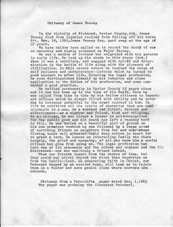
| Description | : | Elizabeth Ann Penney born, Eagletown Chocktaw Nation Territory of Oklahoma Oct. 29, 1839 died Jan 16, 1860 at her fathers home. Buried Penney Cemetery Falls Chapel Sevier Co. Arkansas. Died in childbirth. Son James William Petty born and died Jan. 16, 1860. Both were buried in Penney Cemetery Falls Chapel. Married Huge Petty Sep 1, 1858 by Rev B Aberanathy. Parents James Penney and Hannah Powell Marshall Penney. |
frequently asked questions (FAQ):
-
Where is Elizabeth Ann Penney Petty's memorial?
Elizabeth Ann Penney Petty's memorial is located at: Roland Cemetery, Roland, Sequoyah County, USA.
-
When did Elizabeth Ann Penney Petty death?
Elizabeth Ann Penney Petty death on 16 Jan 1860 in Sevier County, Arkansas, USA
-
Where are the coordinates of the Elizabeth Ann Penney Petty's memorial?
Latitude: 35.4185982
Longitude: -94.5267029
Family Members:
Parent
Siblings
Children
Flowers:
Nearby Cemetories:
1. Roland Cemetery
Roland, Sequoyah County, USA
Coordinate: 35.4185982, -94.5267029
2. Shady Grove Baptist Church Cemetery
Muldrow, Sequoyah County, USA
Coordinate: 35.3947100, -94.5135400
3. Upper Camp Creek Cemetery
Muldrow, Sequoyah County, USA
Coordinate: 35.4444008, -94.5558014
4. Muldrow Memory Garden
Muldrow, Sequoyah County, USA
Coordinate: 35.3905983, -94.5674973
5. Faulkner Cemetery
Muldrow, Sequoyah County, USA
Coordinate: 35.3978004, -94.5894012
6. Liberty Cemetery
Roland, Sequoyah County, USA
Coordinate: 35.4745100, -94.5426710
7. Cottonwood Cemetery
Muldrow, Sequoyah County, USA
Coordinate: 35.3630981, -94.5503006
8. Lees Chapel Cemetery
Muldrow, Sequoyah County, USA
Coordinate: 35.3532982, -94.5738983
9. Dora Cemetery
Van Buren, Crawford County, USA
Coordinate: 35.4493350, -94.4394630
10. Czarnikow Cemetery
Roland, Sequoyah County, USA
Coordinate: 35.4883000, -94.4775000
11. Blackjack Cemetery
Blackjack, Sequoyah County, USA
Coordinate: 35.4262000, -94.6308000
12. Fort Smith National Cemetery
Fort Smith, Sebastian County, USA
Coordinate: 35.3838997, -94.4291992
13. Saint John Episcopal Church Columbarium
Fort Smith, Sebastian County, USA
Coordinate: 35.3895490, -94.4234350
14. Paw Paw Cemetery
Paw Paw, Sequoyah County, USA
Coordinate: 35.3274700, -94.5118700
15. Long Cemetery
Long, Sequoyah County, USA
Coordinate: 35.4972940, -94.5888480
16. First Presbyterian Church Columbarium
Fort Smith, Sebastian County, USA
Coordinate: 35.3849900, -94.4182700
17. Immaculate Conception Catholic Columbarium
Fort Smith, Sebastian County, USA
Coordinate: 35.3828960, -94.4184930
18. Wilson Rock Cemetery
Muldrow, Sequoyah County, USA
Coordinate: 35.3318400, -94.5787900
19. First United Methodist Church Columbarium
Fort Smith, Sebastian County, USA
Coordinate: 35.3834560, -94.4150440
20. Boyd Cemetery
Long, Sequoyah County, USA
Coordinate: 35.5160147, -94.5122222
21. Jewish Cemetery
Fort Smith, Sebastian County, USA
Coordinate: 35.3757000, -94.4176000
22. Calvary Cemetery
Fort Smith, Sebastian County, USA
Coordinate: 35.3764000, -94.4167023
23. Goddard United Methodistb Church Columbarium
Fort Smith, Sebastian County, USA
Coordinate: 35.3720830, -94.4129730
24. Woodlawn Memorial Park
Fort Smith, Sebastian County, USA
Coordinate: 35.3443300, -94.4329000


