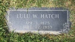
| Birth | : | 30 Apr 1894 Gray County, Kansas, USA |
| Death | : | 16 Nov 1965 Dodge City, Ford County, Kansas, USA |
| Burial | : | Cimarron Cemetery, Cimarron, Gray County, USA |
| Coordinate | : | 37.8178200, -100.3411900 |
| Plot | : | Sec Old 2, Lot 266, Sp 3 |
| Description | : | Cimarron-Mrs. Libbie Duncan, 71, died Tuesday afternoon at Trinity Hospital, Dodge City, after a brief illness. Born April 30, 1894, in Gray County, she married George M. Duncan, Dec. 24, 1919 at Wichita. Until she retired several years ago, she worked for the Cimarron Insurance Co. and was a member of the First Christian Church, Cimarron. Survivors include a son, George of Spokane, Wash.; a daughter, Mrs. Virginia Gibeson, San Antonio, Tex.; two sisters, Mrs. Ethel Johnson and Mrs. Daisy Harris, both of Cimarron; and five grandchildren. Garden City Telegram dated November 17, 1965 Information provided by Contributor #48524515. |
frequently asked questions (FAQ):
-
Where is Elizabeth C. “Libbie” Whiteside Duncan's memorial?
Elizabeth C. “Libbie” Whiteside Duncan's memorial is located at: Cimarron Cemetery, Cimarron, Gray County, USA.
-
When did Elizabeth C. “Libbie” Whiteside Duncan death?
Elizabeth C. “Libbie” Whiteside Duncan death on 16 Nov 1965 in Dodge City, Ford County, Kansas, USA
-
Where are the coordinates of the Elizabeth C. “Libbie” Whiteside Duncan's memorial?
Latitude: 37.8178200
Longitude: -100.3411900
Family Members:
Parent
Spouse
Siblings
Children
Flowers:
Nearby Cemetories:
1. Cimarron Cemetery
Cimarron, Gray County, USA
Coordinate: 37.8178200, -100.3411900
2. Cimarron Cemetery Foote Addition
Cimarron, Gray County, USA
Coordinate: 37.8265700, -100.3452900
3. Ingalls-Logan Cemetery
Ingalls, Gray County, USA
Coordinate: 37.8417015, -100.4574966
4. Ridenhour Cemetery
Ford County, USA
Coordinate: 37.8396988, -100.1716995
5. Johnson Cemetery
Ensign, Gray County, USA
Coordinate: 37.7086010, -100.2156130
6. Fairview Cemetery
Montezuma, Gray County, USA
Coordinate: 37.6431007, -100.4147034
7. Living Hope Mennonite Church Cemetery
Ingalls, Gray County, USA
Coordinate: 37.7311600, -100.5798300
8. Ensign Cemetery
Ensign, Gray County, USA
Coordinate: 37.6274986, -100.2339020
9. North Mennonite Cemetery
Montezuma, Gray County, USA
Coordinate: 37.6204400, -100.4781500
10. Saint Michaels Cemetery
Hodgeman County, USA
Coordinate: 37.9421997, -100.1018982
11. Maple Grove Cemetery
Dodge City, Ford County, USA
Coordinate: 37.7612410, -100.0507630
12. Scroggins Mausoleum
Dodge City, Ford County, USA
Coordinate: 37.7403000, -100.0498200
13. Amish Cemetery
Dodge City, Ford County, USA
Coordinate: 37.6639500, -100.0913300
14. Morningside Cemetery
Montezuma, Gray County, USA
Coordinate: 37.5762900, -100.4337100
15. Boot Hill Cemetery (Defunct)
Dodge City, Ford County, USA
Coordinate: 37.7544800, -100.0222800
16. Pierceville Township Cemetery
Pierceville, Finney County, USA
Coordinate: 37.8861900, -100.6650400
17. Prairie Grove Cemetery (Defunct)
Dodge City, Ford County, USA
Coordinate: 37.7612600, -100.0129500
18. Cave Cemetery
Gray County, USA
Coordinate: 37.5469017, -100.2518997
19. Concord Cemetery
Ford County, USA
Coordinate: 37.5910988, -100.1157990
20. Colusa Cemetery
Haskell County, USA
Coordinate: 37.6632996, -100.6567001
21. Homeland Mennonite Cemetery
Gray County, USA
Coordinate: 37.5469790, -100.4868440
22. Evans Cemetery
Gray County, USA
Coordinate: 37.5325012, -100.4777985
23. Section 29 Gravesite
Haskell County, USA
Coordinate: 37.6008400, -100.6263100
24. Christ the King Cemetery
Ford County, USA
Coordinate: 37.6493073, -100.0056305


