

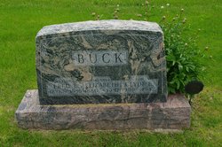
Elizabeth “Lizzie” Roth Buck
| Birth | : | 13 Mar 1880 Trenton, Henry County, Iowa, USA |
| Death | : | 21 Mar 1947 Henry County, Iowa, USA |
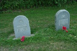
| Burial | : | Stambaugh Cemetery, Iron River, Iron County, USA |
| Coordinate | : | 46.0774994, -88.6286011 |
| Plot | : | Section 4. Row 7 |
frequently asked questions (FAQ):
-
Where is Elizabeth “Lizzie” Roth Buck's memorial?
Elizabeth “Lizzie” Roth Buck's memorial is located at: Stambaugh Cemetery, Iron River, Iron County, USA.
-
When did Elizabeth “Lizzie” Roth Buck death?
Elizabeth “Lizzie” Roth Buck death on 21 Mar 1947 in Henry County, Iowa, USA
-
Where are the coordinates of the Elizabeth “Lizzie” Roth Buck's memorial?
Latitude: 46.0774994
Longitude: -88.6286011
Family Members:
Parent

Spouse

Siblings

Children


Flowers:


Nearby Cemetories:
1. Stambaugh Cemetery
Iron River, Iron County, USA
Coordinate: 46.0774994, -88.6286011
2. Iron River Cemetery
Iron River, Iron County, USA
Coordinate: 46.1027985, -88.6358032
3. Stambaugh Cemetery
Stambaugh, Iron County, USA
Coordinate: 46.0492670, -88.6409150
4. Resthaven Cemetery
Iron River, Iron County, USA
Coordinate: 46.0964012, -88.6772003
5. Bates Township Cemetery
Mapleton, Iron County, USA
Coordinate: 46.1201629, -88.5664721
6. Indian Cemetery
Crystal Falls, Iron County, USA
Coordinate: 46.0389230, -88.5104410
7. Rosehill Cemetery
Beechwood, Iron County, USA
Coordinate: 46.1568985, -88.7617035
8. Martin Cemetery
Tipler, Florence County, USA
Coordinate: 45.9502983, -88.6549988
9. Tipler Cemetery
Tipler, Florence County, USA
Coordinate: 45.9252100, -88.6334000
10. Lakeview Cemetery
Alvin, Forest County, USA
Coordinate: 45.9831009, -88.8341980
11. Hematite Cemetery
Amasa, Iron County, USA
Coordinate: 46.2356520, -88.4636600
12. Evergreen Memorial Cemetery
Crystal Falls, Iron County, USA
Coordinate: 46.1005620, -88.3124540
13. Long Lake Cemetery
Long Lake, Florence County, USA
Coordinate: 45.8532982, -88.6575012
14. Mansfield Mine Memorial
Mansfield, Iron County, USA
Coordinate: 46.1134700, -88.2178200
15. Commonwealth Cemetery
Commonwealth, Florence County, USA
Coordinate: 45.9144000, -88.2494000
16. Phelps Cemetery
Phelps, Vilas County, USA
Coordinate: 46.0646000, -89.0795000
17. Woodlawn Cemetery
Florence, Florence County, USA
Coordinate: 45.9235992, -88.2343979
18. Volkmann Cemetery
Phelps, Vilas County, USA
Coordinate: 46.0544900, -89.0928900
19. Katakikon Indian Village Cemetery
Watersmeet, Gogebic County, USA
Coordinate: 46.1513889, -89.0850000
20. Forest Home Cemetery
Newald, Forest County, USA
Coordinate: 45.7520800, -88.6962000
21. Schuett Burial Site
Fence, Florence County, USA
Coordinate: 45.7655000, -88.4400100
22. Rosehill East Cemetery
Mansfield, Iron County, USA
Coordinate: 46.0735589, -88.1243176
23. Hillside Cemetery
Fence, Florence County, USA
Coordinate: 45.7366982, -88.4246979
24. Channing Cemetery
Channing, Dickinson County, USA
Coordinate: 46.1302986, -88.0839005