
| Birth | : | 1877 |
| Death | : | Jun 1953 Hagerstown, Washington County, Maryland, USA |
| Burial | : | Samples Manor Cemetery, Samples Manor, Washington County, USA |
| Coordinate | : | 39.3732262, -77.7216568 |
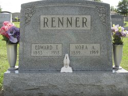
| Description | : | MRS. ELLA E. McGOWAN, widow of Thomas L. McGowan, died early today at the home of her daughter, Mrs. Frank Eichelberger, 42 South Mulberry St. She was aged 76 years and had been ill six months. Mr. McGowan resided at Dargan for years and was a member of the Church of God at Samples Manor. Surviving are daughters, Mrs. Eichelberger and Miss Eleanor McGowan, Dargan, and Mrs. Gertrude West, Stamford, Conn.; sons, Melvin, Wilson and William, this city, and Thomas, Martinsburg;sisters, Mrs. Nora Renner, Williamsport and Mrs. Emma McGowan, Dargan. Nine grandchildren and eight great grandchildren also... Read More |
frequently asked questions (FAQ):
-
Where is Ella E. Pierce McGowan's memorial?
Ella E. Pierce McGowan's memorial is located at: Samples Manor Cemetery, Samples Manor, Washington County, USA.
-
When did Ella E. Pierce McGowan death?
Ella E. Pierce McGowan death on Jun 1953 in Hagerstown, Washington County, Maryland, USA
-
Where are the coordinates of the Ella E. Pierce McGowan's memorial?
Latitude: 39.3732262
Longitude: -77.7216568
Family Members:
Parent

Spouse
Siblings
Children
Flowers:


Nearby Cemetories:
1. Samples Manor Cemetery
Samples Manor, Washington County, USA
Coordinate: 39.3732262, -77.7216568
2. Moler Cemetery
Moler Crossroads, Jefferson County, USA
Coordinate: 39.3672700, -77.7495100
3. Moler Cemetery
Bakerton, Jefferson County, USA
Coordinate: 39.3673700, -77.7496000
4. Mount Moriah Baptist Church Cemetery
Washington County, USA
Coordinate: 39.3535995, -77.6908035
5. Flanegan Cemetery
Bakerton, Jefferson County, USA
Coordinate: 39.3750000, -77.7620000
6. Garrett's Mill Assemblies of God Cemetery
Garretts Mill, Washington County, USA
Coordinate: 39.3527184, -77.6881485
7. McGolenick-Phillips Cemetery
Garretts Mill, Washington County, USA
Coordinate: 39.3612300, -77.6793900
8. Brownsville Heights Cemetery
Brownsville, Washington County, USA
Coordinate: 39.3678093, -77.6694260
9. Hageley Cemetery
Bakerton, Jefferson County, USA
Coordinate: 39.3641838, -77.7730423
10. Saint Lukes Episcopal Church Cemetery
Brownsville, Washington County, USA
Coordinate: 39.3739014, -77.6669006
11. Norris Cemetery
Garretts Mill, Washington County, USA
Coordinate: 39.3463968, -77.6781411
12. Old Brownsville Church of the Brethren Cemetery
Brownsville, Washington County, USA
Coordinate: 39.3792572, -77.6633759
13. Virts Farm Cemetery
Sandy Hook, Washington County, USA
Coordinate: 39.3299675, -77.6966705
14. Harper Cemetery
Harpers Ferry, Jefferson County, USA
Coordinate: 39.3236847, -77.7345352
15. Cedar Hill Cemetery
Harpers Ferry, Jefferson County, USA
Coordinate: 39.3283520, -77.7524420
16. Knoxville Mountain Cemetery
Knoxville, Frederick County, USA
Coordinate: 39.3395000, -77.6649000
17. Saint Peter's Cemetery
Harpers Ferry, Jefferson County, USA
Coordinate: 39.3213806, -77.7480927
18. Fairview Lutheran Cemetery
Bolivar, Jefferson County, USA
Coordinate: 39.3215700, -77.7567500
19. Saint James Lutheran Church Cemetery
Uvilla, Jefferson County, USA
Coordinate: 39.3686104, -77.7995300
20. Duffield Colored Cemetery
Uvilla, Jefferson County, USA
Coordinate: 39.3603900, -77.7985600
21. Uvilla Methodist Church Cemetery
Jefferson County, USA
Coordinate: 39.3660040, -77.7998030
22. Garrott Family Cemetery
Knoxville, Frederick County, USA
Coordinate: 39.3395100, -77.6539500
23. Knoxville Reformed Cemetery
Knoxville, Frederick County, USA
Coordinate: 39.3288994, -77.6647034
24. Renaud Cemetery
Moler Crossroads, Jefferson County, USA
Coordinate: 39.3970846, -77.7986351