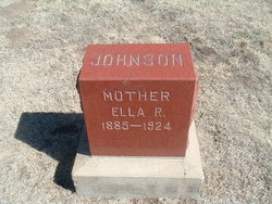
Ella R Rothrock Johnson
| Birth | : | 25 Aug 1885 Nickerson, Reno County, Kansas, USA |
| Death | : | 1924 Hutchinson, Reno County, Kansas, USA |
| Burial | : | Mount Moriah Cemetery, Sundance, Crook County, USA |
| Coordinate | : | 44.4049988, -104.3942032 |
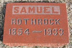
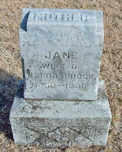
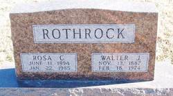
| Description | : | Mrs. A.B. Johnson was born at Nickerson, Kansas, Aug. 25, 1885. She spent her girlhood days near Sylvia, and in 1903 was married to A.B. Johnson. They moved to Hutchinson where they lived when she passed away. She is survived by her husband and five children, Vivian, Elmer, Ruby, Beulah, and Norrva, all of who reside at the family home at 505 East 9th. A brother Walter Rothrock, a sister Blanche Snowbarger and her father, Sam Rothrock of Sylvia, also survive her. She has been a patient suffering for the past eighteen months. She was converted in her youth and... Read More |
frequently asked questions (FAQ):
-
Where is Ella R Rothrock Johnson's memorial?
Ella R Rothrock Johnson's memorial is located at: Mount Moriah Cemetery, Sundance, Crook County, USA.
-
When did Ella R Rothrock Johnson death?
Ella R Rothrock Johnson death on 1924 in Hutchinson, Reno County, Kansas, USA
-
Where are the coordinates of the Ella R Rothrock Johnson's memorial?
Latitude: 44.4049988
Longitude: -104.3942032
Family Members:
Parent
Spouse
Siblings
Children
Flowers:
Nearby Cemetories:
1. Mount Moriah Cemetery
Sundance, Crook County, USA
Coordinate: 44.4049988, -104.3942032
2. Green Mountain Cemetery
Sundance, Crook County, USA
Coordinate: 44.3964005, -104.3452988
3. Inyan Kara Cemetery
Sundance, Crook County, USA
Coordinate: 44.2613983, -104.2994003
4. Miller Creek Cemetery
Crook County, USA
Coordinate: 44.4510994, -104.6136017
5. Greenwood Cemetery
Crook County, USA
Coordinate: 44.2355995, -104.4886017
6. Soldiers Gravesite
Crook County, USA
Coordinate: 44.2185000, -104.2674000
7. Tower Cemetery
Devils Tower, Crook County, USA
Coordinate: 44.5651200, -104.6603400
8. Bear Gulch Cemetery
Lawrence County, USA
Coordinate: 44.3819008, -104.0325012
9. Green Mountain Cemetery
Horton, Weston County, USA
Coordinate: 44.1646996, -104.2397003
10. Beulah Cemetery
Beulah, Crook County, USA
Coordinate: 44.5441550, -104.0754550
11. Alva Cemetery
Alva, Crook County, USA
Coordinate: 44.6945480, -104.4453690
12. Pine Haven Area Cemetery
Pine Haven, Crook County, USA
Coordinate: 44.3431950, -104.8095490
13. Hulett Cemetery
Hulett, Crook County, USA
Coordinate: 44.6955986, -104.5867004
14. Kimball Family Cemetery
Aladdin, Crook County, USA
Coordinate: 44.7177800, -104.2887700
15. Saint Alberts Catholic Cemetery
Weston County, USA
Coordinate: 44.1082340, -104.1581150
16. Greenwood Cemetery
Upton, Weston County, USA
Coordinate: 44.0894012, -104.6132965
17. Preston Ghost Town Cemetery
Preston, Lawrence County, USA
Coordinate: 44.3577500, -103.8871670
18. Moore Hill Cemetery
Crook County, USA
Coordinate: 44.7235985, -104.6731033
19. Carbonate Cemetery
Maurice, Lawrence County, USA
Coordinate: 44.4000000, -103.8680500
20. Boyd Cemetery
Weston County, USA
Coordinate: 44.0774994, -104.1192017
21. Pine Grove Cemetery
Oshoto, Crook County, USA
Coordinate: 44.5594000, -104.9023000
22. Rose Hill Cemetery
Spearfish, Lawrence County, USA
Coordinate: 44.4802180, -103.8509270
23. Carr Cemetery
Hanna, Lawrence County, USA
Coordinate: 44.2411003, -103.8606033
24. Moorcroft Cemetery
Moorcroft, Crook County, USA
Coordinate: 44.2685510, -104.9461810


