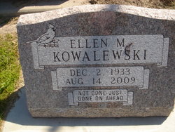
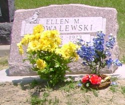
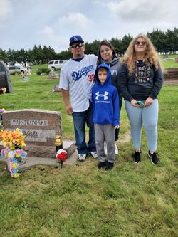
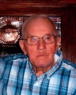
Ellen Marie Piontkowski Kowalewski
| Birth | : | 2 Dec 1933 Rockville, Sherman County, Nebraska, USA |
| Death | : | 14 Aug 2009 Kearney, Buffalo County, Nebraska, USA |
| Burial | : | Knollcrest Cemetery, Arcadia, Hancock County, USA |
| Coordinate | : | 41.0997360, -83.5316490 |
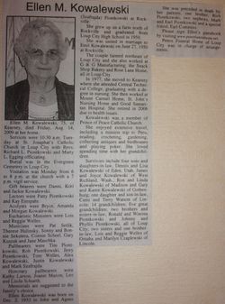
| Description | : | Daughter of John & Agnes (Szafrajda) Piontkowski. Married to Emil Kowalewski on 6-27-1950 at Rockville, NE. Grew up on a farm north of Rockville, graduated from Loup City High School in 1950. Married: June 27, 1950, to Emil Kowalewski in Rockville. Lived on a farm northeast of Loup City, worked at G&G Manufacturing, the Snack Shop Bakery and Rose Lane Home, all in Loup City; moved to Kearney, 1997, attended Central Technical College, graduated with a degree in nursing; worked at Mount Carmel Home, St. John's Nursing Home and Good Samaritan Hospital; retired in 2006 because of health issues. Activities: member of Prince of Peace... Read More |
frequently asked questions (FAQ):
-
Where is Ellen Marie Piontkowski Kowalewski's memorial?
Ellen Marie Piontkowski Kowalewski's memorial is located at: Knollcrest Cemetery, Arcadia, Hancock County, USA.
-
When did Ellen Marie Piontkowski Kowalewski death?
Ellen Marie Piontkowski Kowalewski death on 14 Aug 2009 in Kearney, Buffalo County, Nebraska, USA
-
Where are the coordinates of the Ellen Marie Piontkowski Kowalewski's memorial?
Latitude: 41.0997360
Longitude: -83.5316490
Family Members:
Parent
Siblings
Flowers:
Nearby Cemetories:
1. Arcadia Cemetery
Arcadia, Hancock County, USA
Coordinate: 41.1100006, -83.5100021
2. Baker-Hamblin Cemetery
Findlay, Hancock County, USA
Coordinate: 41.0983340, -83.5734660
3. Enon Valley Presbyterian Cemetery
West Independence, Hancock County, USA
Coordinate: 41.0682983, -83.4907990
4. Wells Family Cemetery
Arcadia, Hancock County, USA
Coordinate: 41.1225482, -83.4785878
5. Kampf Cemetery
Biglick Township, Hancock County, USA
Coordinate: 41.0574320, -83.4963660
6. Davis Cemetery
Hancock County, USA
Coordinate: 41.0597000, -83.5738983
7. Vickers Cemetery
Washington Township, Hancock County, USA
Coordinate: 41.1585999, -83.5074997
8. Union Cemetery
West Independence, Hancock County, USA
Coordinate: 41.0746994, -83.4543991
9. Trinity Baptist Cemetery
Findlay, Hancock County, USA
Coordinate: 41.0525690, -83.5888460
10. High Bank Cemetery
Hancock County, USA
Coordinate: 41.0346985, -83.5543976
11. Bright Cemetery
Findlay, Hancock County, USA
Coordinate: 41.0317001, -83.5417023
12. Tussing Cemetery
Findlay, Hancock County, USA
Coordinate: 41.0321380, -83.5477530
13. Bechtel Cemetery
Van Buren, Hancock County, USA
Coordinate: 41.1427994, -83.6303024
14. Graham Cemetery
Hancock County, USA
Coordinate: 41.0403150, -83.4468340
15. Biglick Cemetery
Hancock County, USA
Coordinate: 41.0355988, -83.4411011
16. Radar Cemetery (Defunct)
Van Buren, Hancock County, USA
Coordinate: 41.1314498, -83.6498657
17. Alspach Cemetery
Findlay, Hancock County, USA
Coordinate: 41.0069490, -83.5583100
18. Sheller Cemetery
Seneca County, USA
Coordinate: 41.0980988, -83.4024963
19. Saint Wendelin Catholic Cemetery
Fostoria, Hancock County, USA
Coordinate: 41.1618996, -83.4321976
20. Bloom Chapel Cemetery
Bairdstown, Wood County, USA
Coordinate: 41.1875000, -83.5888977
21. Fountain Cemetery
Fostoria, Hancock County, USA
Coordinate: 41.1641998, -83.4302979
22. Weaver Cemetery
Bairdstown, Wood County, USA
Coordinate: 41.1838989, -83.6093979
23. Joseph Davis Burial Site
Findlay, Hancock County, USA
Coordinate: 41.0451120, -83.6498440
24. Elm Grove Cemetery
South Findlay, Hancock County, USA
Coordinate: 40.9986430, -83.5884160

