
| Birth | : | 15 Jun 1922 Aurora, Cloud County, Kansas, USA |
| Death | : | 11 Dec 2020 Wichita, Sedgwick County, Kansas, USA |
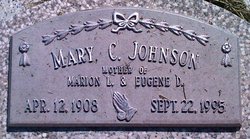
| Burial | : | Sulphur Springs Cemetery, Aurora, Cloud County, USA |
| Coordinate | : | 39.4086610, -97.4986840 |
| Description | : | Chaput-Buoy Funeral Home Elma M. Koerber, age 98, formerly of Aurora, KS, passed away on Friday, December 11, 2020 at her daughter's home in Wichita, KS. She was born on June 15, 1922 in Sulphur Springs, KS to William & Mary (Gunter) Ming. Elma married Edward A. Koerber on Nov. 25, 1953 and he preceded her in death on April 4, 2008. She was a loving farm wife. She was a member of the Huscher United Methodist Church, the United Methodist Women and taught Sunday school. She served on the local election board. She moved into Sunset Nursing... Read More |
frequently asked questions (FAQ):
-
Where is Elma Minnie Ming Koerber's memorial?
Elma Minnie Ming Koerber's memorial is located at: Sulphur Springs Cemetery, Aurora, Cloud County, USA.
-
When did Elma Minnie Ming Koerber death?
Elma Minnie Ming Koerber death on 11 Dec 2020 in Wichita, Sedgwick County, Kansas, USA
-
Where are the coordinates of the Elma Minnie Ming Koerber's memorial?
Latitude: 39.4086610
Longitude: -97.4986840
Family Members:
Parent

Spouse
Siblings
Children
Flowers:


Nearby Cemetories:
1. Sulphur Springs Cemetery
Aurora, Cloud County, USA
Coordinate: 39.4086610, -97.4986840
2. Princeville Cemetery
Aurora, Cloud County, USA
Coordinate: 39.4672012, -97.5010986
3. Smith Grave
Miltonvale, Cloud County, USA
Coordinate: 39.3645300, -97.4308700
4. Saint Peters Cemetery
Aurora, Cloud County, USA
Coordinate: 39.4763985, -97.5180969
5. French Presbyterian Church Cemetery
Cloud County, USA
Coordinate: 39.4395200, -97.4148290
6. Oakland Union Cemetery
Miltonvale, Cloud County, USA
Coordinate: 39.3647003, -97.5824966
7. Miltonvale Cemetery
Miltonvale, Cloud County, USA
Coordinate: 39.3358002, -97.4447021
8. Enterprise Cemetery
Cloud County, USA
Coordinate: 39.4230995, -97.6106033
9. Thomas Cemetery
Miltonvale, Cloud County, USA
Coordinate: 39.3300000, -97.5750000
10. Green Mound Cemetery
Rice, Cloud County, USA
Coordinate: 39.5248450, -97.5081630
11. Fairview Cemetery
Lamar, Ottawa County, USA
Coordinate: 39.2928009, -97.5299988
12. Nelson Cemetery
Rice, Cloud County, USA
Coordinate: 39.5257988, -97.5410995
13. Kindel Cemetery
Center Township, Cloud County, USA
Coordinate: 39.4519005, -97.6464005
14. Iwacura Cemetery
Morganville, Clay County, USA
Coordinate: 39.4550000, -97.3510000
15. Saint Peters Cemetery
Miltonvale, Cloud County, USA
Coordinate: 39.3652350, -97.6483570
16. Saint Joseph Cemetery
Saint Joseph, Cloud County, USA
Coordinate: 39.5074941, -97.4022328
17. Pleasant View Cemetery
Ames, Cloud County, USA
Coordinate: 39.5346985, -97.4431000
18. Pleasant Hill Cemetery
Huscher, Cloud County, USA
Coordinate: 39.5093994, -97.6292038
19. Shields Cemetery
Clay County, USA
Coordinate: 39.3208008, -97.3507996
20. Cedar Grove Cemetery
Clyde, Cloud County, USA
Coordinate: 39.5494003, -97.4056015
21. Rice Cemetery
Rice, Cloud County, USA
Coordinate: 39.5614014, -97.5552979
22. Lincoln Cemetery
Clay Center, Clay County, USA
Coordinate: 39.4230995, -97.2930984
23. Walnut Grove Cemetery
Cloud County, USA
Coordinate: 39.5699997, -97.4993973
24. Hall Cemetery
Cloud County, USA
Coordinate: 39.4455986, -97.7033005