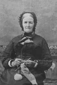
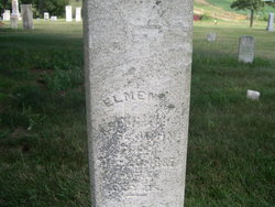
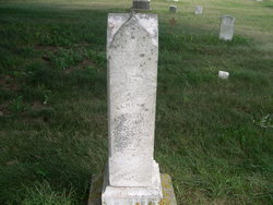
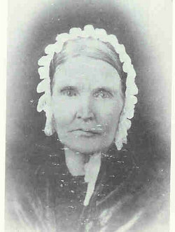
Elmena Freeman St John
| Birth | : | 20 Mar 1820 Conquest, Cayuga County, New York, USA |
| Death | : | 20 Dec 1887 Clayton County, Iowa, USA |
| Burial | : | Waipukurau Cemetery, Waipukurau, Central Hawke's Bay District, New Zealand |
| Coordinate | : | -40.0070560, 176.5484260 |
| Description | : | Elmena was the eldest child of John and Amanda Lucas Freeman and was born on March 20, 1820 on their farm near Conquest, New York. She spent her early years at Conquest and then went with her family to Michigan in 1835. Soon afterwards, they moved to Porter, Rock County, Wisconsin. She married Nehemiah St John on February 5, 1839 when she was nineteen years of age. They established a farm in Rock County and while they lived in Wisconsin, they had seven children: Robert Freeman, Ruth Emma, Daniel Harley, Amanda Alzina, David Barber, Frank... Read More |
frequently asked questions (FAQ):
-
Where is Elmena Freeman St John's memorial?
Elmena Freeman St John's memorial is located at: Waipukurau Cemetery, Waipukurau, Central Hawke's Bay District, New Zealand.
-
When did Elmena Freeman St John death?
Elmena Freeman St John death on 20 Dec 1887 in Clayton County, Iowa, USA
-
Where are the coordinates of the Elmena Freeman St John's memorial?
Latitude: -40.0070560
Longitude: 176.5484260
Family Members:
Parent
Spouse
Siblings
Children
Nearby Cemetories:
1. Waipukurau Cemetery
Waipukurau, Central Hawke's Bay District, New Zealand
Coordinate: -40.0070560, 176.5484260
2. Harding Family Cemetery
Waipukurau, Central Hawke's Bay District, New Zealand
Coordinate: -39.9817240, 176.5448760
3. Mataweka Urupā
Waipawa, Central Hawke's Bay District, New Zealand
Coordinate: -39.9662600, 176.6079600
4. Tapairu Urupā
Waipawa, Central Hawke's Bay District, New Zealand
Coordinate: -39.9587400, 176.5977000
5. Waipawa Cemetery
Waipawa, Central Hawke's Bay District, New Zealand
Coordinate: -39.9419700, 176.5711600
6. Kaikora North Cemetery
Otane, Central Hawke's Bay District, New Zealand
Coordinate: -39.9002200, 176.6251200
7. Otane Cemetery
Hastings, Hastings District, New Zealand
Coordinate: -39.8823430, 176.6264680
8. Forest Gate Cemetery
Onga Onga, Central Hawke's Bay District, New Zealand
Coordinate: -39.9149430, 176.3778800
9. Kahukuru Cemetery
Takapau, Central Hawke's Bay District, New Zealand
Coordinate: -40.0348340, 176.3413110
10. Ashcott Station Cemetery
Takapau, Central Hawke's Bay District, New Zealand
Coordinate: -39.9531860, 176.3440410
11. Takapau Cemetery
Takapau, Central Hawke's Bay District, New Zealand
Coordinate: -40.0202390, 176.3190200
12. Te Aute Church Cemetery
Pukehou, Central Hawke's Bay District, New Zealand
Coordinate: -39.8251400, 176.6476900
13. Tikokino–Hampden Bush Cemetery
Tikokino, Central Hawke's Bay District, New Zealand
Coordinate: -39.8189510, 176.4392740
14. Ashley Clinton Cemetery
Ashley Clinton, Central Hawke's Bay District, New Zealand
Coordinate: -39.9495130, 176.2747120
15. Southern Star Abbey Cemetery
Takapau, Central Hawke's Bay District, New Zealand
Coordinate: -40.0808560, 176.2766900
16. Gwavas Station Cemetery
Tikokino, Central Hawke's Bay District, New Zealand
Coordinate: -39.7757280, 176.4889350
17. Ormondville Cemetery
Ormondville, Tararua District, New Zealand
Coordinate: -40.1036470, 176.2605290
18. Makaretu Cemetery
Makaretu, Central Hawke's Bay District, New Zealand
Coordinate: -39.9138889, 176.2521007
19. Pourerere Station Cemetery
Pourerere, Central Hawke's Bay District, New Zealand
Coordinate: -40.0955450, 176.8649650
20. Te Hauke Urupā
Te Hauke, Hastings District, New Zealand
Coordinate: -39.7727100, 176.6897100
21. Pendle Hill Cemetery
Tikokino, Central Hawke's Bay District, New Zealand
Coordinate: -39.8333920, 176.2912990
22. Norsewood Cemetery
Norsewood, Tararua District, New Zealand
Coordinate: -40.0676530, 176.2138900
23. St Michael & All Angel's Anglican Church Cemetery
Porangahau, Central Hawke's Bay District, New Zealand
Coordinate: -40.3022980, 176.6154250
24. Kaiwhitikitiki Urupā
Porangahau, Central Hawke's Bay District, New Zealand
Coordinate: -40.3064010, 176.6087780

