
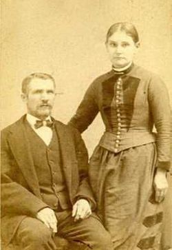

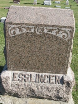
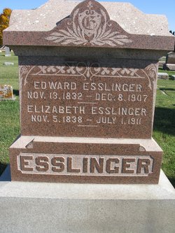
Emanuel Esslinger
| Birth | : | 24 Dec 1836 Berks County, Pennsylvania, USA |
| Death | : | 10 Nov 1909 West Fork Township, Franklin County, Iowa, USA |
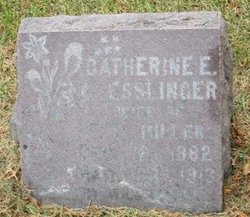
| Burial | : | West Fork Cemetery, Franklin County, USA |
| Coordinate | : | 42.8918991, -93.0836029 |
| Description | : | U.S., Civil War Soldier Records and Profiles, 1861-1865 about Emanuel Esslinger Name: Emanuel Esslinger Residence: Wisconsin Enlistment Date: 20 Aug 1862 Rank at enlistment: Corporal State Served: Wisconsin Survived the War?: Yes Service Record: Enlisted in Company K, Wisconsin 33rd Infantry Regiment on 20 Aug 1862.Mustered out on 09 Aug 1865. Sources: Roster of Wisconsin Volunteers: War of the Rebellion ++++++++++++++++++++++++++++ Suggested edit: History of Franklin and Cerro Gordo Counties, Iowa 1883, Page 580, Chapter XXXIV, West Fork Township, Iowa. Union Publishing Company, Springfield, Illinois. Emanuel Esslinger was born in Pennsylvania, on... Read More |
frequently asked questions (FAQ):
-
Where is Emanuel Esslinger's memorial?
Emanuel Esslinger's memorial is located at: West Fork Cemetery, Franklin County, USA.
-
When did Emanuel Esslinger death?
Emanuel Esslinger death on 10 Nov 1909 in West Fork Township, Franklin County, Iowa, USA
-
Where are the coordinates of the Emanuel Esslinger's memorial?
Latitude: 42.8918991
Longitude: -93.0836029
Family Members:
Parent
Spouse
Siblings
Children

Flowers:


Nearby Cemetories:
1. West Fork Cemetery
Franklin County, USA
Coordinate: 42.8918991, -93.0836029
2. Saint John Zion Cemetery
Sheffield, Franklin County, USA
Coordinate: 42.8969002, -93.1472015
3. Saint Patricks Catholic Cemetery
Dougherty, Cerro Gordo County, USA
Coordinate: 42.9227791, -93.0294418
4. Hillside Cemetery
Sheffield, Franklin County, USA
Coordinate: 42.9006004, -93.2007980
5. Sacred Heart Cemetery
Rockwell, Cerro Gordo County, USA
Coordinate: 42.9592018, -93.1913986
6. Rockwell Cemetery
Rockwell, Cerro Gordo County, USA
Coordinate: 42.9786000, -93.1919000
7. Way Side Cemetery
Chapin, Franklin County, USA
Coordinate: 42.8293991, -93.2225037
8. Needham Cemetery
Bristow, Butler County, USA
Coordinate: 42.7956500, -92.9726300
9. Hansell Cemetery
Franklin County, USA
Coordinate: 42.7666702, -93.1047211
10. Harlan Cemetery
Dumont, Butler County, USA
Coordinate: 42.7663994, -93.0143967
11. Shobes Grove Cemetery
Franklin County, USA
Coordinate: 42.9000015, -93.2722168
12. Old Chapin Cemetery
Chapin, Franklin County, USA
Coordinate: 42.8232994, -93.2624969
13. Halls Grove Cemetery
Greene, Butler County, USA
Coordinate: 42.8840100, -92.8782300
14. Dumont Cemetery
Dumont, Butler County, USA
Coordinate: 42.7553177, -92.9748230
15. Oak Hill Cemetery
Bristow, Butler County, USA
Coordinate: 42.7719002, -92.9353027
16. Westside Cemetery
Marble Rock, Floyd County, USA
Coordinate: 42.9556007, -92.8739014
17. Hampton Cemetery
Hampton, Franklin County, USA
Coordinate: 42.7452812, -93.1975021
18. Old Bristow Cemetery
Bristow, Butler County, USA
Coordinate: 42.7733078, -92.9165845
19. Hillside Cemetery
Marble Rock, Floyd County, USA
Coordinate: 42.9583015, -92.8666992
20. Trinity Lutheran Cemetery
Hampton, Franklin County, USA
Coordinate: 42.7667007, -93.2518997
21. Zion Reformed Church Cemetery
Franklin County, USA
Coordinate: 42.8413887, -93.3188934
22. Pleasant Valley Township Cemetery
Swaledale, Cerro Gordo County, USA
Coordinate: 42.9505615, -93.3216705
23. South Bristow Cemetery
Bristow, Butler County, USA
Coordinate: 42.7527400, -92.9168100
24. North Vilmar Cemetery
Vilmar, Butler County, USA
Coordinate: 42.8329700, -92.8392900