
| Birth | : | 19 Jul 1880 West Fork Township, Franklin County, Iowa, USA |
| Death | : | 22 Sep 1901 West Fork Township, Franklin County, Iowa, USA |
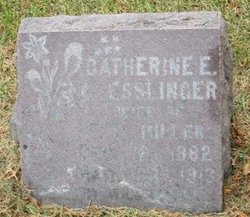
| Burial | : | West Fork Cemetery, Franklin County, USA |
| Coordinate | : | 42.8918991, -93.0836029 |
| Description | : | Age 21 yrs 2 mos 3 days Other sibling (no memorial yet): Hayes Rudolph Esslinger (b 3-28-1877 Sheffield, IA), married to Sadie J. Reynolds Esslinger (5-14-1883, died 9-1970 Des Moines, Polk, IA) |
frequently asked questions (FAQ):
-
Where is Julius Clyde Esslinger's memorial?
Julius Clyde Esslinger's memorial is located at: West Fork Cemetery, Franklin County, USA.
-
When did Julius Clyde Esslinger death?
Julius Clyde Esslinger death on 22 Sep 1901 in West Fork Township, Franklin County, Iowa, USA
-
Where are the coordinates of the Julius Clyde Esslinger's memorial?
Latitude: 42.8918991
Longitude: -93.0836029
Family Members:
Parent
Siblings

Flowers:


Nearby Cemetories:
1. West Fork Cemetery
Franklin County, USA
Coordinate: 42.8918991, -93.0836029
2. Saint John Zion Cemetery
Sheffield, Franklin County, USA
Coordinate: 42.8969002, -93.1472015
3. Saint Patricks Catholic Cemetery
Dougherty, Cerro Gordo County, USA
Coordinate: 42.9227791, -93.0294418
4. Hillside Cemetery
Sheffield, Franklin County, USA
Coordinate: 42.9006004, -93.2007980
5. Sacred Heart Cemetery
Rockwell, Cerro Gordo County, USA
Coordinate: 42.9592018, -93.1913986
6. Rockwell Cemetery
Rockwell, Cerro Gordo County, USA
Coordinate: 42.9786000, -93.1919000
7. Way Side Cemetery
Chapin, Franklin County, USA
Coordinate: 42.8293991, -93.2225037
8. Needham Cemetery
Bristow, Butler County, USA
Coordinate: 42.7956500, -92.9726300
9. Hansell Cemetery
Franklin County, USA
Coordinate: 42.7666702, -93.1047211
10. Harlan Cemetery
Dumont, Butler County, USA
Coordinate: 42.7663994, -93.0143967
11. Shobes Grove Cemetery
Franklin County, USA
Coordinate: 42.9000015, -93.2722168
12. Old Chapin Cemetery
Chapin, Franklin County, USA
Coordinate: 42.8232994, -93.2624969
13. Halls Grove Cemetery
Greene, Butler County, USA
Coordinate: 42.8840100, -92.8782300
14. Dumont Cemetery
Dumont, Butler County, USA
Coordinate: 42.7553177, -92.9748230
15. Oak Hill Cemetery
Bristow, Butler County, USA
Coordinate: 42.7719002, -92.9353027
16. Westside Cemetery
Marble Rock, Floyd County, USA
Coordinate: 42.9556007, -92.8739014
17. Hampton Cemetery
Hampton, Franklin County, USA
Coordinate: 42.7452812, -93.1975021
18. Old Bristow Cemetery
Bristow, Butler County, USA
Coordinate: 42.7733078, -92.9165845
19. Hillside Cemetery
Marble Rock, Floyd County, USA
Coordinate: 42.9583015, -92.8666992
20. Trinity Lutheran Cemetery
Hampton, Franklin County, USA
Coordinate: 42.7667007, -93.2518997
21. Zion Reformed Church Cemetery
Franklin County, USA
Coordinate: 42.8413887, -93.3188934
22. Pleasant Valley Township Cemetery
Swaledale, Cerro Gordo County, USA
Coordinate: 42.9505615, -93.3216705
23. South Bristow Cemetery
Bristow, Butler County, USA
Coordinate: 42.7527400, -92.9168100
24. North Vilmar Cemetery
Vilmar, Butler County, USA
Coordinate: 42.8329700, -92.8392900