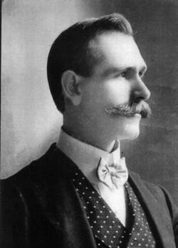
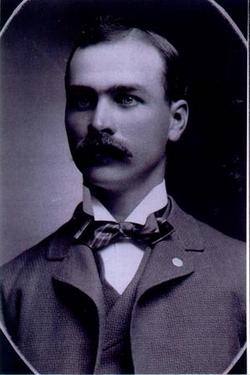
Emma Charlotta Rosengren Soder
| Birth | : | 26 Oct 1833 Stockholm, Stockholms kommun, Stockholms län, Sweden |
| Death | : | 15 Dec 1911 Hamilton County, Iowa, USA |
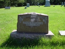
| Burial | : | Oakwood Cemetery, Stratford, Hamilton County, USA |
| Coordinate | : | 42.2942009, -93.9182968 |
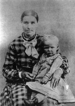
| Description | : | Emma's mother Johanna Rosengren was very poor and in 1839 she contacted the public orphange to apply for allowances for her daughter. For a few months in 1839 her mother got a monthly contribution for her. On December 17, 1840 Emma's mother had a stillborn baby in Stockholm, Sweden and died 3 days later of puerperal fever. Swedish records show Emma went to Horn parish as an orphan 1841. In July 1841 she was left to a family living near the city of Linkoping. The family got yearly paid for taking care of her. The man of the family was... Read More |
frequently asked questions (FAQ):
-
Where is Emma Charlotta Rosengren Soder's memorial?
Emma Charlotta Rosengren Soder's memorial is located at: Oakwood Cemetery, Stratford, Hamilton County, USA.
-
When did Emma Charlotta Rosengren Soder death?
Emma Charlotta Rosengren Soder death on 15 Dec 1911 in Hamilton County, Iowa, USA
-
Where are the coordinates of the Emma Charlotta Rosengren Soder's memorial?
Latitude: 42.2942009
Longitude: -93.9182968
Family Members:
Spouse
Children
Flowers:
Nearby Cemetories:
1. Oakwood Cemetery
Stratford, Hamilton County, USA
Coordinate: 42.2942009, -93.9182968
2. Hooks Point Cemetery
Hamilton County, USA
Coordinate: 42.2944530, -93.9199090
3. Vegors Cemetery
Webster County, USA
Coordinate: 42.3177986, -93.9421997
4. Neese Cemetery
Homer, Hamilton County, USA
Coordinate: 42.3250000, -93.8935000
5. Nesse Cemetery
Hamilton County, USA
Coordinate: 42.3250008, -93.8933029
6. Hardin Township Cemetery
Hardin Township, Webster County, USA
Coordinate: 42.2411003, -93.9708023
7. McGuire Bend Cemetery
Dayton, Webster County, USA
Coordinate: 42.3410000, -93.9880000
8. South Marion Cemetery
Stratford, Hamilton County, USA
Coordinate: 42.2327995, -93.8735962
9. Bass Cemetery
Dayton, Webster County, USA
Coordinate: 42.2966995, -94.0149994
10. Homer Cemetery
Homer, Hamilton County, USA
Coordinate: 42.3680992, -93.9088974
11. Hartman Cemetery
Lehigh, Webster County, USA
Coordinate: 42.3666397, -93.9835627
12. Saratoga Cemetery
Stanhope, Hamilton County, USA
Coordinate: 42.3539009, -93.8167038
13. Linn Cemetery
Pilot Mound, Boone County, USA
Coordinate: 42.2045330, -93.9970230
14. Ober and Scott Cemetery
Duncombe, Webster County, USA
Coordinate: 42.3841390, -93.9982856
15. Oak Grove Cemetery
Lehigh, Webster County, USA
Coordinate: 42.3438988, -94.0475006
16. Christ the King Catholic Cemetery
Dayton, Webster County, USA
Coordinate: 42.2601929, -94.0727539
17. Lawn Hill Cemetery
Stanhope, Hamilton County, USA
Coordinate: 42.2677994, -93.7611008
18. Dayton Cemetery
Dayton, Webster County, USA
Coordinate: 42.2675000, -94.0755000
19. Mineral Ridge Cemetery
Ridgeport, Boone County, USA
Coordinate: 42.1749992, -93.9266968
20. White Cemetery
Boone County, USA
Coordinate: 42.1777992, -93.9636002
21. Blanchard Cemetery
Webster County, USA
Coordinate: 42.4021988, -93.9997025
22. Lake Center Cemetery
Stanhope, Hamilton County, USA
Coordinate: 42.2482986, -93.7568970
23. West Lawn Cemetery
Lehigh, Webster County, USA
Coordinate: 42.3616982, -94.0678024
24. Zion Cemetery
Kamrar, Hamilton County, USA
Coordinate: 42.3544006, -93.7572021

