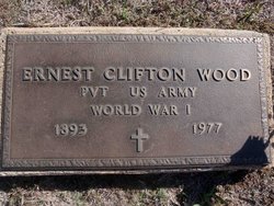
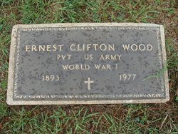
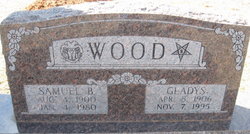
Ernest Clifton “Ert” Wood
| Birth | : | 11 Mar 1893 Pettis County, Missouri, USA |
| Death | : | 15 Oct 1977 Wichita, Sedgwick County, Kansas, USA |
| Burial | : | New Salem Baptist Church Cemetery, Vine Grove, Hardin County, USA |
| Coordinate | : | 37.7968900, -86.0704700 |
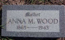
| Description | : | Ernest Clifton "Ert" Wood was born after his father, Clifton Wood (1861-1945), fulfilled the homestead requirements in Kiowa County (just over the Comanche County line), Kansas, and returned to his home in Missouri. (His father went there in fall, 1886, the year of the great blizzard, with two brothers, Lisha Wood, and Jasper Wood, and two friends, Isac Bailey and Abe Hoffslot, to homestead.) The next year, December 28, 1887, Ert's father married Anna Mae McDaniel (1866-1943). Before they returned to the homestead, three sons were born, one being Ernest. Ert came in 1898 with his parents... Read More |
frequently asked questions (FAQ):
-
Where is Ernest Clifton “Ert” Wood's memorial?
Ernest Clifton “Ert” Wood's memorial is located at: New Salem Baptist Church Cemetery, Vine Grove, Hardin County, USA.
-
When did Ernest Clifton “Ert” Wood death?
Ernest Clifton “Ert” Wood death on 15 Oct 1977 in Wichita, Sedgwick County, Kansas, USA
-
Where are the coordinates of the Ernest Clifton “Ert” Wood's memorial?
Latitude: 37.7968900
Longitude: -86.0704700
Family Members:
Parent
Siblings
Children
Flowers:
Nearby Cemetories:
1. Arms Cemetery
Hardin County, USA
Coordinate: 37.7705994, -86.0697021
2. McCoy Cemetery
Hardin County, USA
Coordinate: 37.7717018, -86.0832977
3. Swan Cemetery
Meade County, USA
Coordinate: 37.8244019, -86.0569000
4. Saint Martin of Tours Cemetery
Flaherty, Meade County, USA
Coordinate: 37.8336280, -86.0749980
5. Martin Cemetery
Hardin County, USA
Coordinate: 37.7542000, -86.0907974
6. Pleasant View Methodist Church Cemetery
Hardin County, USA
Coordinate: 37.7514535, -86.0910779
7. Tarpley Cemetery
Hardin County, USA
Coordinate: 37.7708015, -86.0147018
8. Howell Methodist Church Cemetery
Vine Grove, Hardin County, USA
Coordinate: 37.7785988, -86.0093994
9. Miller Cemetery
Hardin County, USA
Coordinate: 37.7500000, -86.0999985
10. Forks of Otter Creek Cemetery
Vine Grove, Hardin County, USA
Coordinate: 37.8072014, -86.0010986
11. Mays Grove Cemetery
Hardin County, USA
Coordinate: 37.7433014, -86.0922012
12. Clarkson Cemetery
Ekron, Meade County, USA
Coordinate: 37.8091500, -86.1445900
13. Big Springs Methodist Church Cemetery
Big Spring, Breckinridge County, USA
Coordinate: 37.7999600, -86.1484820
14. Lewis Cemetery
Hardin County, USA
Coordinate: 37.7386017, -86.0385971
15. Saint Brigid Cemetery
Vine Grove, Hardin County, USA
Coordinate: 37.7999992, -85.9875031
16. Big Spring Baptist Church Cemetery
Big Spring, Breckinridge County, USA
Coordinate: 37.7971910, -86.1544110
17. Ridge Spring United Methodist Church Cemetery
Hardin County, USA
Coordinate: 37.7381140, -86.0248030
18. Vine Grove Cemetery
Vine Grove, Hardin County, USA
Coordinate: 37.8126900, -85.9828300
19. Blue Ball Baptist Cemetery
Hardin County, USA
Coordinate: 37.7261009, -86.0372009
20. Vine Grove Cemetery East
Vine Grove, Hardin County, USA
Coordinate: 37.8079450, -85.9718800
21. Stith-Branham Family Cemetery
Vine Grove, Hardin County, USA
Coordinate: 37.8157501, -85.9726486
22. Dowell Cemetery
Guston, Meade County, USA
Coordinate: 37.8534540, -86.1433950
23. Wright Family Cemetery
Meade County, USA
Coordinate: 37.8415530, -86.1574110
24. Hynes Cemetery
Meade County, USA
Coordinate: 37.8588982, -86.0021973

