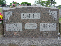
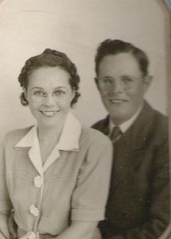
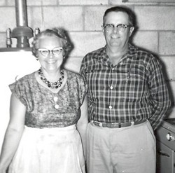
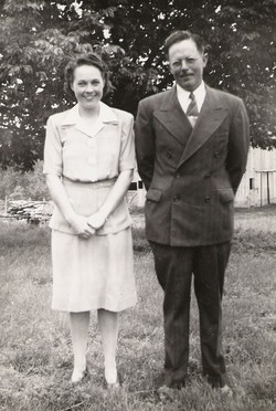
Ernest Lawrence Smith
| Birth | : | 30 Nov 1913 Henderson, Mills County, Iowa, USA |
| Death | : | 15 Sep 1981 Topeka, Shawnee County, Kansas, USA |
| Burial | : | Dayton City Cemetery, Dayton, Columbia County, USA |
| Coordinate | : | 46.3143270, -117.9646120 |
| Plot | : | Section L |
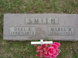
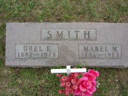
| Description | : | Ernest Lawrence Smith Ernest Lawrence Smith, son of Orel Eugene and Mabel Danford Smith, was born Sunday, November 30, 1913 in Henderson, Iowa, and passed from this life Tuesday, September 15, at age of 67 years, 9 months and 15 days at St. Francis Hospital, Topeka, after a long illness. Ernie moved to Kansas with his family in 1918 where he attended Harrison Grade School and graduated from Soldier High School. He was married to Bernice Clara Akright on Saturday, June 5, 1943. Ernie was a retired farmer and had attended the Soldier Christian Church. He had also served as a member of the... Read More |
frequently asked questions (FAQ):
-
Where is Ernest Lawrence Smith's memorial?
Ernest Lawrence Smith's memorial is located at: Dayton City Cemetery, Dayton, Columbia County, USA.
-
When did Ernest Lawrence Smith death?
Ernest Lawrence Smith death on 15 Sep 1981 in Topeka, Shawnee County, Kansas, USA
-
Where are the coordinates of the Ernest Lawrence Smith's memorial?
Latitude: 46.3143270
Longitude: -117.9646120
Family Members:
Parent
Spouse
Siblings
Flowers:
Nearby Cemetories:
1. Dayton City Cemetery
Dayton, Columbia County, USA
Coordinate: 46.3143270, -117.9646120
2. Pioneer Memorial Cemetery
Dayton, Columbia County, USA
Coordinate: 46.3022003, -118.0061035
3. Bundy Hollow Cemetery
Dayton, Columbia County, USA
Coordinate: 46.2296982, -118.0378036
4. Huntsville Cemetery
Huntsville, Columbia County, USA
Coordinate: 46.2956990, -118.1064350
5. Smith Hollow Cemetery
Columbia County, USA
Coordinate: 46.4228000, -117.9974000
6. Pioneer Memorial Park
Columbia County, USA
Coordinate: 46.2877998, -117.8082962
7. Covello Cemetery
Covello, Columbia County, USA
Coordinate: 46.3903008, -117.8206024
8. Lansdale Cemetery
Waitsburg, Walla Walla County, USA
Coordinate: 46.2810059, -118.1406174
9. Turner Cemetery
Turner, Columbia County, USA
Coordinate: 46.4164009, -117.8432999
10. IOOF Cemetery
Waitsburg, Walla Walla County, USA
Coordinate: 46.2667007, -118.1466980
11. Waitsburg City Cemetery
Waitsburg, Walla Walla County, USA
Coordinate: 46.2637400, -118.1459200
12. Highland Cemetery
Patit, Columbia County, USA
Coordinate: 46.3572000, -117.7167000
13. Marengo Cemetery
Marengo, Columbia County, USA
Coordinate: 46.4449640, -117.7557580
14. Keiser Cemetery
Walla Walla County, USA
Coordinate: 46.1876755, -118.1909180
15. Foster Cemetery
Prescott, Walla Walla County, USA
Coordinate: 46.2909040, -118.2568020
16. Dixie Cemetery
Dixie, Walla Walla County, USA
Coordinate: 46.1438900, -118.1514000
17. Cox Cemetery
Garfield County, USA
Coordinate: 46.3828570, -117.6577180
18. Owsley Cemetery
Pataha, Garfield County, USA
Coordinate: 46.4738998, -117.7232971
19. Starbuck Cemetery
Starbuck, Columbia County, USA
Coordinate: 46.5149040, -118.1315820
20. Dry Creek Cemetery
Walla Walla County, USA
Coordinate: 46.0923000, -118.1188000
21. Ivy Cemetery
Prescott, Walla Walla County, USA
Coordinate: 46.3050003, -118.3292007
22. Rosehill Cemetery
Buroker, Walla Walla County, USA
Coordinate: 46.1362228, -118.2641754
23. Lyons Creek Cemetery
Walla Walla, Walla Walla County, USA
Coordinate: 46.0753784, -118.1579514
24. Holy Rosary Cemetery
Pomeroy, Garfield County, USA
Coordinate: 46.4740000, -117.6206000

