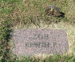
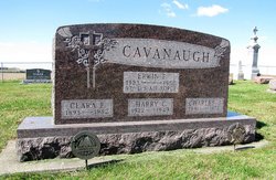
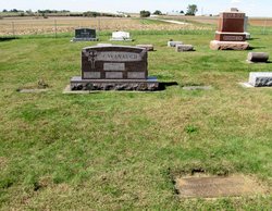
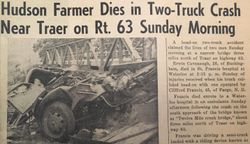
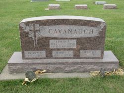
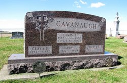
Erwin Francis Cavanaugh
| Birth | : | 2 Sep 1923 Black Hawk County, Iowa, USA |
| Death | : | 13 Aug 1950 Waterloo, Black Hawk County, Iowa, USA |
| Burial | : | New Row Methodist Church, Blackburn with Darwen Unitary Authority, England |
| Coordinate | : | 53.7208950, -2.5023720 |
| Inscription | : | 9th US air force son of J and Clara E |
| Description | : | United States World War II Army Enlistment Records, 1938-1946 Name: Erwin F Cavanaugh Event Type: Military Service Event Date: 17 Mar 1943 Term of Enlistment: Enlistment for the duration of the War or other emergency, plus six months, subject to the discretion of the President or otherwise according to law Event Place: Cp Dodge, Herrold, Iowa Race: White Citizenship Status: citizen Birth Year: 1923 Birthplace: IOWA Education Level: 1 year of high school Civilian Occupation: Farm hands, general farms Marital Status: Single, without dependents Military Rank: Private Army Branch: No branch assignment Army Component: Selectees (Enlisted Men) United States Census, 1940 Name: Irwin Cavanaugh Event Place: Lincoln Township, Black Hawk, Iowa Gender: Male Age: 16 Marital Status: Single Race: White Relationship to Head... Read More |
frequently asked questions (FAQ):
-
Where is Erwin Francis Cavanaugh's memorial?
Erwin Francis Cavanaugh's memorial is located at: New Row Methodist Church, Blackburn with Darwen Unitary Authority, England.
-
When did Erwin Francis Cavanaugh death?
Erwin Francis Cavanaugh death on 13 Aug 1950 in Waterloo, Black Hawk County, Iowa, USA
-
Where are the coordinates of the Erwin Francis Cavanaugh's memorial?
Latitude: 53.7208950
Longitude: -2.5023720
Family Members:
Parent
Spouse
Siblings
Flowers:
Nearby Cemetories:
1. New Row Methodist Church
Blackburn with Darwen Unitary Authority, England
Coordinate: 53.7208950, -2.5023720
2. St Stephen Churchyard
Tockholes, Blackburn with Darwen Unitary Authority, England
Coordinate: 53.7058350, -2.5169320
3. St James Churchyard
Lower Darwen, Blackburn with Darwen Unitary Authority, England
Coordinate: 53.7245510, -2.4634700
4. St. Peter's Churchyard
Blackburn, Blackburn with Darwen Unitary Authority, England
Coordinate: 53.7448110, -2.4865070
5. Independent Chapel Churchyard
Blackburn, Blackburn with Darwen Unitary Authority, England
Coordinate: 53.7454960, -2.4864460
6. Pleasington Cemetery and Crematorium
Blackburn, Blackburn with Darwen Unitary Authority, England
Coordinate: 53.7388880, -2.5368710
7. Wesleyan Methodist Chapel Chapelyard
Blackburn, Blackburn with Darwen Unitary Authority, England
Coordinate: 53.7464910, -2.4848380
8. Pleasington Priory
Pleasington, Blackburn with Darwen Unitary Authority, England
Coordinate: 53.7348590, -2.5433060
9. Blackburn Cathedral
Blackburn, Blackburn with Darwen Unitary Authority, England
Coordinate: 53.7472960, -2.4820020
10. St Paul's
Blackburn, Blackburn with Darwen Unitary Authority, England
Coordinate: 53.7491222, -2.4891266
11. Mount St Presbyterian Chapelyard
Blackburn, Blackburn with Darwen Unitary Authority, England
Coordinate: 53.7478000, -2.4775000
12. St Peters Churchyard
Darwen, Blackburn with Darwen Unitary Authority, England
Coordinate: 53.6955520, -2.4648090
13. Holy Trinity Church
Blackburn with Darwen Unitary Authority, England
Coordinate: 53.7511727, -2.4747178
14. St Alban's Churchyard
Blackburn, Blackburn with Darwen Unitary Authority, England
Coordinate: 53.7530090, -2.4748540
15. St Paul's Churchyard
Withnell, Chorley Borough, England
Coordinate: 53.6970740, -2.5592150
16. St. Paul's Churchyard
Darwen, Blackburn with Darwen Unitary Authority, England
Coordinate: 53.6979270, -2.4318640
17. Blackburn Cemetery
Blackburn, Blackburn with Darwen Unitary Authority, England
Coordinate: 53.7662430, -2.4726050
18. Holy Trinity Churchyard
Hoghton, Chorley Borough, England
Coordinate: 53.7279300, -2.5848550
19. Darwen Cemetery
Darwen, Blackburn with Darwen Unitary Authority, England
Coordinate: 53.6781400, -2.4598300
20. Darwen Eastern Cemetery
Darwen, Blackburn with Darwen Unitary Authority, England
Coordinate: 53.6769300, -2.4547700
21. St. Josephs Roman Catholic Churchyard
Brindle, Chorley Borough, England
Coordinate: 53.7350780, -2.5880640
22. Pickup Bank Congregational Chapel
Pickup Bank, Blackburn with Darwen Unitary Authority, England
Coordinate: 53.7012440, -2.4164220
23. St. Mary's Churchyard
Mellor, Ribble Valley Borough, England
Coordinate: 53.7728600, -2.5312400
24. Mellor Methodist Churchyard
Blackburn, Blackburn with Darwen Unitary Authority, England
Coordinate: 53.7742950, -2.5255060

