| Birth | : | 27 Jun 1923 Hoke County, North Carolina, USA |
| Death | : | 31 Dec 2017 Asheboro, Randolph County, North Carolina, USA |
| Burial | : | Cool Springs Baptist Church Cemetery, Franklinville, Randolph County, USA |
| Coordinate | : | 35.8072420, -79.6805660 |
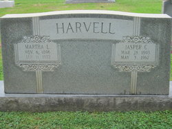
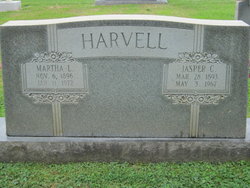
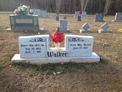
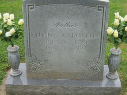
| Description | : | Essie Mae Harvell Walker, 94, of Franklinville, died Sunday, December 31, 2017 at Randolph Health & Rehabilitation Center in Asheboro. Funeral Services, 2:00 pm, Thursday, January 4, 2018, at Cool Springs Baptist Church, Franklinville. Officiating, Rev. John Harmon. Burial will follow in the church cemetery. Essie was a native of Hoke County and a member of Cool Springs Baptist Church. She was preceded in death by her parents, Jasper and Martha Lucus Harvell, husband, James William "Bill" Walker, son, David Lee Walker, brother, Lonnie Harvell, and three infant sisters. |
frequently asked questions (FAQ):
-
Where is Essie Mae Harvell Walker's memorial?
Essie Mae Harvell Walker's memorial is located at: Cool Springs Baptist Church Cemetery, Franklinville, Randolph County, USA.
-
When did Essie Mae Harvell Walker death?
Essie Mae Harvell Walker death on 31 Dec 2017 in Asheboro, Randolph County, North Carolina, USA
-
Where are the coordinates of the Essie Mae Harvell Walker's memorial?
Latitude: 35.8072420
Longitude: -79.6805660
Family Members:
Parent
Spouse
Siblings
Children
Flowers:
Nearby Cemetories:
1. Cool Springs Baptist Church Cemetery
Franklinville, Randolph County, USA
Coordinate: 35.8072420, -79.6805660
2. Grays Chapel Cemetery
Grays Chapel, Randolph County, USA
Coordinate: 35.8183570, -79.6986060
3. Whites Memorial Baptist Church Cemetery
Franklinville, Randolph County, USA
Coordinate: 35.7939680, -79.7149760
4. Sandy Creek Baptist Church Cemetery
Liberty, Randolph County, USA
Coordinate: 35.8235550, -79.6429050
5. Sandy Creek Primitive Baptist Church Cemetery
Liberty, Randolph County, USA
Coordinate: 35.8239020, -79.6406560
6. Whites Chapel United Methodist Church Cemetery
Liberty, Randolph County, USA
Coordinate: 35.7850520, -79.6422990
7. Patterson Grove Christian Church Cemetery
Ramseur, Randolph County, USA
Coordinate: 35.7743940, -79.6536550
8. Odell Trogdon Cemetery
Grays Chapel, Randolph County, USA
Coordinate: 35.7947200, -79.7300200
9. Melanchthon Lutheran Church Cemetery
Liberty, Randolph County, USA
Coordinate: 35.8451630, -79.6440640
10. Faith Temple Baptist Church Cemetery
Franklinville, Randolph County, USA
Coordinate: 35.8023770, -79.7460950
11. First Baptist Church Cemetery
Franklinville, Randolph County, USA
Coordinate: 35.7482230, -79.6908630
12. McMasters Cemetery
Randolph County, USA
Coordinate: 35.8072370, -79.6021500
13. Franklinville United Methodist Church Cemetery
Franklinville, Randolph County, USA
Coordinate: 35.7462900, -79.7037500
14. Clear View Baptist Church Cemetery
Franklinville, Randolph County, USA
Coordinate: 35.7530800, -79.7234300
15. Bethany United Methodist Church Cemetery #1
Franklinville, Randolph County, USA
Coordinate: 35.8101300, -79.7606200
16. Old Salem Cemetery
Franklinville, Randolph County, USA
Coordinate: 35.7414017, -79.6742020
17. Red Cross Baptist Church Cemetery
Redcross, Randolph County, USA
Coordinate: 35.8715591, -79.6995850
18. Hollys Chapel Pentecostal Holiness Church
Ramseur, Randolph County, USA
Coordinate: 35.7825600, -79.6048200
19. Friendship AME Church Cemetery
Ramseur, Randolph County, USA
Coordinate: 35.7463280, -79.6437970
20. Bethel United Methodist Church Cemetery
Randolph County, USA
Coordinate: 35.8779190, -79.7051540
21. York Family Cemetery
Ramseur, Randolph County, USA
Coordinate: 35.7603000, -79.6108000
22. Cedar Falls United Methodist Church Cemetery
Asheboro, Randolph County, USA
Coordinate: 35.7472920, -79.7338990
23. Cedar Falls Baptist Church Cemetery
Cedar Falls, Randolph County, USA
Coordinate: 35.7480800, -79.7357800
24. Billy Trogdon Cemetery
Asheboro, Randolph County, USA
Coordinate: 35.7392800, -79.7219100


