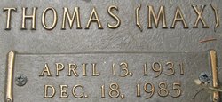
| Birth | : | 22 Dec 1898 Rutherford County, North Carolina, USA |
| Death | : | 22 Mar 1983 Rutherfordton, Rutherford County, North Carolina, USA |
| Burial | : | Race Path Baptist Church Cemetery, Ellenboro, Rutherford County, USA |
| Coordinate | : | 35.2944250, -81.7507420 |
| Description | : | name: Minnie Ester Matheny event: Death event date: 22 Mar 1983 event place: Rutherfordton, Rutherford, North Carolina burial date: 24 Mar 1983 burial place: Rutherford, Nc cemetery: Race Path Bapt. Ch. residence: Rutherfordton, Rutherford, NC gender: Female death age: 84 marital status: Widowed race: White occupation: Home Maker birth date: 22 Dec 1898 birthplace: Rutherford, Nc father: Andrew Bryson Bailey mother: Lou Etta Harrill |
frequently asked questions (FAQ):
-
Where is Esther Bailey Matheney's memorial?
Esther Bailey Matheney's memorial is located at: Race Path Baptist Church Cemetery, Ellenboro, Rutherford County, USA.
-
When did Esther Bailey Matheney death?
Esther Bailey Matheney death on 22 Mar 1983 in Rutherfordton, Rutherford County, North Carolina, USA
-
Where are the coordinates of the Esther Bailey Matheney's memorial?
Latitude: 35.2944250
Longitude: -81.7507420
Family Members:
Parent
Spouse
Siblings
Children
Flowers:
Nearby Cemetories:
1. Race Path Baptist Church Cemetery
Ellenboro, Rutherford County, USA
Coordinate: 35.2944250, -81.7507420
2. Plain View Baptist Cemetery
Ellenboro, Rutherford County, USA
Coordinate: 35.2988750, -81.7410280
3. Liberty Baptist Cemetery
Ellenboro, Rutherford County, USA
Coordinate: 35.3034477, -81.7356873
4. Goode Graveyard
Six Points, Rutherford County, USA
Coordinate: 35.2796440, -81.7439270
5. Daily-Brooks Graveyard
Ellenboro, Rutherford County, USA
Coordinate: 35.3060141, -81.7232363
6. Gantts Grove Baptist Church Cemetery
Mooresboro, Cleveland County, USA
Coordinate: 35.2767067, -81.7276077
7. Campfield Memorial Baptist Cemetery
Ellenboro, Rutherford County, USA
Coordinate: 35.3147202, -81.7288895
8. Zachariah McDaniel Cemetery
Ellenboro, Rutherford County, USA
Coordinate: 35.3213300, -81.7416800
9. Bethel Baptist Church Cemetery
Ellenboro, Rutherford County, USA
Coordinate: 35.3258810, -81.7544180
10. Dobbins Hawkins Cemetery
Boiling Springs, Cleveland County, USA
Coordinate: 35.2813070, -81.7148160
11. Victory Baptist Church Cemetery
Ellenboro, Rutherford County, USA
Coordinate: 35.3042000, -81.7884980
12. Webb Baptist Cemetery
Ellenboro, Rutherford County, USA
Coordinate: 35.3231900, -81.7696300
13. High Shoal Baptist Cemetery
Henrietta, Rutherford County, USA
Coordinate: 35.2659800, -81.7777450
14. Oak Grove United Methodist Church Cemetery
Ellenboro, Rutherford County, USA
Coordinate: 35.3131840, -81.7884070
15. Jonas Rollins Cemetery
Mooresboro, Cleveland County, USA
Coordinate: 35.2699210, -81.7180040
16. Heavenbound Baptist Church Cemetery
Ellenboro, Rutherford County, USA
Coordinate: 35.3307330, -81.7623250
17. Goodes Grove Baptist Cemetery
Mooresboro, Cleveland County, USA
Coordinate: 35.2562027, -81.7421036
18. Caroleen Avondale Henrietta Cemetery
Avondale, Rutherford County, USA
Coordinate: 35.2753940, -81.7925690
19. Bridges Family Cemetery
Mooresboro, Cleveland County, USA
Coordinate: 35.2622200, -81.7194000
20. Youngs Chapel AME Zion
Mooresboro, Cleveland County, USA
Coordinate: 35.3032750, -81.6978580
21. Sandy Run Baptist Church Cemetery
Mooresboro, Cleveland County, USA
Coordinate: 35.2963700, -81.6963300
22. Smart-Hamrick Family Cemetery
Ellenboro, Rutherford County, USA
Coordinate: 35.3295850, -81.7858840
23. John Matheny Family Cemetery
Mooresboro, Cleveland County, USA
Coordinate: 35.2492500, -81.7438310
24. Trinity Baptist Church Cemetery
Mooresboro, Cleveland County, USA
Coordinate: 35.2601280, -81.7133865


