


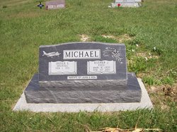
Esther June Fogo Michael
| Birth | : | 6 Mar 1932 Jewell County, Kansas, USA |
| Death | : | 22 Feb 2011 Mankato, Jewell County, Kansas, USA |
| Burial | : | Esbon Cemetery, Esbon, Jewell County, USA |
| Coordinate | : | 39.8143997, -98.4199982 |
| Plot | : | Block 10 Lot 6 |
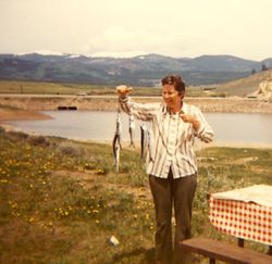
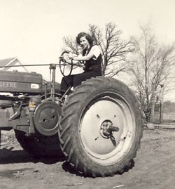
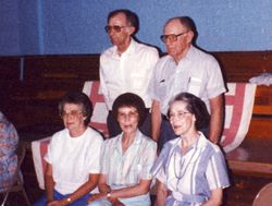
| Description | : | Esther June (Fogo) Michael, 78, of Mankato, Kansas, died Tuesday, February 22, 2011 at the Jewell County Hospital in Mankato, Kansas. She was born on March 6, 1932 on a farm between Burr Oak and Esbon, Kansas. She was the youngest daughter of Charles E. and Stella Fogo. She attended a rural school near her home and graduated in 1950 from Esbon High School. She then attended Fort Hays State College (University) for two years. On October 5, 1952 she married Doyle Michael in Burr Oak. Following their marriage, she and Doyle lived in Corpus Christie, Texas and Peacedale, Rhode... Read More |
frequently asked questions (FAQ):
-
Where is Esther June Fogo Michael's memorial?
Esther June Fogo Michael's memorial is located at: Esbon Cemetery, Esbon, Jewell County, USA.
-
When did Esther June Fogo Michael death?
Esther June Fogo Michael death on 22 Feb 2011 in Mankato, Jewell County, Kansas, USA
-
Where are the coordinates of the Esther June Fogo Michael's memorial?
Latitude: 39.8143997
Longitude: -98.4199982
Family Members:
Flowers:


Nearby Cemetories:
1. Esbon Cemetery
Esbon, Jewell County, USA
Coordinate: 39.8143997, -98.4199982
2. Saint Elizabeth Cemetery
Esbon, Jewell County, USA
Coordinate: 39.7844009, -98.4347000
3. Prairie Home Cemetery
Esbon, Jewell County, USA
Coordinate: 39.8278008, -98.4661026
4. Zion Cemetery
Jewell County, USA
Coordinate: 39.7672005, -98.3914032
5. Baker Cemetery
Jewell County, USA
Coordinate: 39.8581009, -98.3617020
6. Pleasant View Cemetery
Jewell County, USA
Coordinate: 39.7666900, -98.3668040
7. Providence Cemetery
Jewell County, USA
Coordinate: 39.8866997, -98.4008026
8. Salem Cemetery
Esbon, Jewell County, USA
Coordinate: 39.8755989, -98.5006027
9. Oak Creek Cemetery
Jewell County, USA
Coordinate: 39.9014015, -98.3918991
10. Baxter Cemetery
Ionia, Jewell County, USA
Coordinate: 39.7158420, -98.4158680
11. Sweet Home Cemetery
Lebanon, Smith County, USA
Coordinate: 39.7854830, -98.5465380
12. Amity Cemetery
Jewell County, USA
Coordinate: 39.9153170, -98.4673780
13. Pleasant Plains Cemetery
Lebanon, Smith County, USA
Coordinate: 39.8793400, -98.5419400
14. German Baptist Brethren Cemetery I
Burr Oak, Jewell County, USA
Coordinate: 39.8787900, -98.2955400
15. Burr Oak Cemetery
Burr Oak, Jewell County, USA
Coordinate: 39.8652992, -98.2846985
16. Odessa Cemetery
Jewell County, USA
Coordinate: 39.7124100, -98.4953613
17. West Lutheran Cemetery
Mankato, Jewell County, USA
Coordinate: 39.7852150, -98.2694250
18. German Baptist Brethren Cemetery II
Burr Oak, Jewell County, USA
Coordinate: 39.8720860, -98.2786470
19. Walnut Creek Friends Cemetery
Northbranch, Jewell County, USA
Coordinate: 39.9298800, -98.3436400
20. Old Highland Township Cemetery
Jewell County, USA
Coordinate: 39.9430600, -98.4458900
21. Price Cemetery
Oak Township, Smith County, USA
Coordinate: 39.7986860, -98.5993060
22. Conservative Friends Cemetery
Jewell County, USA
Coordinate: 39.9448800, -98.3527500
23. Ionia Cemetery
Ionia, Jewell County, USA
Coordinate: 39.6772003, -98.3574982
24. Mount Hope Cemetery
Mankato, Jewell County, USA
Coordinate: 39.7825012, -98.2300034