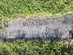
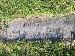
Esther Leerar Monson
| Birth | : | 30 Aug 1916 Stilson, Hancock County, Iowa, USA |
| Death | : | 6 Aug 2006 Mason City, Cerro Gordo County, Iowa, USA |
| Burial | : | Palms Memorial Park, Sarasota, Sarasota County, USA |
| Coordinate | : | 27.3349991, -82.4638977 |
| Description | : | Mason City- Esther Monson, 89, of Mason City, passed away Sunday, August 6, 2006, at Good Shepherd Health Center, Mason City. Funeral service will be held 11 A.M. Thursday, August 10, 2006, at Grace United Methodist Church, 200 14th Street NW, Mason City, with Rev. Keith L. Scott officiating. A private family graveside service will be held at Memorial Park Cemetery, Mason City. Visitation will be held from 5-7 P.M. Wednesday, August 9, 2006, at Hogan Bremer Moore Colonial Chapel, 126 Third Street NE, Mason City. The family requests memorials may be directed to Grace United Methodist... Read More |
frequently asked questions (FAQ):
-
Where is Esther Leerar Monson's memorial?
Esther Leerar Monson's memorial is located at: Palms Memorial Park, Sarasota, Sarasota County, USA.
-
When did Esther Leerar Monson death?
Esther Leerar Monson death on 6 Aug 2006 in Mason City, Cerro Gordo County, Iowa, USA
-
Where are the coordinates of the Esther Leerar Monson's memorial?
Latitude: 27.3349991
Longitude: -82.4638977
Family Members:
Parent
Spouse
Siblings
Children
Flowers:
Nearby Cemetories:
1. Palms Memorial Park
Sarasota, Sarasota County, USA
Coordinate: 27.3349991, -82.4638977
2. Sunnyside Mennonite Cemetery
Sarasota, Sarasota County, USA
Coordinate: 27.3267678, -82.4623747
3. Friendship Baptist Cemetery
Sarasota, Sarasota County, USA
Coordinate: 27.3250562, -82.4587084
4. Unitarian Universalist Church's Memory Garden
Sarasota, Sarasota County, USA
Coordinate: 27.3384610, -82.4889880
5. Sarasota Community Church Columbarium
Sarasota, Sarasota County, USA
Coordinate: 27.3245125, -82.4887278
6. Temple Beth Sholom Cemetery
Sarasota, Sarasota County, USA
Coordinate: 27.3414000, -82.4945000
7. Tatum Ridge Cemetery
Fruitville, Sarasota County, USA
Coordinate: 27.3304300, -82.4154800
8. Hopewell Memorial Park
Sarasota, Sarasota County, USA
Coordinate: 27.2980022, -82.4359207
9. First Congregational United Church of Christ Memorial Garden
Sarasota, Sarasota County, USA
Coordinate: 27.3250390, -82.5171200
10. Saint Wilfred's Episcopal Church Prayer Garden
Sarasota, Sarasota County, USA
Coordinate: 27.2917998, -82.4941453
11. Church of the Palms Memorial Garden
Sarasota, Sarasota County, USA
Coordinate: 27.2980400, -82.5043760
12. West Coast Church of the Cross Memorial Garden
Sarasota, Sarasota County, USA
Coordinate: 27.3068950, -82.5127100
13. Carlie Brucia Memorial Garden
Sarasota County, USA
Coordinate: 27.2853570, -82.4463180
14. Saint John’s United Methodist Church Memorial Gard
Sarasota, Sarasota County, USA
Coordinate: 27.2853490, -82.4395770
15. Bee Ridge Presbyterian Church Memorial Gardens
Sarasota, Sarasota County, USA
Coordinate: 27.2827861, -82.4820639
16. Church of the Incarnation Memorial Garden
Sarasota, Sarasota County, USA
Coordinate: 27.2991238, -82.5114441
17. Bethel Mennonite Church Cemetery
Sarasota, Sarasota County, USA
Coordinate: 27.3466200, -82.3996800
18. Meadows Memorial Garden
Sarasota, Sarasota County, USA
Coordinate: 27.3361092, -82.5308304
19. Saint Paul Lutheran Church Pet Memorial Garden
Sarasota, Sarasota County, USA
Coordinate: 27.3361092, -82.5308304
20. Saint Patrick's Garden of Remembrance
Sarasota, Sarasota County, USA
Coordinate: 27.2974340, -82.4101940
21. Luke Wood House Burial Ground
Sarasota, Sarasota County, USA
Coordinate: 27.3285310, -82.5323530
22. Grace Baptist Church Memorial Garden
Sarasota, Sarasota County, USA
Coordinate: 27.2975920, -82.4085370
23. Church of the Nativity Episcopal Memory Garden
Sarasota, Sarasota County, USA
Coordinate: 27.3857900, -82.5049060
24. Woodlawn Cemetery
Sarasota, Sarasota County, USA
Coordinate: 27.3464550, -82.5331770


