


Esther Maria Freed
| Birth | : | 11 Jun 1891 Clay Township, Webster County, Iowa, USA |
| Death | : | 22 May 1905 Clay Township, Webster County, Iowa, USA |
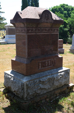
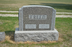
| Burial | : | Dayton Cemetery, Dayton, Webster County, USA |
| Coordinate | : | 42.2675000, -94.0755000 |
| Plot | : | Section 1, Lot 100 |
| Description | : | Dayton Review June 8, 1905 Another home in Burnside has been visited by the messenger of death and taken away from the home and friends, Esther Maria Freed, daughter of Mr. and Mrs. C.J. Freed. Esther was their youngest child, born June 11, 1891 and died May 22, 1905, thus being 13 years, 11 months and 11 days at the time of death. During the rainy and chilly days in the first part of May she caught a cold after which other serious sickness set in. During three days before she died she was not able to speak any,... Read More |
frequently asked questions (FAQ):
-
Where is Esther Maria Freed's memorial?
Esther Maria Freed's memorial is located at: Dayton Cemetery, Dayton, Webster County, USA.
-
When did Esther Maria Freed death?
Esther Maria Freed death on 22 May 1905 in Clay Township, Webster County, Iowa, USA
-
Where are the coordinates of the Esther Maria Freed's memorial?
Latitude: 42.2675000
Longitude: -94.0755000
Family Members:
Parent

Siblings


Flowers:


Nearby Cemetories:
1. Dayton Cemetery
Dayton, Webster County, USA
Coordinate: 42.2675000, -94.0755000
2. Christ the King Catholic Cemetery
Dayton, Webster County, USA
Coordinate: 42.2601929, -94.0727539
3. Bass Cemetery
Dayton, Webster County, USA
Coordinate: 42.2966995, -94.0149994
4. Swedish Lutheran Church Cemetery
Dayton, Webster County, USA
Coordinate: 42.2175000, -94.1065000
5. Oak Grove Cemetery
Lehigh, Webster County, USA
Coordinate: 42.3438988, -94.0475006
6. Hardin Township Cemetery
Hardin Township, Webster County, USA
Coordinate: 42.2411003, -93.9708023
7. Linn Cemetery
Pilot Mound, Boone County, USA
Coordinate: 42.2045330, -93.9970230
8. Lawn Cemetery
Boone County, USA
Coordinate: 42.1771011, -94.0867996
9. West Lawn Cemetery
Lehigh, Webster County, USA
Coordinate: 42.3616982, -94.0678024
10. McGuire Bend Cemetery
Dayton, Webster County, USA
Coordinate: 42.3410000, -93.9880000
11. Runyan Cemetery
Pilot Mound, Boone County, USA
Coordinate: 42.1749992, -94.0015030
12. Pilot Mound Cemetery
Pilot Mound, Boone County, USA
Coordinate: 42.1636200, -94.0282600
13. Vegors Cemetery
Webster County, USA
Coordinate: 42.3177986, -93.9421997
14. Lost Grove Cemetery
Harcourt, Webster County, USA
Coordinate: 42.2583008, -94.2331009
15. Hooks Point Cemetery
Hamilton County, USA
Coordinate: 42.2944530, -93.9199090
16. Oakwood Cemetery
Stratford, Hamilton County, USA
Coordinate: 42.2942009, -93.9182968
17. Hartman Cemetery
Lehigh, Webster County, USA
Coordinate: 42.3666397, -93.9835627
18. White Cemetery
Boone County, USA
Coordinate: 42.1777992, -93.9636002
19. Border Plains Cemetery
Border Plains, Webster County, USA
Coordinate: 42.3917000, -94.0448000
20. Ober and Scott Cemetery
Duncombe, Webster County, USA
Coordinate: 42.3841390, -93.9982856
21. Union Cemetery
Boxholm, Boone County, USA
Coordinate: 42.1369019, -94.0852966
22. Renner Cemetery
Boone County, USA
Coordinate: 42.1380420, -94.1256570
23. Otho Cemetery
Otho, Webster County, USA
Coordinate: 42.4025002, -94.1153030
24. Schlicht Cemetery
Fraser, Boone County, USA
Coordinate: 42.1444200, -93.9780100