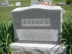
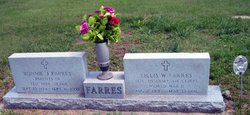
Esther O Krause Farres
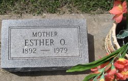
| Birth | : | 1892 |
| Death | : | 1979 |
| Burial | : | Woodbine Cemetery, Woodbine, Dickinson County, USA |
| Coordinate | : | 38.7924995, -96.9636002 |
| Inscription | : | Mother |
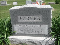
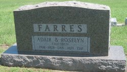
| Description | : | WOODBINE, KANSAS: Esther O. Farres, 87, died September 1, 1979. She was a member of the Woodbine Methodist Church. Survivors include three sons; five daughters; a sister; 29 grandchildren; and 26 great-grandchildren. She was preceded in death by her husband, Hubert L. Farres; and two children, Olga Watt and Adair. Burial was at the Woodbine Cemetery under the direction of Donahue Funeral Home. |
frequently asked questions (FAQ):
-
Where is Esther O Krause Farres's memorial?
Esther O Krause Farres's memorial is located at: Woodbine Cemetery, Woodbine, Dickinson County, USA.
-
When did Esther O Krause Farres death?
Esther O Krause Farres death on 1979 in
-
Where are the coordinates of the Esther O Krause Farres's memorial?
Latitude: 38.7924995
Longitude: -96.9636002
Family Members:
Parent
Spouse
Siblings
Children
Flowers:
Nearby Cemetories:
1. Woodbine Cemetery
Woodbine, Dickinson County, USA
Coordinate: 38.7924995, -96.9636002
2. Langhofer-Riffel Cemetery
Woodbine, Dickinson County, USA
Coordinate: 38.7835530, -96.9874660
3. Langhofer Cemetery
Woodbine, Dickinson County, USA
Coordinate: 38.7905530, -96.9921110
4. Lyons Creek German Baptist Cemetery
Woodbine, Dickinson County, USA
Coordinate: 38.7672680, -96.9645600
5. Immanuel Lutheran Cemetery
Shady Brook, Dickinson County, USA
Coordinate: 38.7392890, -96.9842260
6. Saint Paul Cemetery
Shady Brook, Dickinson County, USA
Coordinate: 38.7358017, -96.9816971
7. Fall Cemetery
Herington, Dickinson County, USA
Coordinate: 38.7324440, -96.9642810
8. Riffel Cemetery (Defunct)
Woodbine, Dickinson County, USA
Coordinate: 38.8177986, -97.0342026
9. Lyona Methodist Church Cemetery
Lyona, Dickinson County, USA
Coordinate: 38.8630400, -96.9266500
10. Clarks Creek Cemetery
Latimer, Morris County, USA
Coordinate: 38.7821999, -96.8664017
11. Saint Johns Cemetery
White City, Morris County, USA
Coordinate: 38.8093987, -96.8531036
12. Mount Zion Cemetery
Junction City, Geary County, USA
Coordinate: 38.8762000, -96.9267080
13. Zion Lutheran Cemetery
Latimer, Morris County, USA
Coordinate: 38.7542000, -96.8578033
14. Blanchett Cemetery
Herington, Dickinson County, USA
Coordinate: 38.7000130, -96.9765330
15. Mollhagen Gravesite
Herington, Dickinson County, USA
Coordinate: 38.6979350, -96.9874040
16. Chalker Cemetery
Herington, Dickinson County, USA
Coordinate: 38.7032010, -97.0104170
17. Saint Johns Lutheran Cemetery
Herington, Dickinson County, USA
Coordinate: 38.6957512, -96.9995117
18. Rinehart Cemetery
Enterprise, Dickinson County, USA
Coordinate: 38.9021988, -96.9638977
19. Navarre Cemetery
Navarre, Dickinson County, USA
Coordinate: 38.7957115, -97.1080627
20. Sunset Hill Cemetery
Herington, Dickinson County, USA
Coordinate: 38.6777992, -96.9561005
21. Pilgrim Home Cemetery
Hope, Dickinson County, USA
Coordinate: 38.7257996, -97.0852966
22. Pleasant Hill Cemetery
Enterprise, Dickinson County, USA
Coordinate: 38.8885150, -97.0749560
23. Hope Cemetery
Hope, Dickinson County, USA
Coordinate: 38.6924057, -97.0706329
24. Saint Phillips Cemetery
Hope, Dickinson County, USA
Coordinate: 38.6810989, -97.0507965

