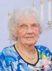
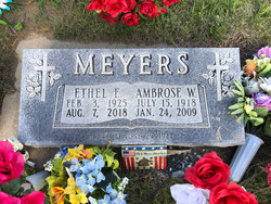
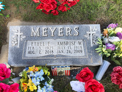
Ethel E. Rader Meyers
| Birth | : | 3 Feb 1925 Frontier County, Nebraska, USA |
| Death | : | 7 Aug 2018 Cozad, Dawson County, Nebraska, USA |
| Burial | : | Immanuel Lutheran Cemetery, Elwood, Gosper County, USA |
| Coordinate | : | 40.4206500, -99.8672000 |
| Description | : | COZAD — Ethel E. Meyers, 93, of Cozad died Tuesday, Aug. 7, 2018, at Cozad Community Hospital. Services will be at 11 a.m. Monday at St. John’s Lutheran Church in Eustis with Vicar Kathy Gundell officiating. Burial will be at 2 p.m. at Immanuel Lutheran Cemetery north of Arapahoe. Berryman Funeral Home in Cozad is in charge of arrangements. She was born Feb. 3, 1925, in Frontier County to Charles and Louise (Silberman) Rader. On June 29, 1947, she married Ambrose W. Meyers in Eustis. He died in January 2009. Survivors include her sons, Charles Meyers of Red Cloud and Daniel Meyers of Kearney; daughters,... Read More |
frequently asked questions (FAQ):
-
Where is Ethel E. Rader Meyers's memorial?
Ethel E. Rader Meyers's memorial is located at: Immanuel Lutheran Cemetery, Elwood, Gosper County, USA.
-
When did Ethel E. Rader Meyers death?
Ethel E. Rader Meyers death on 7 Aug 2018 in Cozad, Dawson County, Nebraska, USA
-
Where are the coordinates of the Ethel E. Rader Meyers's memorial?
Latitude: 40.4206500
Longitude: -99.8672000
Family Members:
Parent
Spouse
Siblings
Children
Flowers:
Nearby Cemetories:
1. Immanuel Lutheran Cemetery
Elwood, Gosper County, USA
Coordinate: 40.4206500, -99.8672000
2. McGuire Cemetery
Gosper County, USA
Coordinate: 40.4380989, -99.8664017
3. Homerville Cemetery
Gosper County, USA
Coordinate: 40.4668999, -99.8593979
4. Pleasant Grove Cemetery
Gosper County, USA
Coordinate: 40.4664001, -99.9250031
5. East Muddy Cemetery
Gosper County, USA
Coordinate: 40.4166985, -99.9614029
6. Fairfield Cemetery
Gosper County, USA
Coordinate: 40.4672012, -99.7549973
7. Arapahoe Cemetery
Arapahoe, Furnas County, USA
Coordinate: 40.3239600, -99.8985500
8. Saint Matthew Lutheran Cemetery
Elwood, Gosper County, USA
Coordinate: 40.3519000, -99.9630000
9. Stump Cemetery
Furnas County, USA
Coordinate: 40.3478012, -99.7621994
10. Salem East Cemetery
Gosper County, USA
Coordinate: 40.4972000, -99.9803009
11. Salem West Cemetery
Frontier County, USA
Coordinate: 40.4968987, -99.9886017
12. Zion Cemetery
Gosper County, USA
Coordinate: 40.4085999, -99.7005997
13. Highland Union Cemetery
Gosper County, USA
Coordinate: 40.3513990, -99.7172360
14. Edison Cemetery
Edison, Furnas County, USA
Coordinate: 40.2919006, -99.7902985
15. Miller Cemetery
Elwood, Gosper County, USA
Coordinate: 40.3514980, -100.0374350
16. Holbrook Cemetery
Holbrook, Furnas County, USA
Coordinate: 40.3138000, -100.0045000
17. Norwegian Lutheran Cemetery
Holbrook, Furnas County, USA
Coordinate: 40.3380910, -100.0425560
18. Yoder Cemetery
Smithfield, Gosper County, USA
Coordinate: 40.4957000, -99.6845500
19. Stowe Cemetery
Stockville, Frontier County, USA
Coordinate: 40.4900017, -100.0753021
20. Garfield Cemetery
Furnas County, USA
Coordinate: 40.2491989, -99.8992004
21. Elwood Cemetery
Elwood, Gosper County, USA
Coordinate: 40.5999300, -99.8397300
22. Highland Cemetery
Bertrand, Phelps County, USA
Coordinate: 40.5194016, -99.6430969
23. Quakerville Cemetery
Gosper County, USA
Coordinate: 40.6189003, -99.8097000
24. Hope Lutheran Cemetery
Smithfield, Gosper County, USA
Coordinate: 40.5667500, -99.6800000


